Day Hike 6: Caesarea to Olga (half day hike) 28Dec2010.
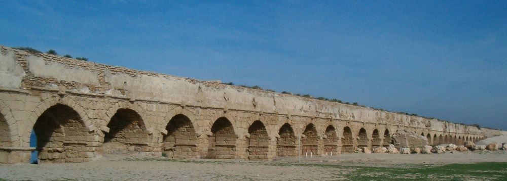
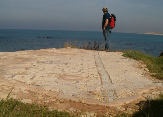
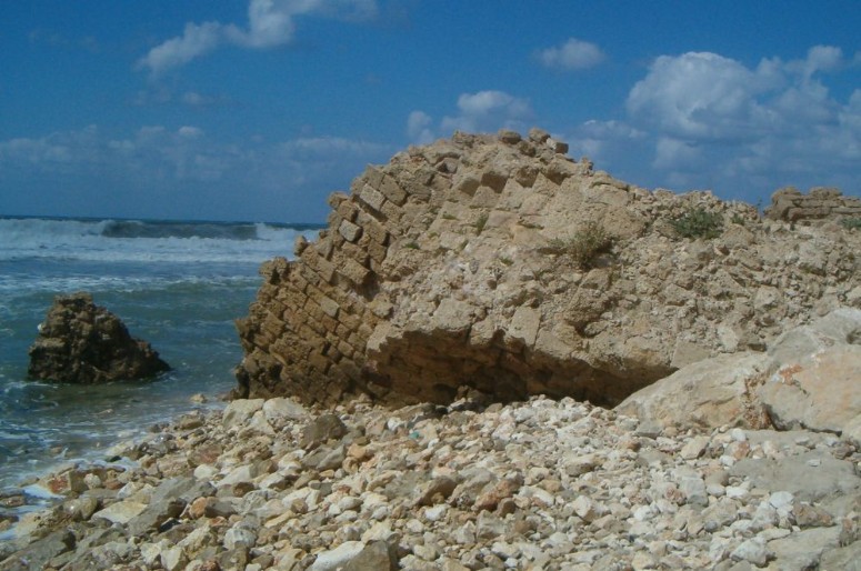
We started at the Caesarea Aqueduct where we had stopped our last hike, but before we picked up our Golan Stone we explored the ruins. There are actually two aqueducts in the area. The one in the back was better preserved, and we walked a ways inside the tunnel where water once flowed to the city of Caesarea. Then we found the rock and started walking. The path soon took us off the beach and past various unmarked ruins. It passed by the base of an ancient building with a mosaic floor that turned out to be the base of a third century synagogue.
The trail then turned inland and skirted the edge of the Caesarea Archeological park right next to the high, well preserved Roman walls. We have visited this area many times, and it is well worth stopping for an afternoon and exploring the ruins and museums. Note: if you eat at any of the fine restaurants in the park you can get a refund off most of the price of entrance. Enquire about the details when you enter. There is another entrance to the park on the south side that was closed when we passed, but there was a good water fountain there.
The trail then mostly follows roads as it makes its way past the Hadera power plant. The three stacks of this plant had been in front of us since we reached the Carmel mountains and it was a feeling of real accomplishment to finally have them behind us. The trail then went along the highway (Rt. 2) for a few minutes and then turned off towards the west. There it crosses the Hadera river.
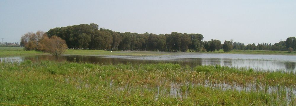
We walked through a peaceful park with old eucalyptus trees, along a river we never knew existed, towards the sea. This would have been a surprisingly lovely area though it was next to the huge power plant if it weren’t that the river is polluted. There are wonderful organizations trying to pressure the local government and national government to clean up Israel’s rare and precious fresh water ways. Visit the Zalul Non-profit organization
to find ways to help.This Hadera River Park ended on a deserted road that took us back inland into west Hadera. There at the Olga Junction where the Israel trail goes over Rt. 2 we left the rock.
Day Hike 7: Olga to Netanya 18Feb2010
After almost 2 month off the trail (I was in the USA for a while), we picked up the rock at the Olga Junction, took the walking bridge over Rt. 2, and followed the Israel Trail towards the Hadera Train station. I had no expectations for this section of the Trail. After all what could there be of any interest walking through Hadera – an industrial city with a less than stellar reputation? The trail led us to a construction site where a bridge was being build over the train tracks and we promptly lost the markers, but we knew from the map that there was only one way across the train tracks so we weren’t too worried. After about ten minutes of walking in the city past the train station we found ourselves in a park. The path passed a water fountain, which with a little trouble could be opened and closed.
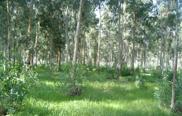
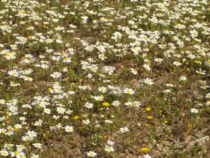
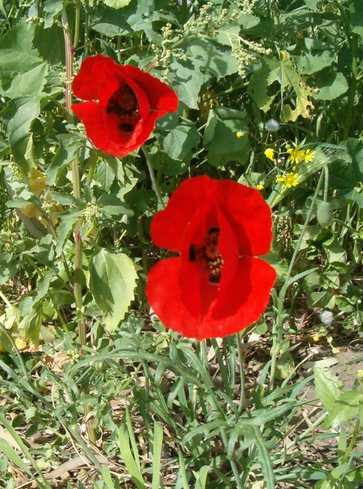
The park was the Hadera Forest made up completely of eucalyptus trees. Soon we found ourselves in a paradise. There were spring flowers everywhere – fields covered with the common chamomile, red anemones and delicate blue Syrian speedwell. Even the forest itself was magical. Silver eucalyptus leaves were spinning down on the breeze. The sun caught some of them and they glittered softly.
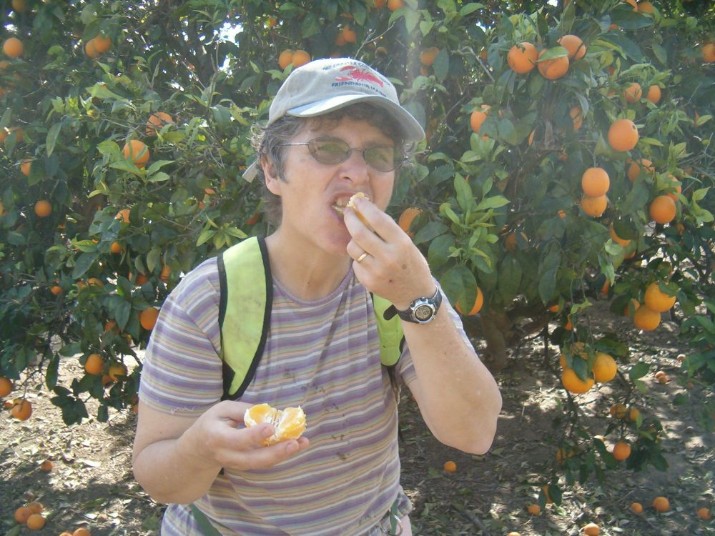
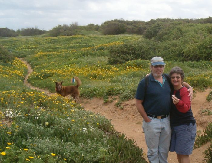
Walking expands the world. Even tiny Israel seems vast when you walk the length of it, and even areas that seem urban on a map can have enchanted enclaves only known to those who walk. The trail hugged the edge of the forest with meadows on the left. Soon we came to an orange orchard with all the trees so weighed down with ripe fruit that some of the branches had broken. We wondered why the oranges hadn’t been harvested while we indulged ourselves with two tart, juicy oranges each, that made our hands sticky and dripped onto my shirt.
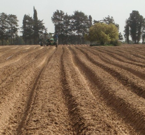
We walked past a pair of fields that were being plowed while we passed, the soil looked almost sensual. Up over a hill and the trail went through more fields bursting with wild flowers and then by a vernal pool. Rt 4, another major highway, goes by the eastern part of this pool, but we never felt how close it was. Thankfully this winter has had lots of rain and the pool was overflowing its banks, teaming with life – copepods, daphnia, tadpoles, insect larva – we could see 20 species in one minute. There were also lots of birds – particularly plovers and egrets.
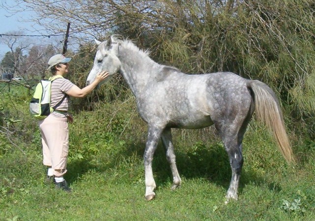
Near the pool there was a field with horses, with one horse who seemed to have escaped and was on our side of the fence. He was a friendly guy and for a while I was afraid he would follow us on our hike.
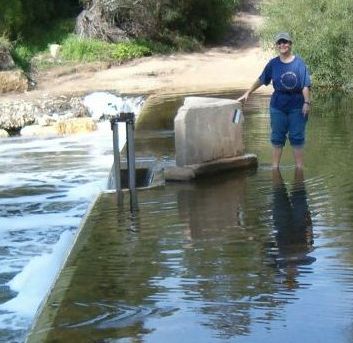
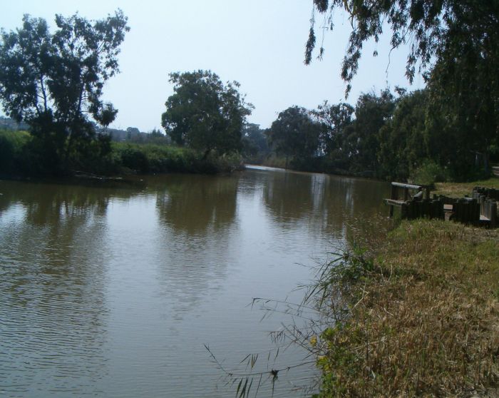
The trail then went under the railroad tracks in a tunnel that we almost had to crawl through. It would have been really hard with big backpacks. We walked parallel the tracks on a road of deep sand and ended up on the banks of the Alexander River. Visit here and here for two sites about the restoration of this river.
Near the picnic grounds there was the ruins of a eighteen century villa build by a Samarian family from the 1700s, the villa itself was built on the ruins of an older Roman structure.
The trail followed the river under Rt. 2 and straight to the Mediterranean. There we found ourselves on a wide open beach with hills in the distance.
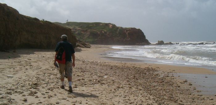
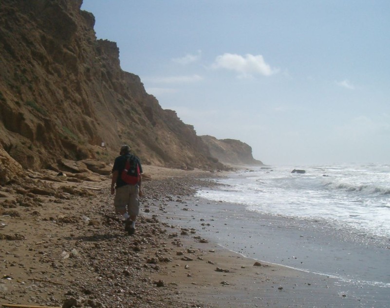
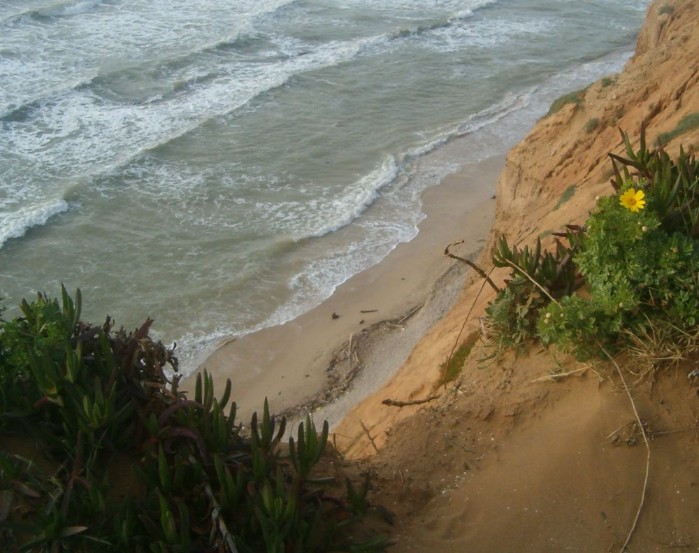
We arrived at the hills to find a typical Israel public beach, with showers, lifeguard stations and a restaurant tucked right against the hills which were actually the beginning of sandstone cliffs. When we passed the public beach we soon found ourselves all alone in the world. The cliffs hid any sign of human habitation inland and there wasn’t a single person to be seen north or south as far as the eye could see. Twenty years of living in Israel and I had no idea that right in the middle of the most populated part of the country there were such lonely spots.

This lasted for two kilometers to another access point with a public beach and another restaurant. There we hid our Golan Stone and headed about 2 kilometers inland to catch a bus back to Haifa.
Day Hike 8: Netanyia to the Sharon Beach National Park
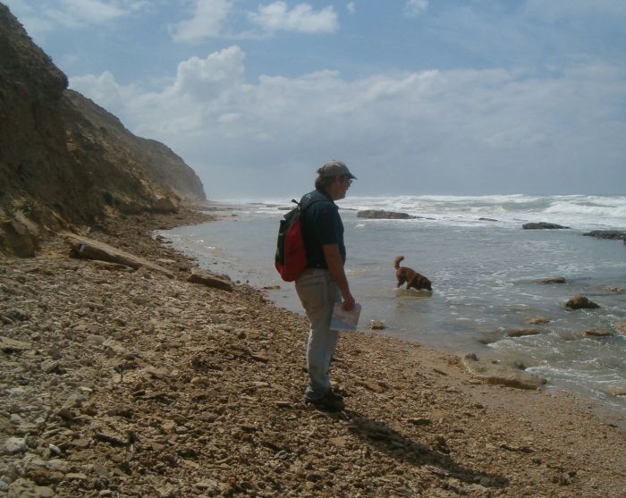
I found my stone even though someone had messed with the area where I left it. We’ve carried it from near Majdal Shams on the Golan Heights to Netanyia, more than 300 kilometers. After retrieving the rock we walked north on the beach slightly worried because the tide was higher than normal and there were areas ahead that looked like the water came upto the cliffs. We weren’t sure we could get by. Netanyia was about 4 kilometers south and the trail was a deserted coast with cliffs hiding civilization.
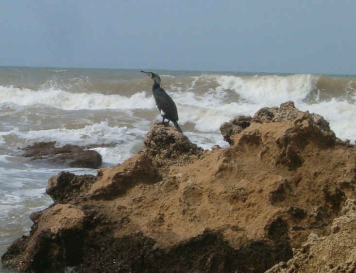
I saw a cormorant sitting on a rock in the surf silhouetted against the waves.
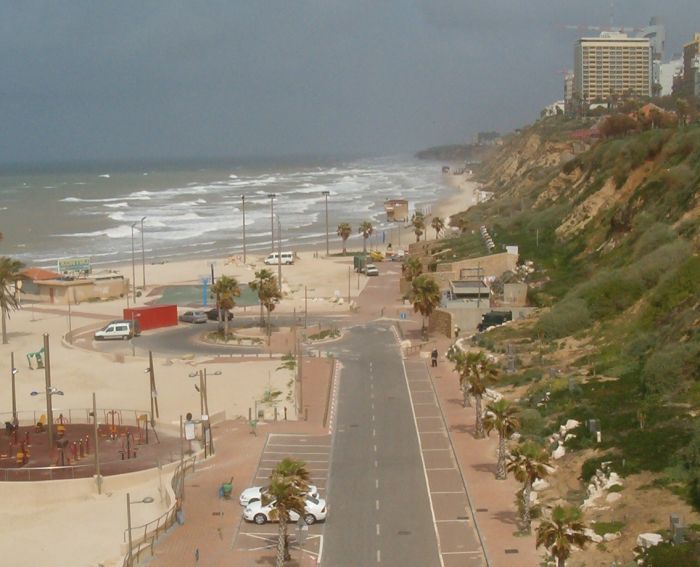
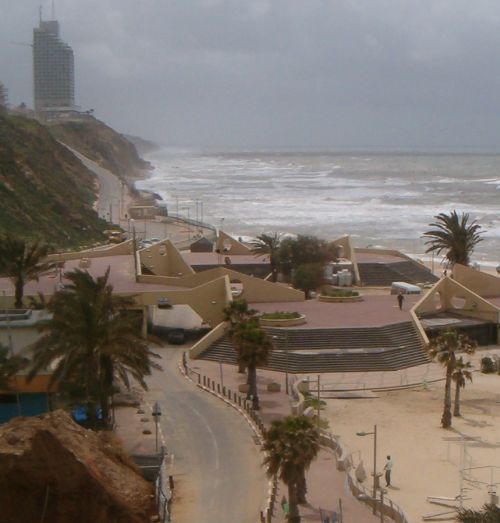
After about and hour we reached a public beach with a restaurant on the northern edge of Netanyia. The water was so high that we had to go up into the building and climb over a wall to get around the pounding surf (it wasn’t that easy to pick Taffy up over). Another 20 minutes and we reach the central city and the path took us up stairs to the city walkway. There were cafes and parks along the way and if it had been a little later we would have eaten lunch at a café there. The views from the city were astounding. You could see wild beaches with huge surf as far as the eye could see both to the south and north. Right below there were kite boarders, with their brightly colored sails, taking advantage of the winds and waves to do amazing acrobatics.
The trail continued up on the walkway because there were areas below which were clearly impassable even on a normal tide, but after about 30 minutes of walking ubove in the city we noticed that the tide was getting low and it looked like we could manage without swimming. We didn’t want to walk up on the streets when the beach looked so enticing. We took one of the few beach access points down and for the first time on this extended hike we left the trail above. (Our motto has always been:
Ours is not to reason why.
Our is but to follow the Tri (tri colored trail markers)!
But this time we couldn’t help ourselves, the temptation of the beach below was too great. It turned out to be a good decision. Afterwards I drove the way the trail actually goes and some of it is next to a highway. Much better to walk the beautiful beach. (However, it has to be low tide!).
Here we found ourselves in one of the loneliest places in all our hike. The cliffs were high and there was no sight or sound of anything inland. There were no people on the beach, and there were no ships at sea. We were alone.
There were areas on this wild beach that were full of flotsam and jetsam brought in from many tides. Most of it was planks of water logged wood, but there were also oranges that must have fallen off a boat, and of course plastic junk from many countries. It’s sad to think of all the garbage that’s floating in the Mediterranean.
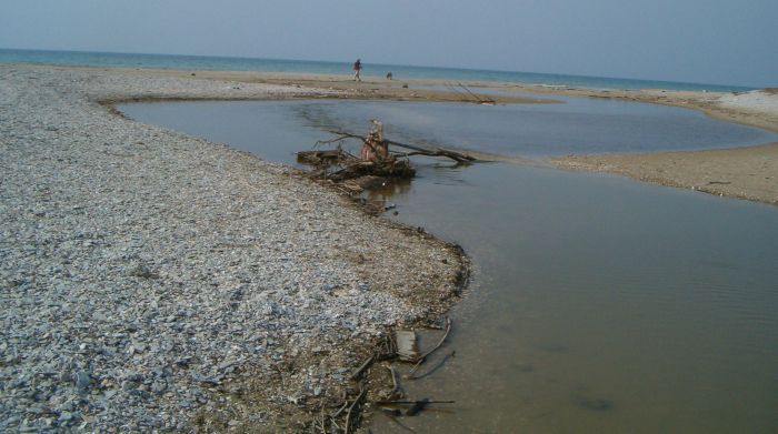
As we walked we hoped that we had read the map correctly and that the trail did return to the beach eventually. After about an hour and a half we reached the Israel Trail coming down from above, and shortly after that we crossed a public beach and the flat delta where the Poleg stream entered the ocean. Without the cliffs blocking the view, all of urban Israel was there to see.
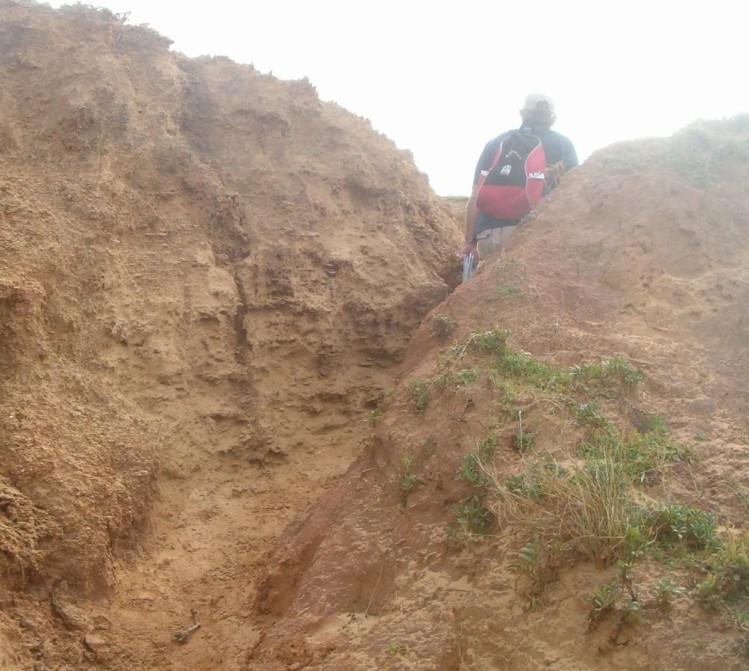
We forded the stream on a make shift bridge and continued past the delta and again along the cliff face for about 45 minutes. At that point the trail took us off the beach and up a vale in the cliffs to the top. Right at the bottom there was an area full of garbage. It upsets me so much when people leave their junk behind. Take out MORE than you bring in!!
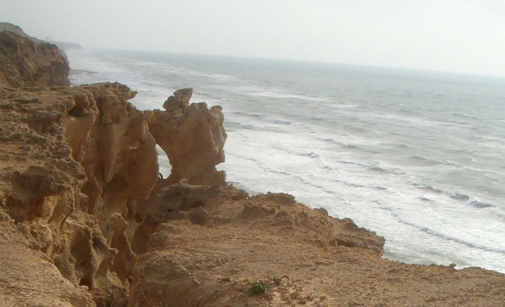
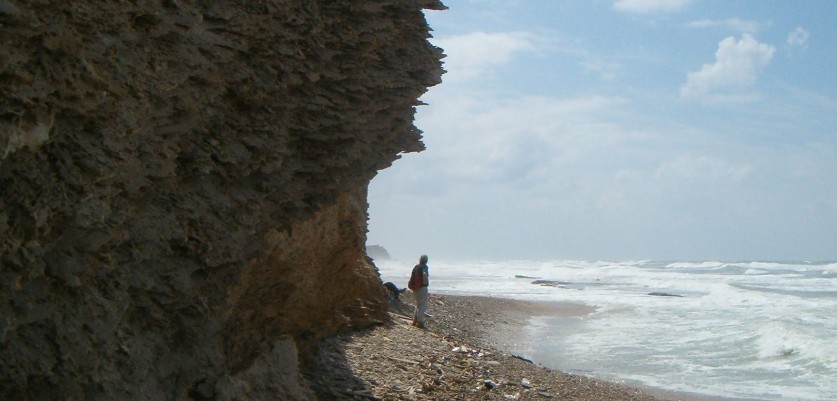
We found ourselves walking on the top of the soft limestone cliffs on a series of hills. This was the Sharon National Park which protects the rare fauna and flora of the cliff area of Israel. The beaches are also the nesting area of sea turtles from June through August.
There were no fences, or any impediment between us and falling off. Many places were scary indeed. There was one prominent point where I wanted to look down the cliff. I walked to the edge and saw that there was a crack along the cliff that looked like it was ready to fall at any second. We had seen many recent rock falls while we hiked the beach so I stayed safely away from that edge!
The trail meandered up and down sandy hills full of green spring vegetation. Kibbutz Ga’ash, where we planned to end our hike, was about 45 minutes of strolling along the cliffs.
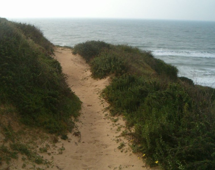
Right before we turned off The Israel Trail we carefully hid our stone. Just as we were turning to go back to the fork Taffy almost stepped off the cliff at a point where the path actually looked like it was going right over it. Our hearts were pounding as we looked down the precipice.
Day hike 9: Sharon National Beach Park to Tel Aviv
We waited for the unseasonably hot and dry weather to end before we started on the ninth and probably last or our day hikes. So it was a perfect 18 degrees C. hiking weather when we picked up our stone and continued in the hills above the limestone cliffs.
What we didn’t count on was that the north west wind which brought the cooler weather also built up the surf, and unbeknown to us (we should have checked) we started the hike at high tide on the day of the new moon. All this combined to give us a challenging hike. Several times we were caught between the cliffs and the surf with no way out. We hiked the whole day with soaking wet hiking boots always on the look out for the rouge wave that might have swept us out to sea!
The first indication of what we were about to face was the roar we could hear from up on the hills. As we wound our way through the beautiful carpets of wildflowers, through the hills, and then to a path straight to the sea, the roar only got louder until we were on the beach looking at wild surf and a tiny beach. A few minutes later the first wave caught us up against the cliff with no where to climb, and I found myself hiking with water sloshing in my boots. There were many places were we had to time our passage to the surf which seemed to have a five minute interval of relatively low waves followed by huge waves. We found ourselves running from one safe spot to another in those intervals. It was a exhilarating!
Two hours later we could see a fortress hanging off a high cliff ahead of us.
Take a look at the video clip to see what we were dealing with and to hear how loud the surf was. Apollonia is on the cliff ahead of us.
Another ten minutes navigating a difficult area with almost no exposed beach and we found ourselves walking on large boulders placed under the fortress to stabilize the cliffs. There were ancient walls and the remnants of a paved street right there on the beach, which we passed with awe. Again, here was a major archeological site of which we had never heard. It turns out to be Apollonia - Arsuf,
a Crusader Fortress that was build on the ruins of different settlements going all the way back to the Phoenicians in the sixth to fifth centuries BCE, and continuously inhabited for 18 successive centuries. It was recently made into a National Park (the newest National Park in Israel right now) which we plan to visit soon. If you are through hikers make time to hike up off the beach and visit what looks to be a beautiful and interesting place. Only in Israel with her surplus of amazing archeological sites could this place be a lesser known tourist area!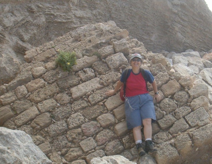
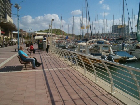
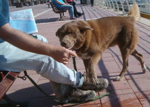
A few minutes past Apollonia we reached Herzliya where there were boardwalks with many cafés with people enjoying lunch. We walked past a wide beach where kite boarders were showing off their skill. We soon arrived at the Herzliya Marina where we ate our lunch while we fantasized about which yacht we would buy to sail the seas when we were done walking. Taffy, of course, also got his share of lunch. We sat there quite a while as our socks and shoes dried a bit in the breeze.
After the marina we were soon walking on a the beach again. The Herzliya municipal beach turned into the Tel Aviv municipal beach – wide lovely public beaches that would probably be full of people in the summer, but only had other walkers and joggers while we made our way to Tel Aviv itself.
At 4pm we reached the little north Tel Aviv airport, and we turned away from the beach and walked east into the city. It gave us a strange feeling to leave the Mediterranean behind. We’ve been hiking with it since September 14 when we climbed over the Carmel and saw it spread out in front of us gleaming like a jewel.
We walked three kilometers on city streets until we arrived at the Yarkon River Park that goes through Tel Aviv from West to East. I was happy to see that the river has been cleaned up a lot since the disaster of 1997. There were many people practicing their rowing in racing shells, and there was a paddle boat rental shop all attesting to a much improved situation. I left our stone by a wall in the Yarkon Park.
Good bye to the Mediterranean, we're heading towards Jerusalem.