4th Day Hike: 10November 2009 (Carmel Forest, to Route 70 near Zihron Yaakov)
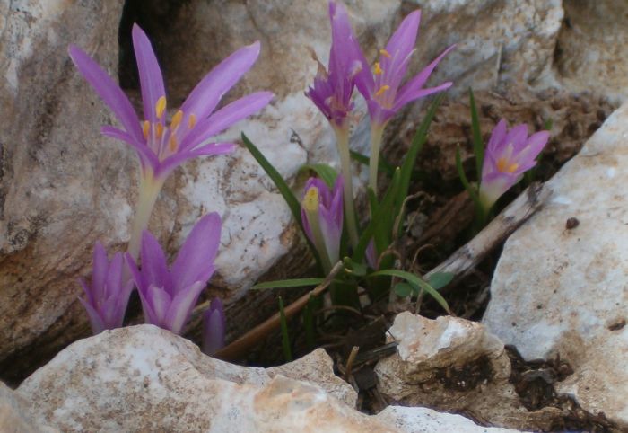
Lots of rain had fallen the week before this hike, so I wasn’t surprised that the winter flowers were beginning to sprout up every where. We picked up our rock from the Golan in a greener world then we had left last hike.
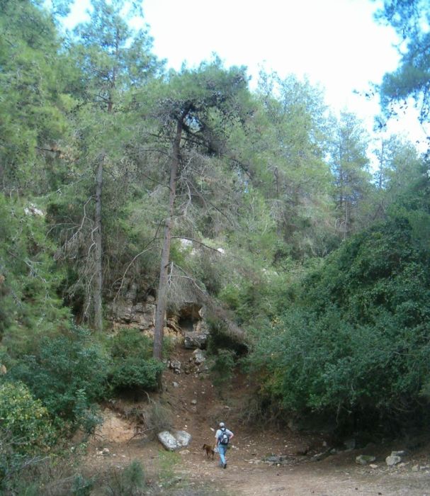
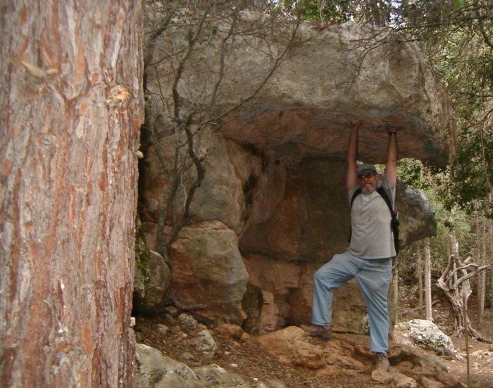
After a short time we saw a low cave slightly off the trail. We went inside to find roosting fruit bats. There were initially disturbed by our presence and flew around us in a swirl. Look at my article in Wild Israel for more about the biololgy of Fruit bats.
The trail continued south along the edge of the mountains. We passed several groups of Arab school kids on an outing.
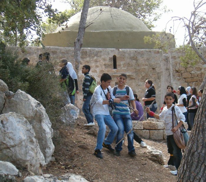
We reached an interesting domed structure which was the tomb of a sheik. One group of the kids were visiting the tomb, but we were unable to find out who the sheik was. There are quite a few of these interesting tombs around the north of Israel and the majority of them are unmarked.
Below the tomb was the ruins of a graveyard, also unmarked.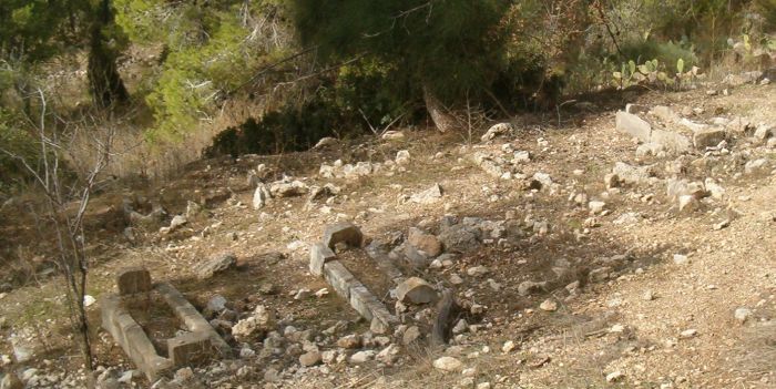
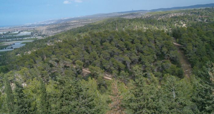
We continued walking for another hour until we arrived at an interesting camping area with water. Here there was a tower that you could climb up to see a 360 degree view of the Carmel mountains.
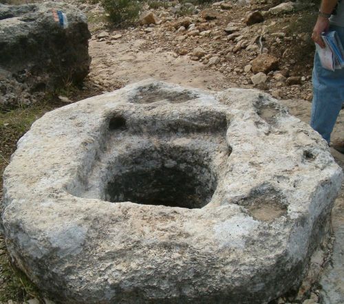
We continued south on a lovely path with wonderful views. We passed several ancient artifacts including a well preserved wine press unmarked on the side of the trail.
Soon we were at a cabin which marked the entrance to another Natural Park called the Carmel Shore National Forest. Another wonder that I hadn’t heard of before this hike. We found ourselves in an old forest with much taller trees than other woods we had passed. Don said he felt he was back in Vermont.
We found a small clearing by a rock face and ate our lunch of turkey sandwiches, oranges (at their peak of tastiness) and Snicker bars. The only sounds were the wind in the trees and occasional birds tweeting.
We passed from this wild area to an orchard of very old olive trees where the trail joined a dirt road. We hiked along this road for about 5 kilometers making our way to Route 70 where we hid our rock and ended the hike.
5th Day: 9December 2009_Route 70 to the Caesarea Aqueduct (Outrunning the rain!)
Winter is here now for real and we still don’t have proper rain gear. We had to reschedule this hike 3 times because it was raining too hard to even consider getting on the trail. Finally we left early on Wednesday with partially cloudy skies, hoping that luck would be on our side. We picked up our rock before 9am, crossed Route 70, and walked west on a dirt road parallel to 70 for a short while. The trail diverged into a swampy area through bamboo which was hard to follow, but we picked up the markers again on another dirt road that led to a tunnel under Route 652. Once on the other side of that major road the trail headed south away from the highway up a valley behind the town of Zihron Yaakov.
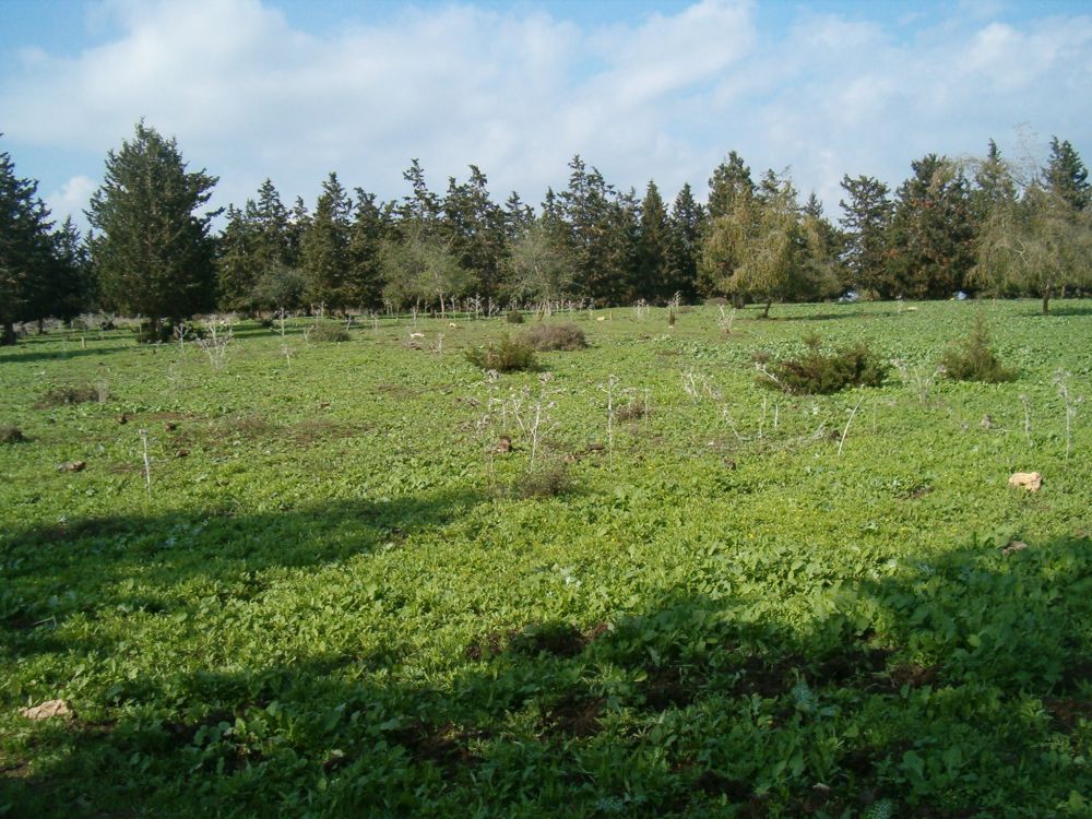
It was perfect walking weather, cool with scattered cloudiness. Our only problem was the mud which collected on our hiking boots until it felt like we were walking on stilts. The sun shown on the wet boulders and vegetation glittering like diamonds. Wild flowered were spouting in each clearing – lovely.
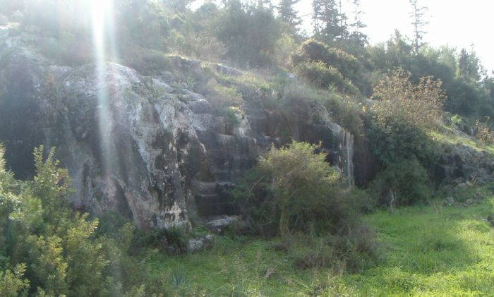
Further towards the top of the ridge about an hour into the hike we passed an ancient quarry. There was no information about the site. Israel is so full of archeological treasures that these lesser sites are simply there to walk by and wonder about. I guess if a person wants information, they would have to study the place themselves.
As we continued we noticed large areas of upturned vegetation where wild boars had rutted for bulbs the night before. After another hour of walking we passed through a more built up area. There was a concrete factory, and then a strip mall area with a discount grocery store and an ORT high school. The trail crossed Route 652 again and passed through the parking area of the school and from there entered the Ramat Hanadiv nature park
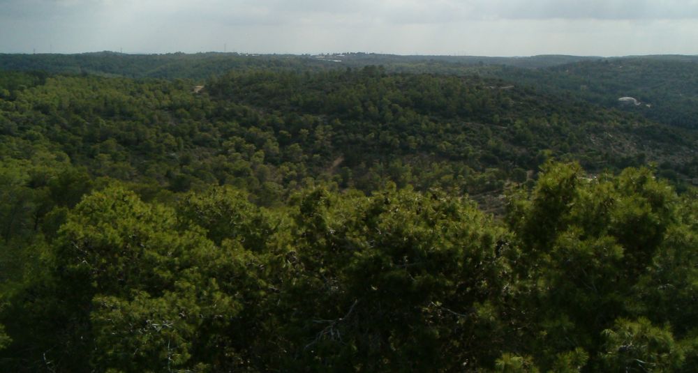
. At this point we were a bit worried about the weather. There were some black clouds approaching us, and it was sprinkling. However, the storm passed by without a deluge.Again the Israel Trail took us to a place that we should have known about, but which we had missed. Ramat Hanadiv was designed in honor of Edmond de Rothschild and he and his wife are buried there. We knew none of this. First we came to the ruins of a Roman agricultural settlement. Past this we hiked up wooded paths coming to a plateau on the top of the Carmel covered in low bushes that allowed for wonderful views, the area gleamed and sparkled. The trail continued into a clearing of startling green and then into a forest with sun beams shining through the trees.
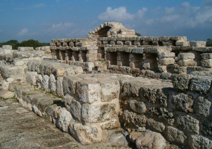
A ten minute walk brought us to another archeological site that had wonderful ruins from the Second Temple, Byzantine, and Medieval periods. We took a half hour to look over this wonderful place and then we sat on a bench with incredible views and ate our roast turkey sandwiches for an early lunch.
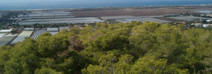
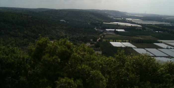
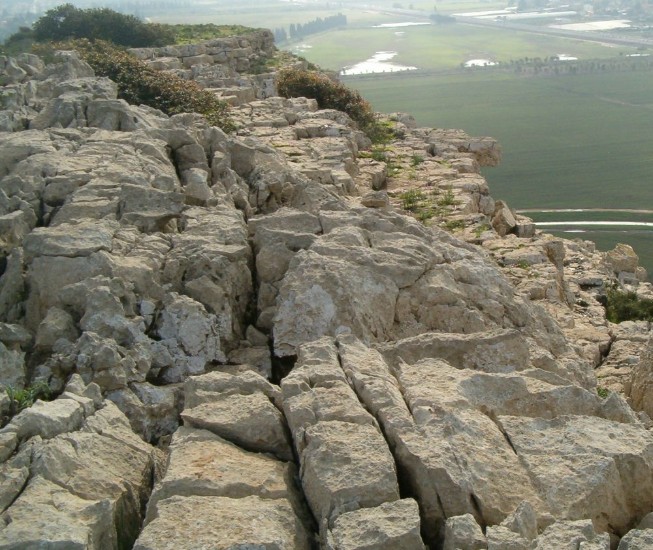
From this site the trail went south east, down hill off the very southern end of the Carmel Mountain Range. Ten minutes of walking on a broad track brought us to a view point where the terrain changed dramatically into jagged square clumps of rocks. To the east was an almost vertical drop to the coastal plain with the sea spread out to infinity. South the mountains ended in a dramatic cliff and the 3 huge smoke stacks of the Hadera power plant were noticeably closer in the hazy distance.
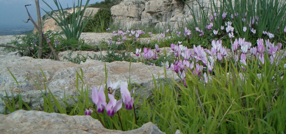
Ramat Hanadiv park was full of Cyclamen plants, probably in another month the whole park will be abloom with them. Here on the rocky ledge facing east we were amazed to see that cyclamen in flower early. Whole shelves of rock were covered in the white and purple flowers. I’m not sure that I’ve ever seen anything more beautiful than those stark rocks covered with the delicate flowers.
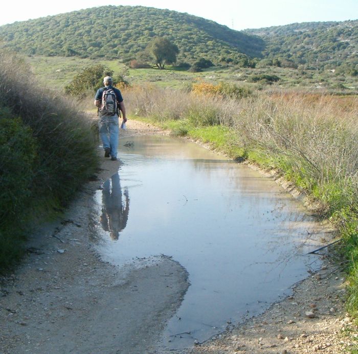
We were afraid we would be rock climbing down the cliffs, but the trail came to a dip between huge rock outcroppings and wound steeply down until we found ourselves off the Camel Mountains for the rest of the Israel Trail. The trail went along the train tracks for about a kilometer until we came to an underpass that was flooded and unpassable. We illegally (but very carefully) crossed the tracks instead. The better alternative would have been to hike the purple trail to the town of Binyamina and cross the tracks at the overpass). From now on we will make sure to bring water sandals on these hikes so that if we need to wade through water we don’t have to do it barefoot.
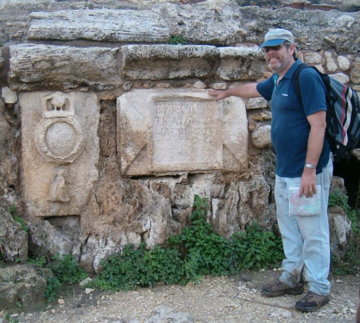
The next part of the trail from the train tracks to Route 4 was a real problem. The first part on a dirt road was fine. Then the trail markers clearly pointed off the dirt road between two winter wheat fields. There was a new trail marker indicating the direction to go, but there was no path. There were the hugely over grown remnants of a Roman aqueduct between the fields. It seems that the Israel Trail once used this as a path, but it is now completely overgrown and impassable. Off the aqueduct we sank deeply into the mud with each step. There was no sign of where we were suppose to walk. Probably the farmers plowed up the path when they seeded their wheat. My advise to anyone hiking this in the next few months is simply to cross the field as best you can. Getting on the aqueduct didn’t help us at all and was treacherous. It took us an hour to walk less then a kilometer! Finally we got to Route 4 and were relieved that the tunnel under it was not so flooded that we couldn’t pass. From there the trail was clearly marked and followed the aqueduct. The trail skirted Beit Hananya, an upscale village that had lovely houses with the added attraction of the Caesarea Roman Aqueduct running by the borders of their yards. vNear the village the aqueduct had a signature, so to speak, where you could still read some of the Latin naming the Legions of the Emperor Hadrian as the builders. The other tablet is the mark of the tenth legion.
After the village we had to take off our footwear and pants to forge the over flowing Taninim stream. Luckily for our bare feet the bottom was smooth.
From there we followed the aqueduct to Route 2, then walked along 2 until we joined Rt. 6531 and went under the highway with that road. We were now in the Arab village of Jisr az-Zarqa. Every time we drive on the highway to Tel-Aviv we pass this town, but I probably would never have entered it without following the Israel Trail which wound its way through the village. It was a strange junky place, but not with out it own kind of charm. Everybody stared at us as we walked by, but not in an unfriendly way, they acted more like we were a bit nuts and they should be kind to us. (We were covered in mud, and looking worse for wear.)
We continued east out of the town and were soon at the banks of the Taninim river, where several villagers were fishing, and one was sitting near a fire. After a few more minutes we found ourselves, for the first time on the hike, on the beach with the whole Mediterranean spread out before us.
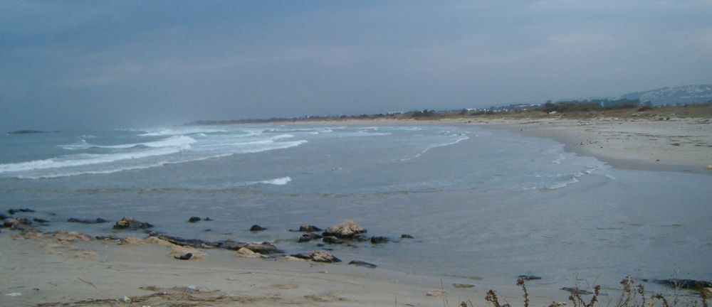
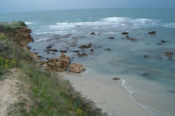
We sat there for 20 minutes, ate what we had left over of our lunch, and rested our aching feet. The whole sky now was full of black clouds threatening to make the end of our hike miserable. We also wanted to be off the trail before dark (5pm at this time of year) and it was already 3pm with about 5 kilometers to hike before we reached the bus stop that would take us to where our car was parked. So on we walked at a good clip. The beach was wonderful, with areas that had small sandstone cliffs between us and the mainland, but we were also getting more and more exhausted. The last few kilometers were more like trudging than walking.
We reached the Caesarea portion of the Roman Aqueduct at about 4:15 at which point it was sprinkling. I found a good place for our Golan Height rock there, and we then walked off the trail for another 2.5 kilometers until we arrived at the bus stop. And only then did the skies open up and the torrential rain start.