Please everywhere you hike take out more than you bring in!
Day 1: Wednesday July 6, 2010
We took a train to Tel Aviv Savador station, and from there a bus (Veolia – Connex bus company
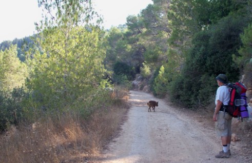
) directly to the Mitzpe Modiin Junction where we ended our hike last month. At 9:30 am we had already picked up the Golan Stone and quickly went to the water faucet we'd found last hike. Well our great find was turned off and there we were with at least 10 kilometers ahead of us and no water. We searched around the picnic and memorial area and finally found a water line where we could fill up, however, I no longer recommend this area as a reliable place to get water.The trail now took us on a path through the Ben Shemen Forest. The cicadas were so loud that sometimes it was hard to talk over their song. Even though we were walking in a forest, the trail was mainly on dirt roads which were not directly under the trees so we were in and out of the sun.
After an hour and a half of hiking we were already tired and hot. We rested in the shade under a bush where we enjoyed the ice water that we always carry with us on the first day. I noticed that instead of the cicadas there was the wonderful buzz of bees all around us. Turns out the bush we were under was the Ziziphus spina-christi, also known as the Jujube, Christ’s thorn, or in Hebrew as the Atad. The flowers in Israel website has a nice description of this tree, and I found another more scholarly paper about the ethnobotany of this plant. This bush is in full bloom in the dry summer and thus doesn’t have to compete with many other flowers for the bee's attention. It is one of several candidates for the plant that was the 'crown of thorns' hence its name. It is also one of the characters in “Parable of the trees” Judges 9:15. Where it is anointed “king of the trees” even though all it had to offer was its shade. Well to us summer hikers, shade is no small gift!
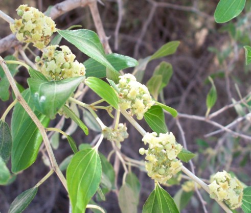
Flowers of the Ziziphus spina-christi blooming in mid summer
Ben Shemen Forest covers a hilly area, not like the Judean mountains to come, but a pleasant relief from the flatness of the Sharon plains where we had been hiking since Tel Aviv. When we reached the highest point of the hills we could see the mountains spread out ahead of us, past the dry, dry eastern part of the Sharon Plains. At 12:30 when the sun was climbing to its most intense position, we stopped for our lunch, drank our delightful ice water, and dozed for an hour.
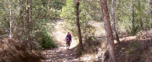
Hiking in Ben Shemen Forest
We continued and soon crossed under Rt. 431, the brand new road from Modiin to Rt. 1. We were now close to a new mall and to a train stop. We should have walked the extra kilometer and filled up with water, but we thought we could fill up at the up coming Kibbutz Sha’alvim so we kept going. This was a mistake, compounded by wishful thinking that the Kibbutz would be open from the back. In Israel, for security reasons, all small communities are fenced and gated usually with only one main entrance, so while the map showed a possible entrance to the town from the back we should have known it wouldn’t be open, and indeed it wasn’t. We arrived there with less than a bottle of water left and a difficult couple of kilometers detour if we wanted to get in through the main gate.
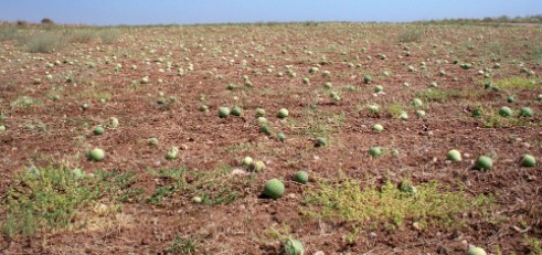
We were saved by water melons!
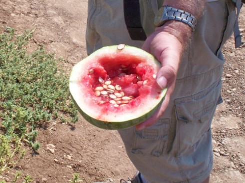
Watermelon that saved us when we ran out of water!
There were numerous fields of them along the trail. We found that while they were chalk full of seeds, they was also full of water and were perfectly ripe. I have a feeling that watermelon is better than Gatorade for hydration.
We were heading for Latrun which was where we hoped to find a place to camp. At about 5pm we again reached Rt. 1, went under and walked along the highway for a little less than 2 km. The highway was on the left of us and on the right was a field of sunflowers which were completely dried and ready to harvest. The trail then veered to the right away from the highway and we soon found ourselves in an orchard of almond trees. The almonds were also completely ripe and ready to harvest. In the last hour we’d passed fields of watermelons, sunflower seeds and almonds!
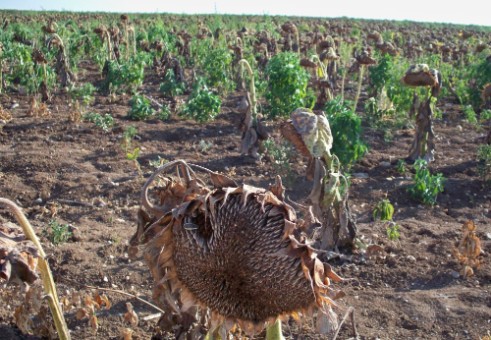
Field of dried Sunflowers
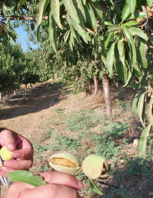
Ripe almonds from almond orchard
Latrun is a strategic hill, with many layers of history, that looks down over the main route to Jerusalem. There are the ruins of a crusader fortress in the area, a monastery famous for its wine and olive oil, and a museum built around an English fort. The English handed over the fort to the Jordanians when they left in 1948 after the English Mandate was over. During the war of independence three attempts were made to take the fort from the Arabs, but none succeeded. The fort was finally captured in the 6 day war of 1967 and from that time on Rt. 1 has again been the main way to Jerusalem.
We climbed up the hill, found what looked like a perfect place to camp, hid our packs and walked to a near by gas station to fill up on water, however when we came back we found out that our “perfect camping place” was actually the place where the 'young guides' youth groups were having their graduation ceremony so we had to find another place. We decided not to risk going forward where we didn’t know what we would find, instead we returned to the almond orchards and set up our camp in the middle of the trees. That night the big dipper was aligned exactly between our row of trees.
Day 2: Thursday July 7, 2010
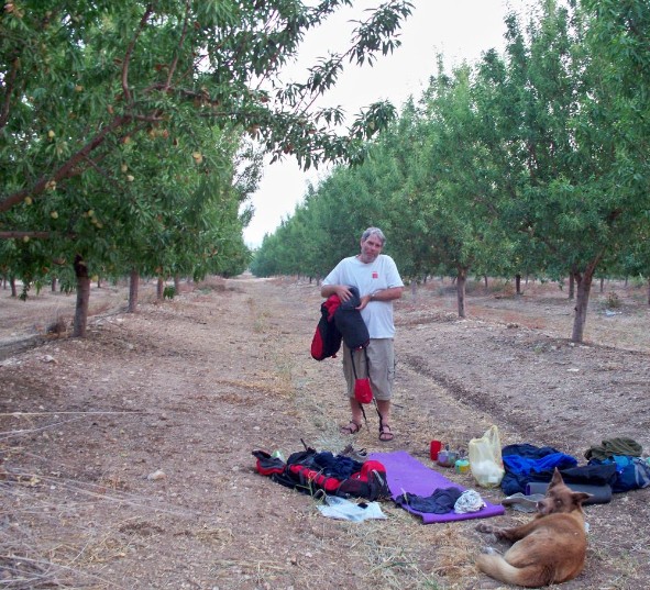
Packing up camp in almond orchard
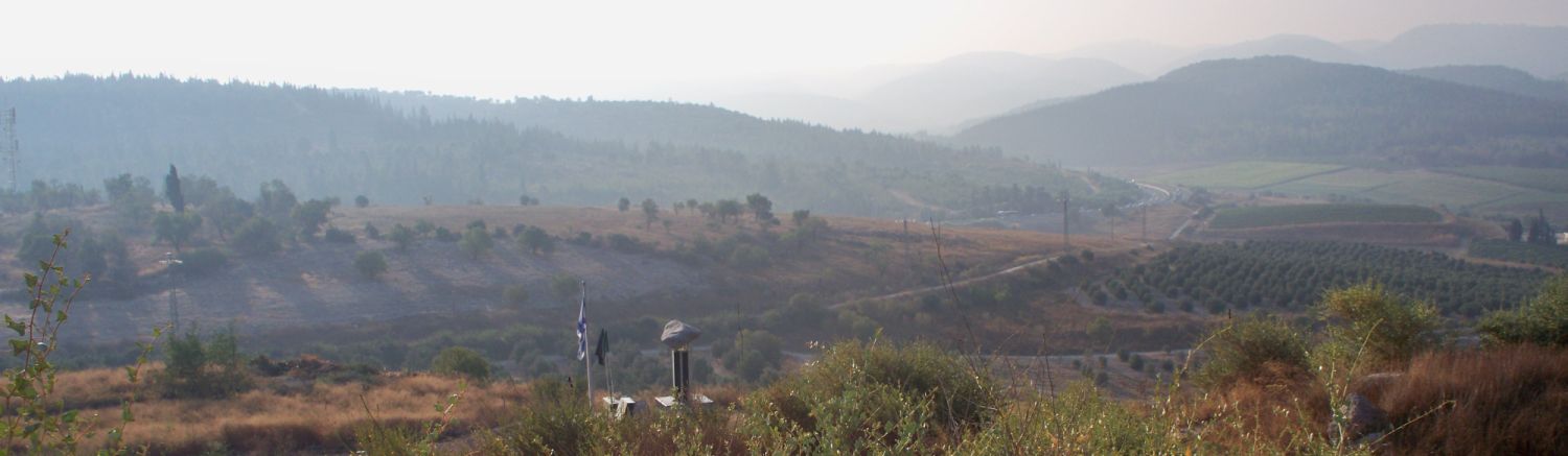
By 6am we were packed and on the trail. We passed the entrance to the Latrun museum and returned to the gas station’s 24 hour convenience store to refill our water bottles and use the facilities. Then we crossed Rt. 3 walked up hill beside the Latrun Monastery and came upon a monument that was a tripod holding a large boulder that was oriented towards a wide vista of dark green mountains where Jerusalem lay hidden in the distance (see the banner picture at the top of the web page for another picture of this monument). It conveyed with striking simplicity the longing for the holy city.
It is a memorial to the 7th Brigade of the Israeli Armored Corps which tried unsuccessfully to gain control of Latrun during the 1948 war of independence, but did finally break the siege of Jerusalem by building the Burma Road. They lost 139 soldiers during these battles.
Memorial to the 7th Brigade of the Israeli Armored Corps (in distance)
We were in a whole new world! On a hill to the west of the memorial were the ruins of the Latrun Crusader Fortress, to the southwest were golden fields of long ago harvested winter wheat. In front of us was a valley of vineyards with mountains on the other side.
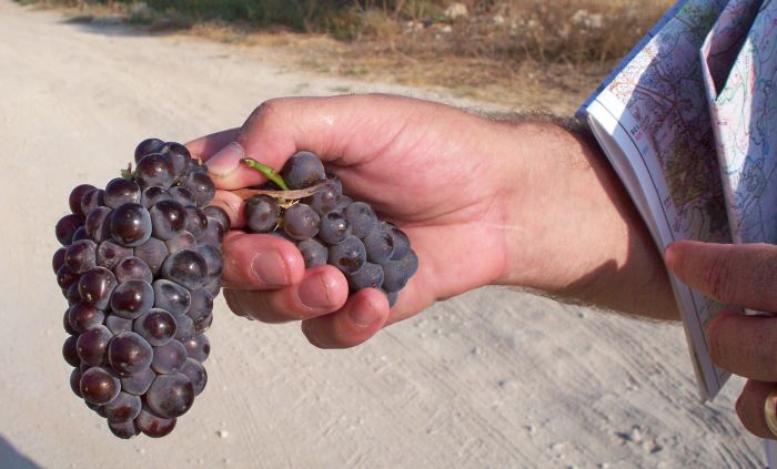
Cluster of grapes from vineyard
We climbed up into the fortress for a short look around, but there was not much left intact. Then we walked down into the valley. We each picked a cluster of grapes which we ate while we walked down. These pastoral paradises are some of my favorite parts of the Israel Trail. On the other side of the valley we rested and drank at an empty picnic area before we started up the hills and into the forest. After hiking uphill for about half and hour we passed the village of Neve Shalom
. This is a joint Jewish Arab village that focuses on peace education.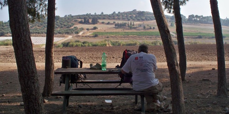
Looking west over pastoral valley
We continued walking on gravel roads steadily uphill through the thick forest for about an hour until we reached the Serpentine Road which is the steepest most difficult part of the Jerusalem “Burma Road”. The army core of engineering finished the serpentine road in 3 days of continual work during the 1948 war of independence. Thus, the Arab blockade on Jerusalem was broken even though Latrun couldn't be taken. There were commemorative plaques along the route with examples of the metal nets that were used to help the trucks navigate.
There were also faded pictures of what the area looked like while they were doing the building in1948. We knew, of course, that the forests we were walking through were planted, but it was almost unbelievable to see how barren the area had been before. At the bottom of the Serpentine road there was another plaque showing how after the Burma route to Jerusalem was finished, the water company Mekorot managed to build a water pipeline to Jerusalem in 30 days of around the clock construction.
Forest near the Serpentine part of the Burma Road
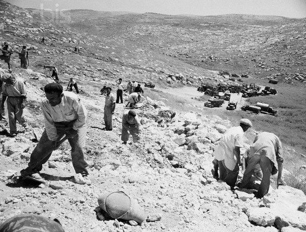
Jewish workers on the Burma Road in 1948, Photographer
E.F. Ilani © Bettmann/CORBIS.
We left the Burma road memorial area and continued walking on the gravel road. We were in a valley where the trail had a loop which added at least an extra Kilometer, Don wanted to skip the loop, but I wanted to make sure we didn’t miss anything. In the end our ditty, “Ours is not to wonder why, ours is but to follow the Tri” (Tri colored blaze), held the day and we stayed on the trail and completed the loop. At the far end of the loop was a back entrance to the village of Mesilat Zion which was actually open, and a Mekorot water station with an easy faucet and pipe to get water. We filled up with water thinking that the area would have been a great place to camp. It was now about 11am and getting hot even walking mostly in the shade of the forest. About a half an hour after the loop we reached a spring where the workers on the Burma road would fill up on water, but it was closed with a grate and unappealingly overgrown and trashed. Sorry that we couldn’t enjoy the spring we continued along the gravel road which was clearly a popular area for outings with picnic areas along both sides, however on this Thursday there wasn’t a soul anywhere. Except for one lady walking near Neve Shalom we had not seen a anyone walking, riding or driving all day. We were now almost where the trail crosses Rt. 38 to Bet Shemesh when we reached another Mekorot water station, this one had build a small pool with running spring water on the side of the gravel road. In all the heat and dryness of Israeli summer it is hard to express the delight of taking a swim in cold clear spring water. We went from being heat exhausted to shivering with cold! We’d get out of the water, heat up in the sun and slip back in. We spent a blissful hour and started on the trail again completely refreshed.
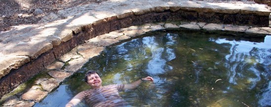
Swimming in spring right before Rt. 38
After crossing Rt. 38 there is another picnic grounds with a water fountain. However, be aware that the fountain sometimes needs messing with before water comes out, also the pipe is all above ground so the water was hot! Still water is water.
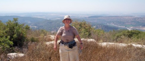
On top of Mount Arna looking west
From this picnic area the trail climbed 300 meters steadily to the top of Mount Arna next to the village of Bet Meir. Half way up we stopped under a tree, ate our lunch and rested for an hour in the heat of the day. Then we walked up the rest of the hill. There was no cover and it was exhausting walking up with full packs in the heat, but finally we gained the summit which overlooked the Sharon Plain to the west and looked straight down to Rt. 1 to the north. I’ve driven back and forth to Jerusalem hundreds of time and never knew of the trail looking directly down on me. It was clear from this spot looking down on the pass how the Arab fighters were able to ambush the conveys trying to break the siege of Jerusalem.
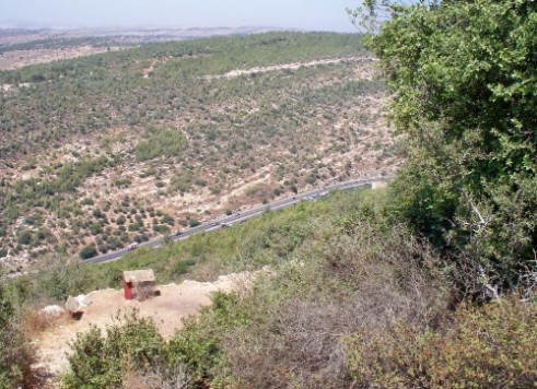
Looking down on Rt 1. from Mount Arna
From the summit the trail meandered through the hills that over shadow Rt. 1 passing several memorials to the Palmach Units that fought there in 1948. At about 4:30 we passed the access road to the village of Bet Meir. Across the street there was some kind of agricultural complex, it wasn’t clear exactly what, but we walked in hoping to find a place to fill up with water. There was no one there, but against the wall there was a faucet with a big sign saying “WATER” . I guess we weren’t the first people to come by and need to fill up!
The trail now started down into a steep, thickly forested valley initially on a gravel road, but then tuning off onto a narrow path down into Nachal Ksalon. The area was wild, and isolated by its steep topography from any sign of civilization. As we navigated the path we realized that the Judean Mountains must be full of lonely, hidden valleys just waiting for us to explore.
Gravel Road on the way down to Nachal Ksalon
The way down looked short on the map, but in reality it was at least triple the map distance because the path (thankfully) zigzagged back and forth down the almost vertical incline. By the time we reached the bottom of the valley we were exhausted and evening was falling.
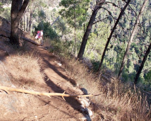
Steep zigzag path down into Nachal Ksalon
The place where the path reached the bottom was a intersection of two valleys and two dirt roads. There was a picnic area at this spot where we decided to make camp. We didn’t know it while we were there, but we were in “Martyr’s Forest”. Here 6 million trees were planted in memory of the Shoah and there are numerous memorials to the fallen.
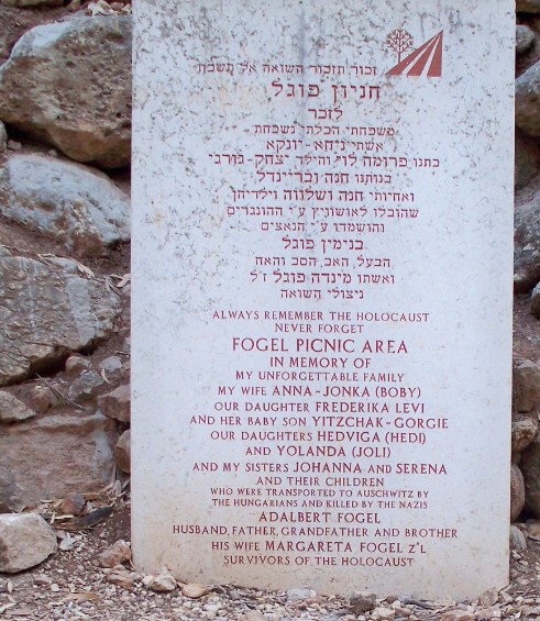
Memorial in Martyr's Forest at the picnic area where we camped
The sun was still up, and the thirsty bees were swarming us. So we waited for sunset and the bees to go home to their hives before we prepared our dinner. We could have explored in the beautiful area, which had the Bnei Brit caves, but we were so tired we couldn’t move. We’d hiked at least 18 kilometers in hot conditions over some rough terrain, it was no wonder we were beat.
When darkness started to set in and the bees slowly disappeared, two jackals trotted quickly past us coming from the area we had just climbed down and going up the hill on the other side of the valley. Taffy saw them and chased them away from ‘his territory’! We called him back. When he was back with us one of the jackals stopped, faced us, and made a explosive, strange cry, completely different than the usual howl. It was probably an alarm call.
Sometime during the night the jackals were howling quite close to us. Taffy stood alert, then perhaps from some ancestral memory, he suddenly lifted his head and howled with them. It was one of those remarkable moments in life that defy description.
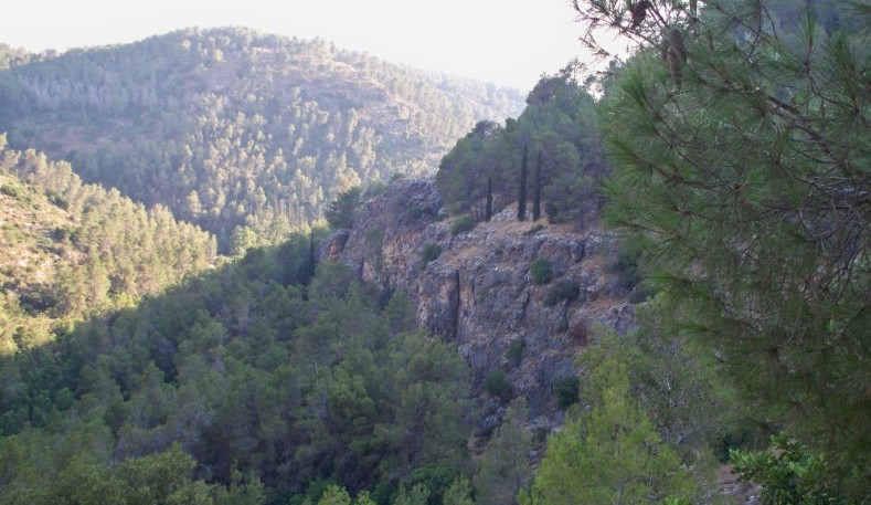
Beautiful Nachal Ksalon
Day 3: Friday July 8 2010
We were on the trail by about 5:30 that morning. It was still cool and though we’d been so exhausted the day before we felt rested and ready for the day. We walked up Nachal Ksalon with many bikers riding past us. Friday is biker day in Israel that is clear.
We reached the first place where we could have gotten off the trail near the village of Sho’eva before 8am, and it was clear, both from how well we felt and how early it was, that we were going to get further that day than we had expected. Unfortunately it was about here that the batteries of my camera finally gave out for good and from this point on the only pictures we have are from Don’s cell phone which are good enough for reminders of what we saw and did, but not good enough to use.
We reached the second place we could have gotten off the trail, the Arab village of Ein Rafa, at 9:30. It is not an old village, but it was interesting and beautiful to see how the farmers of the village were using some of the ancient terraces for their crops.
We than trudged up on a dirt road that went straight up out of the valley we’d been gently climbing. After 2 kilometers of steep climbing we reached Rt. 395 near Kibbutz Tzova. We were now almost completely out of water, this was good in that we’d been able to climb without all the weight and we were lucky that at the top, right on the Israel Trail, was an accessible water fountain on the outside of a Mekarot water station. We cooled ourselves off and filled a few bottles to last us for the last part of our hike.
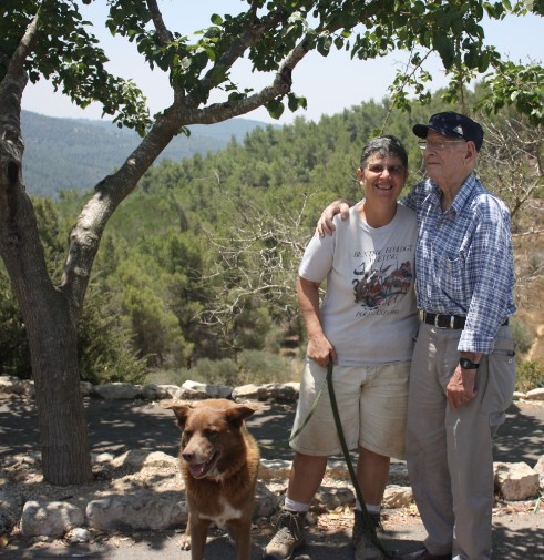
It was still only 10 am so we decided to try and reach Sataf where the Jerusalem Trail leaves the Israel Trail. We needed to get there early enough to catch the last bus back to Haifa before Shabbat (the Sabbath) started. The trail was now a rocky and loose gravel path that went straight down along the side of Rt. 395. At the bottom we reached a lovely forested area with many paths used by day hikers and bikers, we continued on the Trail which now climbed out of the valley steeply up to Sataf, a look out area with a café and picnic area. We called my father who had agreed to be our trail angle, pick us up, and bring us to the bus station. While we waited for him we found a good place to hide my Golan Stone. It felt wonderfully satisfying to have gone so much further than we’d thought possible (we hiked more than 15 kilometers before 12 noon!) and reach this junction.
Don and Diana at Sataf at the end of this hike