Please everywhere you hike take out more than you bring in!
This January’s hike was the first time we camped out during the winter - all the other hikes we took last winter were day hikes. Even the relatively mild winter in Israel requires different planning and a modified list of required items. First we made sure that the weather report for the 3 days of the hike did not include any big storms, we carried rain gear with us, we took a tent, sleeping bags rated to minus 7 Centigrade, and of course we took warm cloths for the nights and mornings. These extra items added some weight, but that was offset because we required less water.
19 January 2011
We left my father’s house at about 7am and after a frustrating wait managed to flag down a taxi that was willing to take us and Taffy to Mount Herzl Military Cemetery. The driver was a character, he never stopped talking once for the 10 minute ride. He called his wife to tell her about having a dog in his car, and explained to us how terrified he was of dogs, though he wanted to get one because his wife loved them.
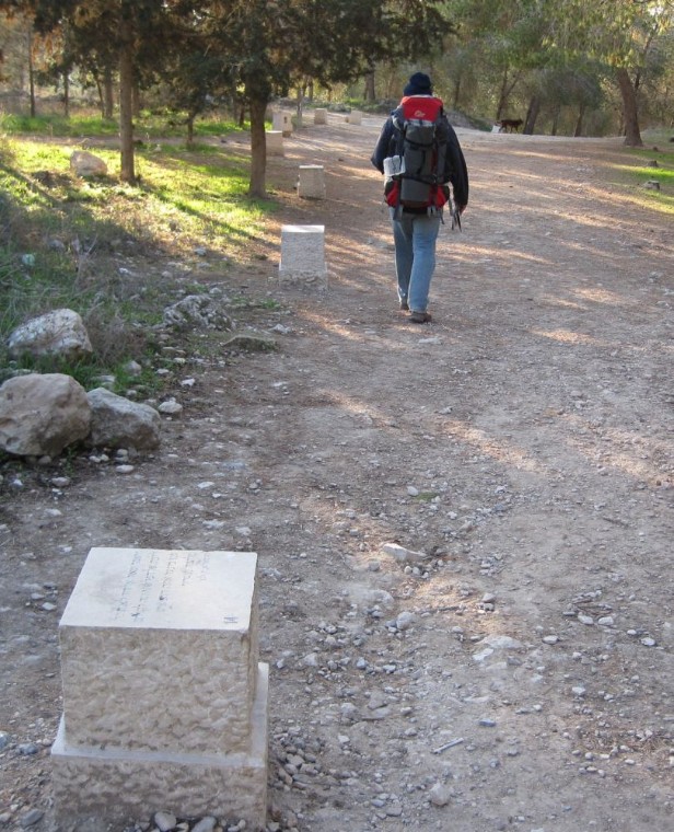
At the entrance to the cemetery a group of workers told us we couldn’t bring Taffy inside, but they relented when I explained we would only be there a few minutes to pick up something. It ended up being much more than a few minutes because we had a hard time finding the Golan Stone - we had hidden it too well. Much to my relief Don finally did find it. We promised ourselves, yet again, to be very careful so as to avoid these stressful searches.
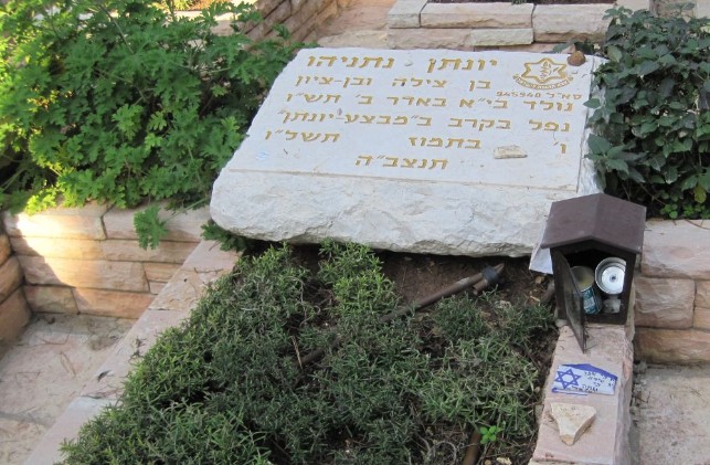
Jonathan Netanyahu's grave in the Mount Herzl Military Cemetery
Then we placed a stone on Yoni’s grave. The Entebbe mission saved many lives and had a profound influence around the world. As far away as the Soviet Union people like Natan Sharansky heard the story of that rescue and it gave them hope that they too would not be forgotten, that good would prevail, and they would be freed. Nevertheless, Jonathon Netanyahu’s life cut short was too high a price.
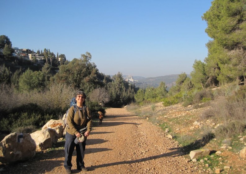
We walked out of the cemetery and turned right up Herzl Boulevard. It was 8am and everyone was up and about. Ten minutes brought us past the Yad veShem Holocaust Museum and to HaZikaron street where we turned right, downhill, on the tree lined street. A few more minutes and there was a blue blaze showing us a path to the left, off the road and into a forest. Suddenly we were out of Jerusalem and on a lovely path to the village of Ein Kerem (Spring of the Vineyard).
Path down from Jerusalem to the village of Ein Kerem
A mere 35 minute walk on this brought us to the charming village which, according to Christian tradition, is where John the Baptist was born. We passed cafés, B&Bs, shops showing off various artworks, fruit and vegetable stores, and churches. I felt disappointed that we had eaten breakfast at my Dad’s house instead of having a little forethought and enjoying a café breakfast there, right on the trail, in Ein Kerem.
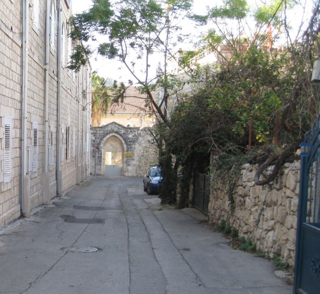
Narrow street in the village of Ein Kerem near Jerusalem
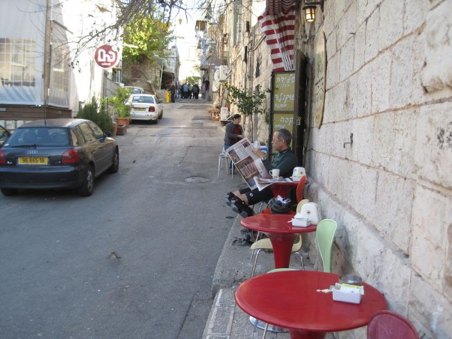
Café in Ein Kerem
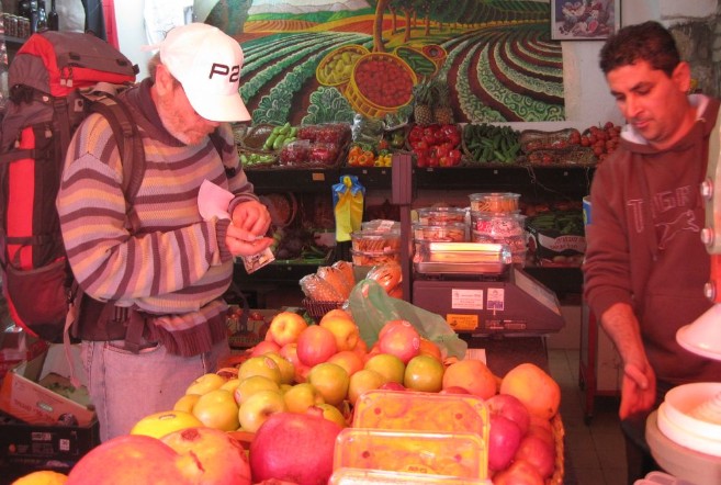
Don buying fruit in Ein Kerem
We did buy ourselves some fresh fruit to enjoy later. In a few minutes we were past Ein Kerem and walking on the Hadassah Hiking Path. Hadassah is a huge medical complex, more like a city than a hospital, and they have undertaken to maintain a loop trail around the area, so the path was well maintained with frequent picnic tables. It was also unusually wide and sometimes seemed to be paved. It turns out we were on an ancient Roman road where once the Roman legions marched to subdue Jerusalem. We found ourselves on different parts of this road several times over the three days of our hike.
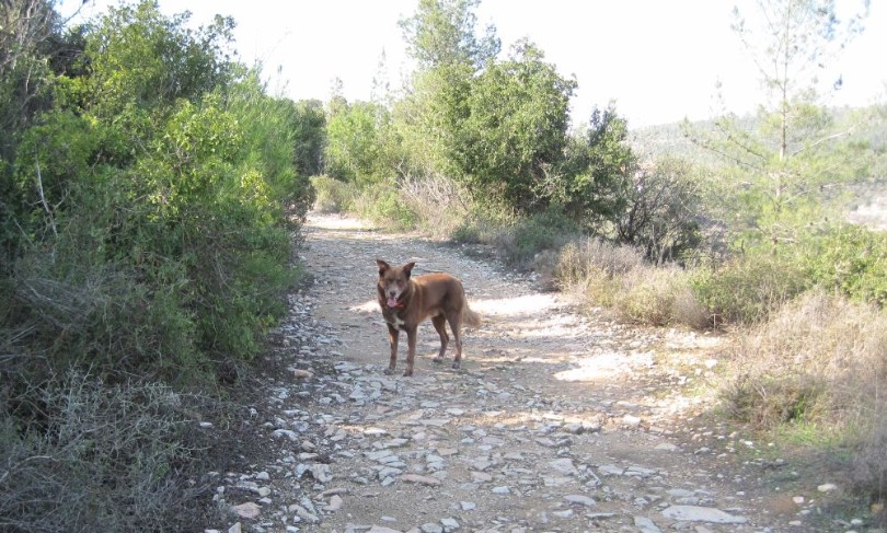
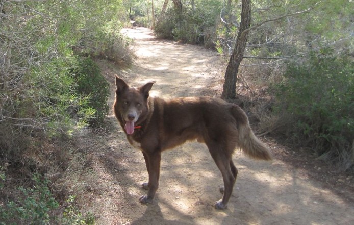
Taffy on Caesar's road near Haddasah Hospital
About an hour from Ein Kerem we once again reached the Israel Trail. The Jerusalem Trail detour was now behind us. We now found ourselves climbing a small hill that was covered with daffodils (Narcissus tazetta) which looked like hundreds of blazing lanterns because of the way the sun shone on them.
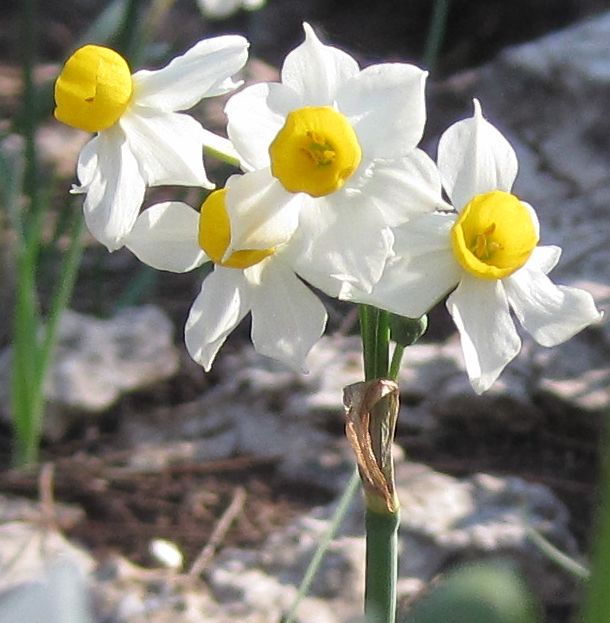
Wild daffodils (Narcissus tazetta) near Jerusalem
While we were walking on this part of the trail Don mentioned to me that he thought we would be passing fairly close to where long ago I had buried my dog Gimli. It turned out that the Israel Trail did not pass close, it actually passed right next to his burial place. What a beautiful and unlikely coincidence this was …
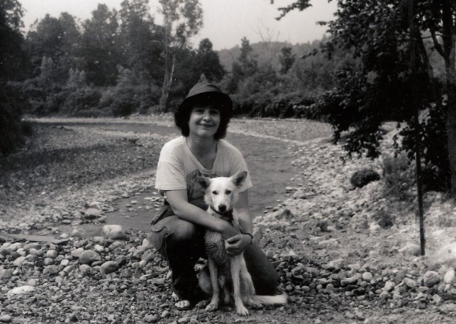
Diana and Gimli by a trout stream near Ithaca New York in 1978.
My 13 year old dog Gimli died suddenly, without ever getting sick or even seeming old while I was visiting my mother in Jerusalem many years ago. I remember sitting on the floor of my Mom’s dinning room with him dead in my arms. I literally didn’t know what to do with myself or how to continue. The only thing I could think of was to find a place to bury him. I drove off into the night in the only direction that I was familiar with at the time, which was towards Hadassah Hospital. I passed the hospital, turned left on a dirt road, and drove until it ended. Then seeing that the area was being used as an illegal dump I carried Gimli up the hill as far away from the garbagy area as I could manage with such a load. I found myself in a terraced region with a small almond tree growing near a stone wall which had a path passing above it. Even in the dark I could see that the area was beautiful. Near the almond tree against the stone wall I spent the whole night digging in the earth with inadequate tools. By the time dawn came I had buried my dog and made a cairn over the grave. The physical work itself, combined with the smell of the soil and the beauty of the place comforted me. That day that dawned was Tu Beshvat, New Year for the trees, an Israeli holiday like arbor day. I used to visit the area quite often, but it had been at least 15 years since I was there last.
If it is not strange enough that the Israel Trail happens to pass next to the place where I buried Gimli, here is something else uncanny - when we came upon Gimli’s burial place it was the day before Tu Beshvat, on the exact 20 year anniversary of his death.
There is no dumping ground there now. The area is well tended and has a small parking lot and information for day hikers. We spent a while placing more rocks on the cairn and remembering Gimli and the way things were, and then we continued on our way.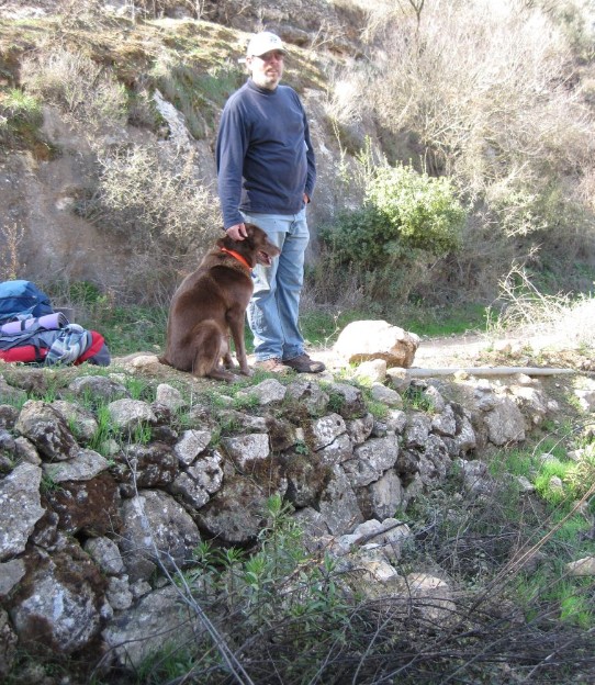
Don and Taffy on the Israel Trail above Gimli's burial place.
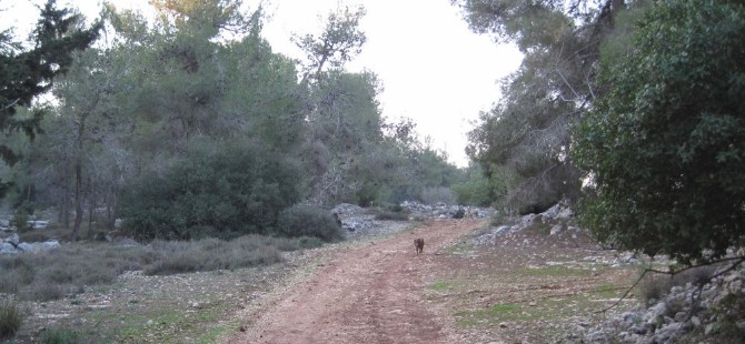
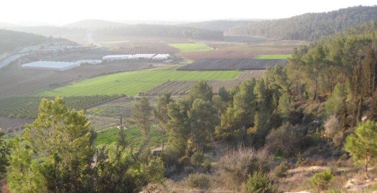
The trail meandered through the Aminadav forest, partly a natural oak forest and partly planted in various pines over the years by Keren Kayemet LeIsrael.
Trail through Aminadav forest
The trail passes many springs and ancient structures including wine presses and water carriers. After two hours of strolling through this area we climbed up to the Sa’adim picnic areas, near the Kennedy memorial. The area was suppose to have water fountains, but we couldn’t find them. There were many groups of school children, mostly religious, on outings in the area so we asked one of their group leaders about water and he pointed us down the road, west, toward a parking lot that was just out of view. I sat with our packs while Don went and filled our bottles. Then we ate our lunch of peanut butter sandwiches and the bananas we had bought in Ein Kerem.
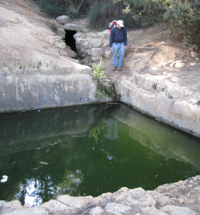
Spring and ruins in the Aminadav forest.
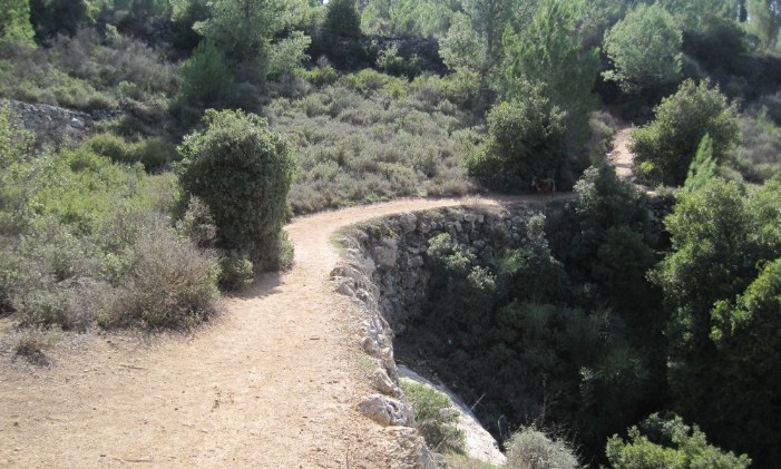
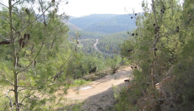
The trail continued through the picnic ground and down the other side of the mountain. We passed a new grove of olive trees planted by consuls from many different countries and crossed a gravel road down a fairly steep path to another gravel road, and it happened again… we found ourselves walking into a wide valley called Nachal Rafaim that was completely isolated from the surrounding civilization. There was the track of the Jerusalem railroad down in the distance, but that was temporarily not in use. We were alone in the world.
Looking down into Nachal Rafaim
We continued down a steep narrow path into the bottom of the valley. We spent a few minutes there enjoying the perfect isolation and the tall Eucoliptus trees.
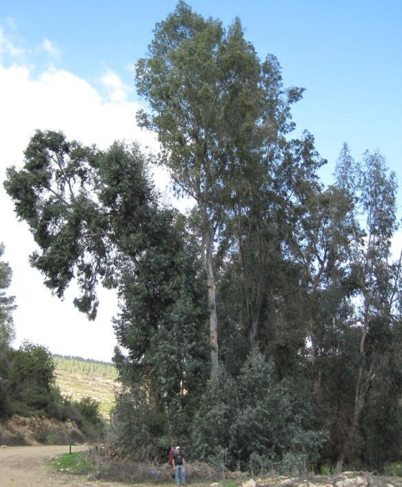
Don standing next to a tall eucalyptus tree at the at the bottom of Nachal Rafaim.
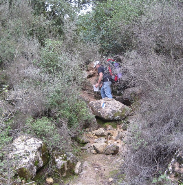
Then we went though a tunnel under the train tracks and immediately back up a narrow steep path that went straight up though a thick oak forest. We were now going up Nachal Kobi towards Ein Kobi. Ein Kobi is a site with ruins reaching as far back as the ancient Jewish settlement periods, through the Ottoman era, and more recently the water from the spring was used to irrigate the crops of a small town of about 100 traditional Arab farmers who lived there until the war of independence. It took us an hour of huffing and puffing to reach the top.
Up the steep path to Ein Kobi from Nachal Rafaim.
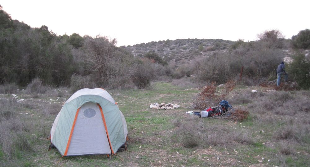
There was a pleasant picnic area at Ein Kobi and we considered stopping there for the night since it was almost 4pm and night fell early at 5pm. Instead we decided to go further along the gravel road towards a place where the map showed another picnic area that we hoped would be less exposed. Ten minutes walk and we reached that perfect place.
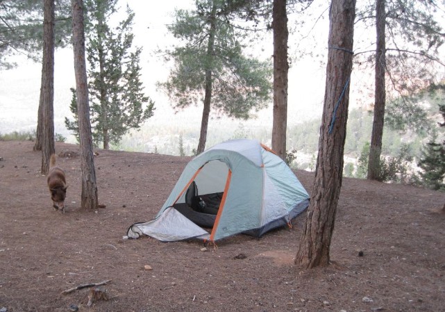
Taffy and tent at our first night's camp.
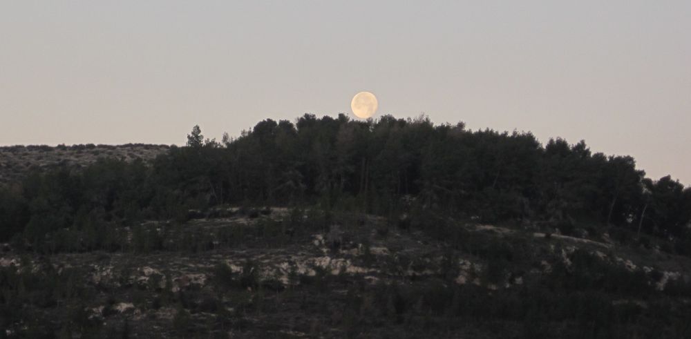
We quickly set up the tent while it was still light. It was getting really cold and we weren’t sure what we were going to do with ourselves for the long winter night. There was a ring of stones for a camp fire so in spite of being tired we spent some time scouting the area for dead wood and made a fire. That fire turned out to be a godsend. It was too early to eat, too early to go to sleep, and too cold to be comfortable even with all our warm cloths, but huddled near the fire we were fine. The full moon was orange as it came up over the mountains behind which Jerusalem was hidden. Again we were in a demi paradise.
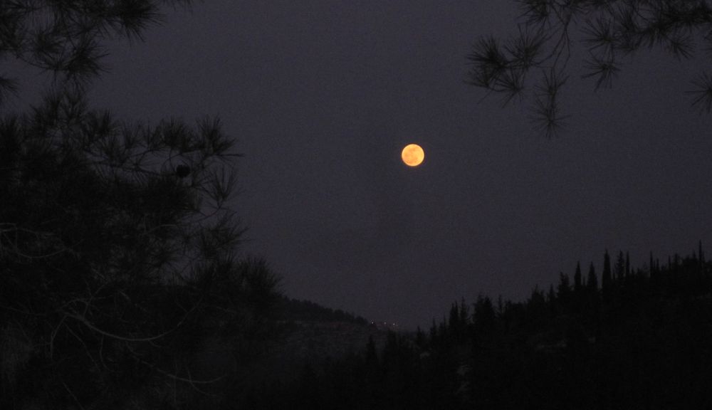
Full moon raise over Judean Mountains.
We then made our standard dinner of Ramón noodles with cream cheese, and with hot food in our bellies retired to the tent. It was only 6:30pm. Now what? Against this very problem I had brought a book of short stories by E.M Forester and a good flash light. I read the first one ‘The Story of a Panic’ about what happens when the god Pan appears on a group outing, the story was weirdly appropriate, but it was hard to find a comfortable way to read in the sleeping bag and stay reasonably warm. I finished the story and though it was barely 7pm I pushed deeply into the bag and faced the long night. Don was already asleep.
20 January 2011
Just as I dread the nights when we are camping I love the mornings. Then with renewed energy we are enticed by the yet unknown sights a head of us. We woke before dawn, and Don like the gallant knight he is on these trips, went out into the cold pre-dawn air and made us our tea. He then brought all the breakfast stuff into the tent and we enjoyed our breakfast in warmth and comfort. We dressed in every layer we had with us, packed up camp and before the sun had come up we were on the trail.
Trail before sun raise with Taffy in the distance
It didn’t take long for us to get hot and strip off the layers. Then the sun came up and sparkled on the dew making it seem that we were walking in a fairytale. As we were trying to find the right path at a point where the blazes were missing we met two warn out looking soldiers who were on their way to a rendezvous point at the end of a week long navigation exercise.
After about two hours of hiking we reached the ruins of a tomb. All I could find about this structure was its name, Sheik Ahmad El-Hubani's Tomb, but who was Sheik Ahmad El-Hubani? Tombs like this one dot the Israeli countryside, yet they seem to be unstudied. I would suggest that a comprehensive investigation of these would form a great PhD thesis for someone studying archeology.
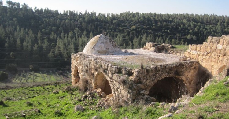
Ruins of Sheik Ahmad El-Hubani's Tomb
We messed around the tomb while a large group of Israel Trail day hikers walked past. We realized that it was Tu Beshvat and there would probably be many people enjoying the great weather on the trails this day. Not too long after the tomb we caught up to the group eating breakfast at the ruins of Dorban. This place, on the top of a hill overlooking Kibbutz Mata, was a maze of walls, ruined structures, and cisterns. Besides its existence and location I can find no information on what these ruins are.
We found a place in the sun overlooking the valley against one of the walls and had a midmorning snack of trail mix and energy bars, then we descended to Kibbutz Mata. Their back gate was open so Don went in and found a place to fill up with water, and then we continued past the Mata spring where there were many ruined stone houses in different states of disrepair.
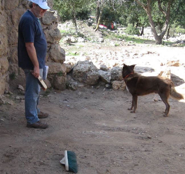
The trail now went up a ridge and we found ourseves in a park and picnic grounds on Route 375. Two buses were there full of soldiers. Two of them waved at us and we realized they were the two worn-out boys from that morning. We were glad to see that they had made it to the rendezvous point. We were now at the Hanot ruins. We put down our packs and made our way to the remains of a building with walls which were almost a meter thick. We walked around for a few minutes when we noticed a nook in the wall that had a bunch of brooms. Brooms?? Then we remembered being told about a mosaic left in the open but protected by sand that you could sweep away. We started brushing away the sand and quickly uncovered intricate, colorful mosaics from the byzantine era.
Don brushing the sand off the mosaics at Hanot.
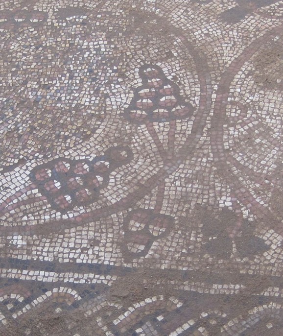
Close up of mosaic
Again we found ourselves walking on Caesar’s road, the same Roman road we walked on near Hadassah hospital, and on which the Roman legions marched to subdue the unruly Jerusalem. There were areas where you could see stairs etched into the stone substrate. Further along, fallen, broken columns were strewn beside the path and there was a reconstructed wine press. We stopped by some of these columns and ate lunch of salami in pita.
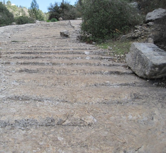
Steps carved out of rock on Caesar's road.
By 1:30 pm, about 2 hours from the mosaic we crossed Route 375 again and left Caesar’s road. We passed through a small forest and passed fields of winter wheat of such an emerald green that I couldn’t pull my eyes away. I took many pictures, but my digital camera couldn’t capture the true color. Israel has a Mediterranean climate and gets all of its rain in the winter. Most crops, therefore, rely on irrigation, but winter wheat is sown in the fall and depends completely on the winter rains to grow.
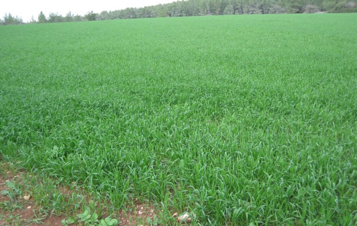
Field of winter wheat
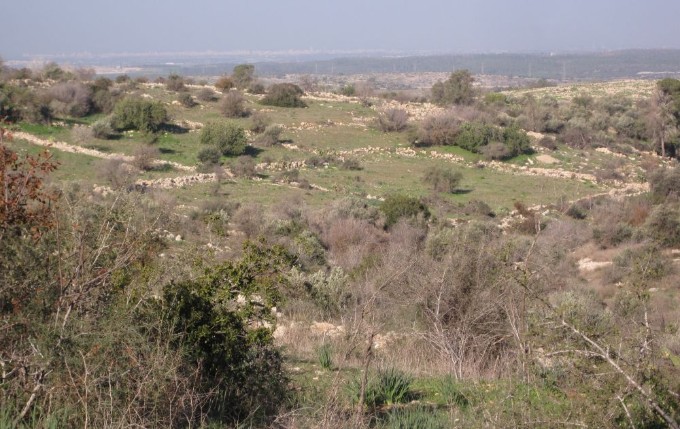
We were now walking on a gravel road on the edge of the Bet Shemesh Hills National Park. The trail went through forested areas, fields, and then descended into a valley with old almond trees. Many of them were in bloom, interspaced with olive trees. As we walked Don saw a fox (probably a red fox, Vulpes vulpes), which in typical fox fashion vanished in an instant. We walked though this beautiful valley for about an hour. It was now 3:30 pm and we were feeling tired and starting to look for a place to camp. The area we were in would have been perfect, but it was still a bit too early.
Don looking over the Bet Shemesh Hills national park
We passed above Kibbutz Netiv Ha Lamed Hey
(look at the link for its tragic history), and continued up and down in an area of native oak and pistachio trees. We soon entered another lovely isolated valley that ran east west and ended at Route 38 with Tel Azeka across the road. We wanted to find a nice place to camp in this area before we reached the vicinity of the road. I saw what looked like a perfect place right down in the bottom of the valley about 5 minute walk off the trail, but Don wanted to keep trying further west. We walked for another 10 minutes, but there were no flat areas that were adequately off the path. In an unusual decision for us we decided to walk back. While we were on the small detour we passed an man in typical religious dress walking the other way. We said hello and passed him without finding out his story – now I’ll never know what he was up to.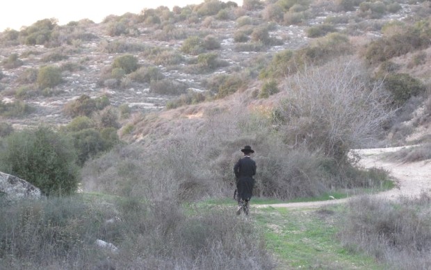
Ultra Orthodox man hiking past us.
We arrived at our perfect camp site at around 4:30 with the sun gone, darkness approaching, and the temperature dropping sharply. We quickly set up our tent, arranged all our stuff, and put on all our layers. Then we gathered some of the ample dead wood from the area and built a fire to keep us warm while the darkness became complete. There were no human lights to be seen and the only sound was the chorus of Jackals in the back ground. Don and I chatted quietly while Taffy lay curled up near by. Soon Don made our usual dinner.
Our second camping site, Don is in the background collecting fire wood.
When all the wood had burned, we retired to our tent. It was all of 6:30pm.
21 January 2011
We rose well before dawn. Don had left all the tea paraphernalia right outside the tent and so he was able to make us our tea with only his head and arms outside in the cold. We decided to eat breakfast further along on the trail since neither one of us were hungry.
The scene was of astounding beauty. The full moon was on its way down towards the west where Tel Azeka was waiting for us, while in the east you could see the very first inkling of predawn light. There are few things in this world that I love more than being on the trail before dawn and watching the dawn break as you walk.
Full moon setting over Tel Azeka
It took less than an hour to reach the road, we crossed into a lemon tree orchard, where we picked up a couple of lemons which we sucked while we looked around for the correct trail up the mountain. Soon we were walking up a steep trail that went directly up on sometimes slippery loose rocks. In 5 minutes we were hot and panting. We stopped to peal off all our layers and continued up. The sun burst out over the hills to the east showing off all the views in brilliant glittering light.
View of the Elah valley from half way up Tel Azeka
Similarly to previous occasions we were walking to an amazing place about which we had never heard. Tel Azeka is considered the place where Saul and the men of Israel were perched before going to battle with the Philistines. But the Philistine warrior Goliath challenges them to a one on one dual instead - who would have a chance against such a man?
“1Now the Philistines gathered together their armies to battle, and they were gathered together at Socoh, which belongeth to Judah, and pitched between Socoh and Azekah, in Ephes-dammim. 2 And Saul and the men of Israel were gathered together, and pitched in the vale of Elah, and set the battle in array against the Philistines. 3 And the Philistines stood on the mountain on the one side, and Israel stood on the mountain on the other side; and there was a valley between them.” Samual 1, 17
(You can read the whole David and Goliath story online in both the original Hebrew and translated to English at this website.
We climbed the steep path and soon found ourselves on the flat top of a mountain which had a 360 degree view. You could see the Mediterranean Sea to the west and the Judean mountains to the east and everything else in between. On the very top was a circular monument with the name of each place you could see. From there on the very top, spaced every few meters, there were blocks of stone with all the quotes in the Torah (bible) that deal with the Philistines.
We both had an eerie feeling, something seemingly mythical was real. Standing on the top of Tel Azeka it was easy to believe that Saul and his army had once stood at that spot and agonized about who would meet the challenge of the iron clad warrior Goliath. Meanwhile from the west, along a similar path to the one we had traveled, came the young man David bringing food for his brothers, not knowing the destiny prepared for him.
Don walking beside engraved blocks on the path going south down from Tel Azeka
We followed the engraved stones down the other side of Azeka where the trail continued on the forested ridge between the coastal plain spread out to our west and the Judean Mountains to the East. We were now going south, and it felt good to finally be going towards Eilat after the long detour east towards Jerusalem.
The area was dotted with picnic grounds and there were ancient springs, and more recent ruins. The weather was perfect – crisp, clear air and dark blue skis. There was the pervasive feeling of peace where the loudest noise was the buzz of bees working on almond blossoms. We were in an enchanted part of the country.
View towards the west from the ridge south of Tel Azeka
But we could not be too leisurely as we walked through it, we had to make the last bus back to Haifa and that meant getting to the Junction of Route 38 and 35 by 10:15am. With this deadline, we didn’t feel comfortable stopping for breakfast. By 10 o’clock we made it to Park Britannica. This facility was suppose to have running water (marked as such on the brand new hiking map of the area), and indeed there were fountains and a bathroom, but all of them were in disrepair and there was no running water available. The Entrance to Kibbutz Li On (alternately called Srigim) is across the street from this park and probably water could be found in the Kibbutz.
We found a safe place to hide the Golan Stone near the Entrance to the Park and hurried to the bus stop to catch our bus. It seemed that every bicycle rider in Israel was out on that lovely day, and almost everyone of them would wave to us as we sat at the junction and waited, the bus, however, never came. Apparently we had misunderstood the schedule for the Superbus bus company. Finally after waiting at the junction for more than an hour we tried hitchhiking, and after what seemed to us to be a long long time a car stopped for us and took us directly to the Bet Shemesh bus station where we needed to catch another bus to catch the train in Tel Aviv. As we drove, Arik the driver, asked us about our adventures. After we told him our story he smiled and said to us that it was written that every step a person takes in the land of Israel is a mitzvah (good deed)! I’m feeling pretty good about the number of mitzvot we’ve done these last few years.