We were all set to start this next leg of our hike, backpacks packed, literally stepping out the door when a return of sanity finally stopped us. It was raining, hailing, flooding, and much colder than usual. Somehow we had deluded ourselves that all this was only happening in the north of the country, but a quick look at the Israel Meteorological Society’s
web page showed us how wrong we were. So we postponed it until the next week.Wednesday March 9 2011
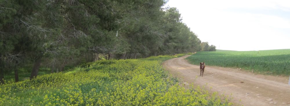
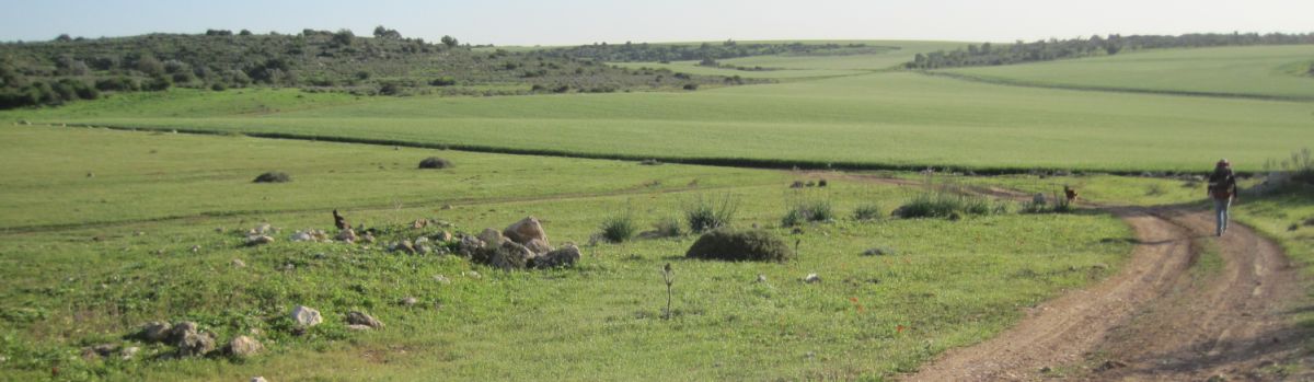
We took an early train to Kiriat Gat and than a Superbus took us to Kibbutz Li On (also called Sarigim) which is opposite the entrance to Park Britannica where we had left the Golan Stone at the end of the last hike. We easily found the stone and were on the trail again by 10:45 in the morning. We meandered up and down hills full of wild flowers. After about half and hour of walking we pasted a picnic area and walked down to a parking lot where there was a functioning water fountain. Then the trail went up and past a look out point called Mizpe Massua where there was a school outing taking place. We were now walking on a plateau with the Judean Mountains to the east and the coastal plain and the Mediterranean Sea to the west. In Israeli atlases the area is referred to as the Judean Hills which are distinct from the higher more easterly Judean Mountains.
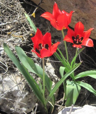
Wild Tulips, Tulipa agenensis, צבעוני ההרים
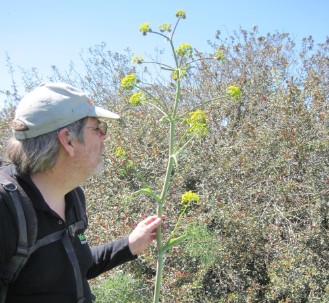
corn parsley, Ridolfia segetum, נירית הקמה
There were puddles on the path from the last week’s rain so Taffy could drink at will, and there were fields of red anemones flaming against the green, yellow daisies and mustard flowers, wild tulips – the world was awash in wild flowers. There were also mysterious alien looking plants which were finally flowering so that I could find out what they were (corn parsley, Ridolfia segetum,
נירית הקמה). The sides of the plateau were covered in small trees and brush, while the top was flat and treeless. After hiking on this plateau for an hour we reached Kirbat Tzura (צורה), which has the ruins of many buildings.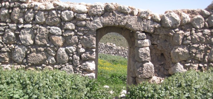
Kirbat Tzura (צורה)
I have not been able to find anything substantial about this site, but regardless, the area was impossibly beautiful. The old stones glowed in the sunlight and the area was covered in yellow daisies. We sat under a lone tree that grew right out of one of the walls, rested, and ate a snack of nuts and dried fruits including delicious dates and figs. My very favorite hiking snacks.
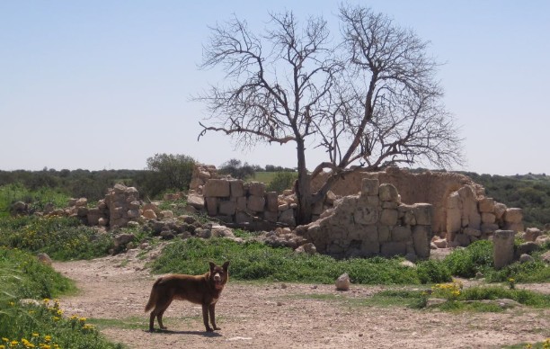
Taffy in front of ruined building in Kirbat Tzura (צורה)
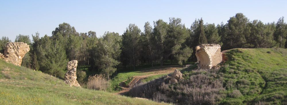
From there the trail continued on the plateau for about 45 minutes until it turned east and went steeply down into the valley. Near the bottom not far from route 35 were the ruins of Goded. (תל
גודד). Perhaps there is more to these ruins then what we saw, but right there where the Israel Trail passes them, there were no signs, no explanations, nothing.We wondered around exploring various caved in caves. One of these areas had a narrow tunnel in side of it, just wide enough to allow one person to crawl. I started crawling down into it, thinking it would not be very long, but it kept going down and further down. Of course, it was absolutely black, and I had the feeling that I might get stuck. There was no place to turn around until I reached a carved out, boulder filled, room. There I turned around and went back up.
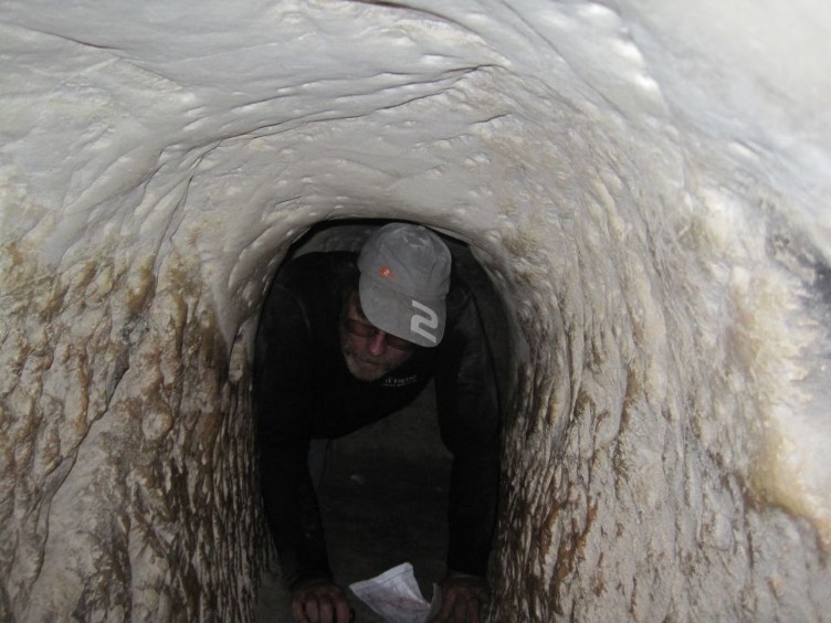
Don crawling in Bar Kochba era tunnel leading to secret meeting room
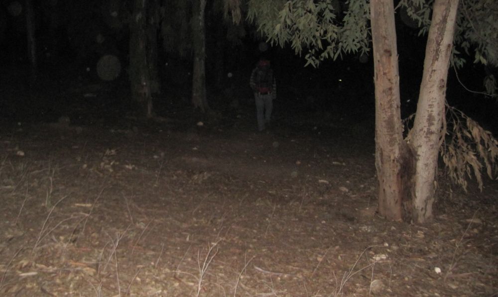
We had to figure out where the tunnel went. Next try we went back in together, one after another, with our flashlights. The narrow tunnel kept going down past that first room where I had turned around. It was the unknown that was intimidating. If had read about the area and had known where I was going I think I would have been less terrified, as it was it took all my will power to persevere. There were several sharp turns that were hard to navigate. I kept thinking that it would be horrible to have started on something like this and not found out where it was leading and that kept me going forward. After what seemed a long time, the tunnel opened to a place where there was about a meter drop into a large strange room. The walls were covered with triangular holes, and there was a circular staircase in the middle going up to what must have once been an opening, but was now closed off. Along the edge there was a ledge where many people could sit.
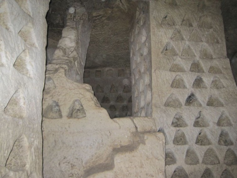
Ancient underground dovecote or columbaria which was used by Bar Kochba as a secret meeting place during the Bar Kochba rebellion against Rome.
We stayed in this eerie place for a few minutes, but I felt the need to get out mostly because I was worried about Taffy who had not come down with us. It was only when I was again in the light of real day that I could appreciate what an experience we had just had.
What was this place? (!). It turns out that Tel Goded has remains going back to the pre-Israelite bronze age. The amazing caves and rooms were hiding places that had been prepared before the Bar Kochba revolt against Rome. (Go to this link for a brief essay on the history of this revolt against Rome.) This hiding place at Tel Goded (also know as Tell Ej-Judeideh) had originally been a Columbarium to raise pigeons, and that was the explanation of the triangular holes. Bar Kochba revolutionaries modified it as a strategic hiding place that could be used for secret meetings to direct the revolt against Rome. There are many such caves around Israel. Take a look at this article for more about them.
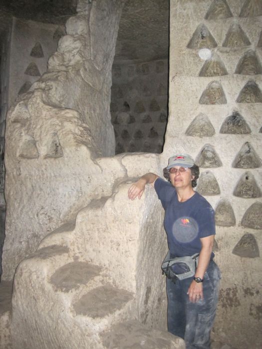
Diana in the Bar Kochba secret room
From Tel Goded we continued towards Kibbutz Bet Guvrin. The Kibbutz was only a few kilometers away, but the trail took a meandering way west of the kibbutz through a hilly wild area. By the time we reached the junction of route 36 at the entrance to the Bet Guvrin archeological gardens it was already almost 4pm and too late to visit the site.
We had not yet eaten our lunch so we bought an ice tea at the gas station and ate our lunch at one of their tables, promising ourselves that we would return an explore the site at a later time.The trail went up the road for about half a kilometer and then turned off on a dirt road towards the south. We spotted a young woman walking towards us, but before we passed her she had disappeared. There didn’t seem to be anyplace where she could have gone off the path, and for some reason this made me nervous.
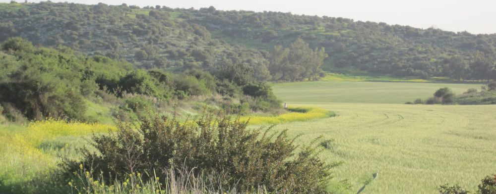
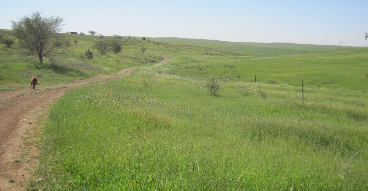
We now were walking in a area of rolling hills planted in endless fields of emerald green winter wheat which were the main characteristic of the rest of the two days of hiking.
It was getting late and we needed to find a place to camp so we made our way to a small grove of eucalyptus trees that looked like a good place. By the time we reached the area it was already dusk and in the dim light we set up our tent right in a bed of nettles. Not good! By the time we had taken the tent down and found another area out of the nettles, it was cold, it was dark, and we were really tired. Nevertheless we managed to make our tasty camp dinner, and it wasn’t even 7pm when we retired into our warm sleeping bags.
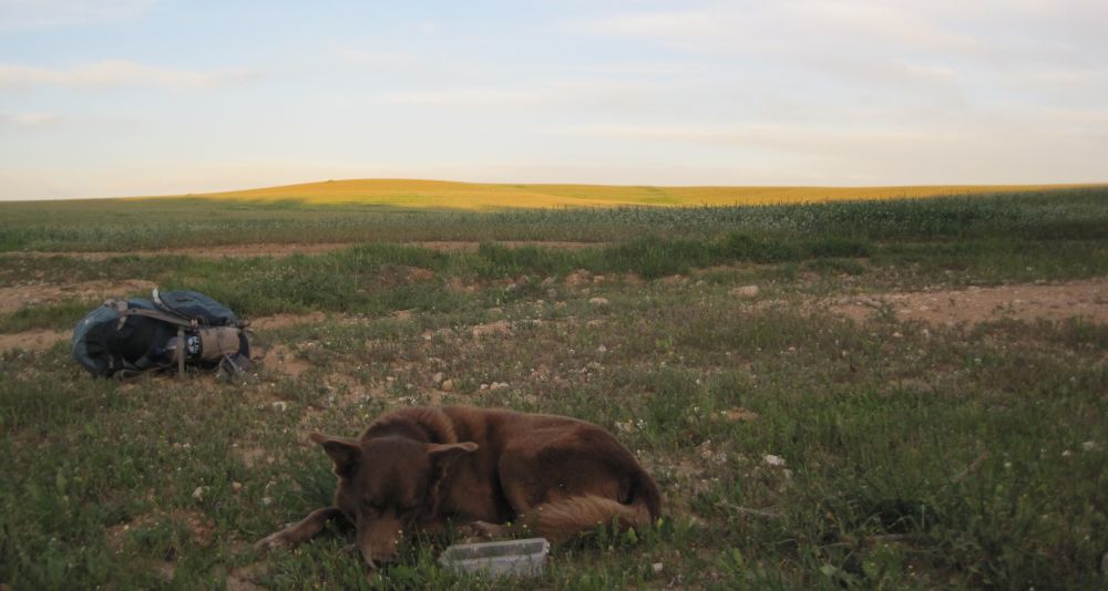
Nights on the trail have become easier for me. When we started this adventure more than two years ago, each night seemed like a decade, I simply could not find a way to sleep in the field. But now, perhaps because I have lost weight, I find myself able to get comfortable and sleep. This night, I was immediately comfortable, but for awhile I thought about that girl who had disappeared and conjured up all sorts of nefarious plots. I fell asleep glad we had Taffy the fabulous trail dog to guard our camp.
Thursday March 10 2011
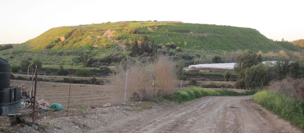
Tel Lachish (תל לכיש)
The next morning we were on our way before sun up with the sky towards the east just beginning to glow. We walked on dirt roads along vineyards. Soon there was a lot of traffic as all the farmers and their workers were making their way to the fields. The next land mark along the way was Tel Lachish which we reached in about 45 minutes. We detoured off the trail and climbed the steep path up the Tel. The views from the top were lovely. The Israel Parks Department recently developed this area.
People started settling in this area during the Neolithic period (which started in 9500 BCE and is considered the end of the stone age) and by the later part of the Early Bronze Age (3000 BCE) it was already a large settlement. The biblical stories about Lachish deal with the time when it was a major Judean city which was conquered by the Assyrians in 701 BCE. Look at this link for a history of the area from the Department of Archaeology of Tel Aviv University.
We walked down from the Tel and looked around for a place to get water, but didn’t find any so we were again on a water hunt as we walked on the dirt roads going south. We were now in a flat land of endless green. The only break from these fields were occasional vineyards and very occasional square patches of trees which were blessed areas for rest and shade. The temperature was cool and every time we stopped we would need to but our sweaters on. It would have been a much harder hike if it had been hot.
We solved our water problem when we spotted a farmer and his workers tending to a group of green houses. We asked to fill our water bottles which he happily helped us do, he also gave us a large bunch of parsley which is what they were harvesting.
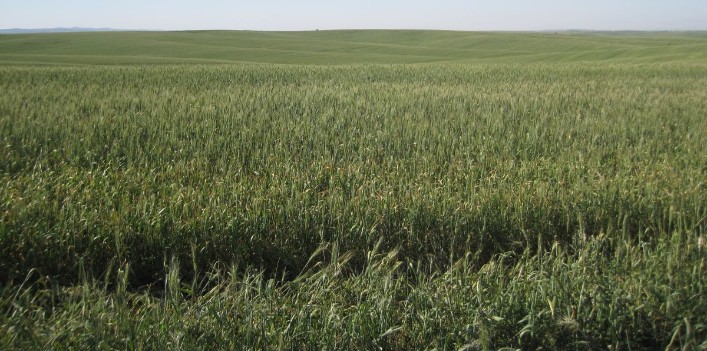
The rest of this day was spent walking the endless green fields. There were crested larks singing, and the drone of insects, but very little other sounds.
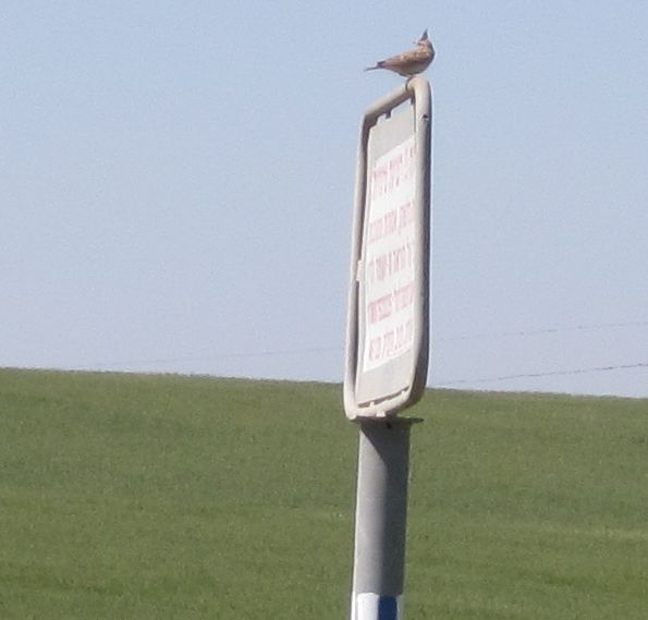
Crested Lark singing its heart out.
I didn’t think it would be possible to get tired of green, but it is. From 8 in the morning when we descended from Lachish to around 5:30pm when we walked into Pora nature reserve near Route 40 all we did was walk on lonely dirt roads through green fields of winter wheat.
We reached Pora with little water left, but we thought (we misread Jacob Saar’s Israel National Trail guide) that Pora had water. However, it didn’t! Now we had a dilemma. Night would soon be upon us, and we were too tired to keep going, but we were out of water. What to do? We found a nice place near the park under eucalyptus trees to camp. I stayed there with Taffy and set up the tent and everything, while Don went in search of water. In the end he begged a two liter bottle off of some nice people leaving the park. Now we just had to hope that the two liters would be enough to get us to the Dvira Junction the next morning.
Ruins of Ottoman rail road bridge at the entrance to the Pora nature park.
We wanted to get to Dvira Junction, which was about 10 Kilometers from Pora, in time to catch a 10:30am bus back to Kiriat Gat in time to catch the train to Haifa. We decided to get up really early and walk the next part of the trail which was next to the highway anyway, by night. We figured we’d eat breakfast in some nice area after dawn. So we were on the trail at 4am, this was 2 full hours before the sun would rise.
Friday March 11 2011
Leaving Pora camp 2 hours before dawn.
This will be the last time we try walking in the true night. Most of that mornings night walk was along route 40 which was lit by street lamps, but it was still too dark to see much of anything. What is the use of hiking the Israel Trail and seeing nothing? Also even on these easy dirt roads it was dangerous walking without being able to see. I’m glad we tried this once and got it out of our system so we won't do it again. However, what did work really well was eating breakfast after walking for a few hours. This will be our new modus operandi: leave camp just as the east is getting light, and eat breakfast at our first rest stop along the way when the sun is up.
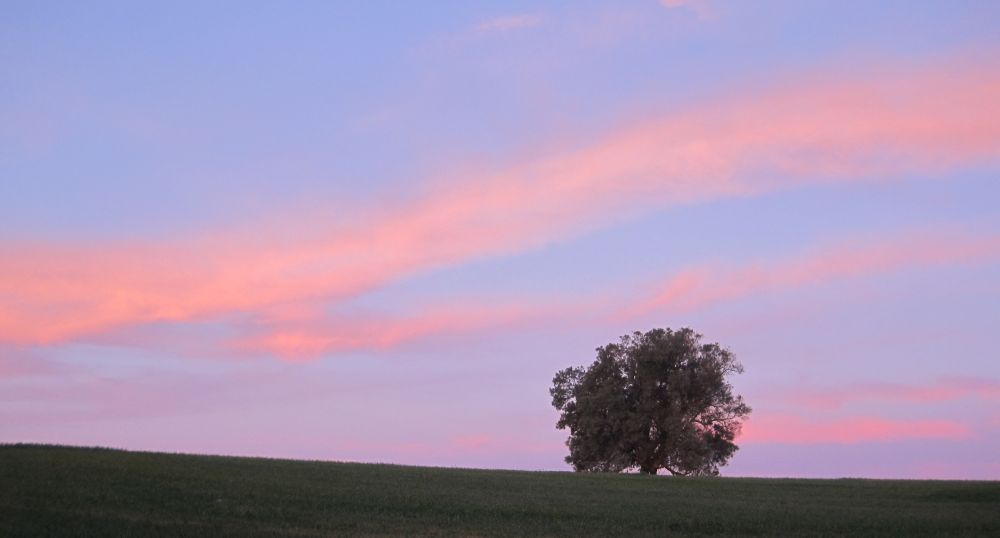
As the trail went under the high way and started towards the south the dawn started to light the sky. Soon the slight wisps of clouds became vivid shades of pink. We stopped for breakfast at about 6am. While we were drinking our hot strong tea the sun burst up over the horizon and changed the world!
It was now just a hop skip and a jump to Dvira junction, but we almost had a disaster in the final kilometers. We passed another Bedouin herder with fierce dogs, and this time though Taffy behaved just right - submissively - as a dog in another dog's territory should act, they nevertheless attacked him. There were six Bedouin dogs against Taffy. The Bedouin herder seemed to have no control. We kicked and yelled and managed to drive them away and when we were at a safe distance checked Taffy. We were so relieved to find that, some how, he had escaped injury. From now on we’ll keep him between us every time we pass Bedouin dogs.
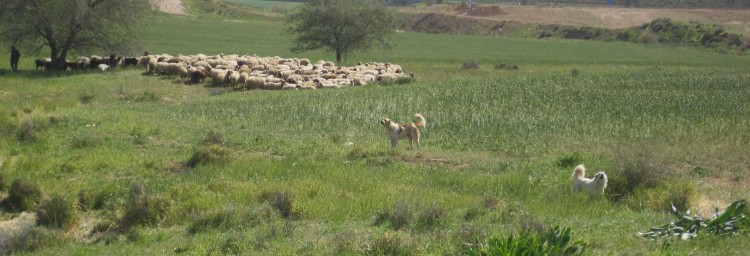
Bedouin sheep, herder and his fierce dogs (not the same dogs who attacked Taffy)
At about 8am we reached the place where we needed to leave the trail to go to the junction. We left the Golan stone carefully and easily hidden near a tree and arrived at the junction before 9am, giving us plenty of time to freshen up before we caught the bus.