Hike 3: Yagur Loop. Up the green and black trail to picnic area. Along dirt road (green blazes) to the red trail, down red trail - Nachal Yagur back to Kibbutz Yagur.
| Hiking Time | 6 hours |
Blaze | Green, Black, Green, Red |
Trail # | 4149, 4160, 4128, 4130 |
Difficulty | Medium to Difficult: red trail has many small cliffs to climb. |
Type of trail | Green and black trails are single file paths. The green trail after this is a dirt road. The red trail is a gorgeous path down a narrow wadi with numerous small cliffs to climb. Expect red trail to take at least double the the time of a regular hike. Climbing down is easier on this trail than climbing up. |
Highlights | Pleasant picnic area with toilet facilities and running water. Beautiful vistas and stillness at the top. Red trail is challenging and exciting to climb, the woods are especially dense and the geological formations are fascinating. |
Problems | The red trail is challenging, don't attempt it alone and give yourself at least 3 hours to complete it. Don't hike this trail in wet weather. Also be aware that this trail is difficult for dogs to navigate. |
Cleaniness | There were trashy areas on the green trail where it starts near Kibbutz Yagur. The red trail was also some what trashy. |
Dec. 2010 Fire | Trail unaffected by fire. |
Remember to take out MORE than you bring in.
Trail Narrative
Go south toward the mountain from the parking area near the horse stables and go through a gate that has the Israel Trail Tri color blaze (orange blue and white) and a sign that has the green blaze and says “נשר” - Nesher. Right after the gate there will be a junction of three trails: The Israel trail and the red trail which go to the left (southeast) and the green trail which goes to the right (southwest). Take the green trail. It goes steadily up the side of the mountain, after about an hour of hiking, when you can see the Nesher concrete plant and two large ponds down below to the north, you will see the blaze for the black trail on your left (south). Take this trail which zigs back the other way. After about 45 minutes of hiking, and several more zigzags on the black trail (and amazing view of cliffs) you will notice that all the traffic noise is gone because there is now a ridge between you and the Haifa Bay area below. Soon after this the black trail meets a blue trail. Take the blue trail to your right (west) and in about a minute you will reach a dirt road (green trail) and a nice picnic area with running water and a bathroom. Enjoy a lovely picnic and the peace and quiet of this area.
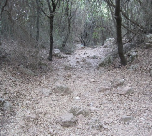
Go back to the dirt road, stand with your back to the way you came up and go left (southeast) on the dirt road. After about 10 minutes you will see a junction with a black blaze pointing down the mountain. This path joins the Israel Trail and goes directly back to Yagur. Ignore that trail and continue on the dirt road, enjoy the stillness and the deep forests above and below. After about 45 minutes you will reach the red trail which crosses the dirt road. Go left (northwest) down the stairs into the narrow ravine where you will be walking in a dry river bed. This is the challenging part of the hike so make sure that you have at least three hours before dark when you start down and that the weather is not wet.
After about 2 hours depending on how many breaks you take you will come to a junction with a blue trail going to the right (south). You have now reached the end of the Nahal Yagur and the difficult part of the hike, however there is still some walking to do. The red trail now goes up a shoulder of the mountain. Make sure that you look back the way you came - Nahal Yagur is an impressive gorge! The climb up is quite steep and there are loose rocks which make it slippery. Then it goes steeply down and you will soon join the Israel trail and see a gate leading to Kibbutz Yagur. Go through the gate and turn left (east). After a few minutes walking you will be back at the parking lot where you started.
Getting to the trail and back:
By Bus:
Take Bus 75, 180, or 185 from the HaifaBay Central Bus station to Kibbutz Yagur's Nursery - the fifteenth stop. From there walk about 2 km to the start of the hike in Kibbutz Yagur. (follow the link for an online map)
By Car:
Drive to Kibbutz Yagur which is at the end of the main road through Nesher (Rt 752). Take the first right after you go through the Kibbutz gate. That brings you into the parking lot near the riding stables. Park there.
Pictures from the Hike
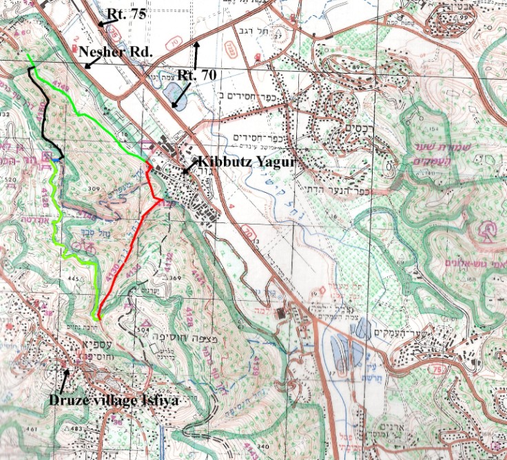
Cliffs near green trail
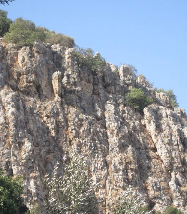
Black trail nearing the top
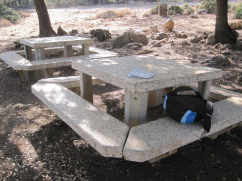
Picnic area
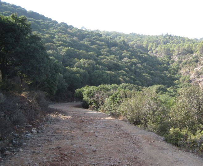
Carmel Mountains from the Green dirt road
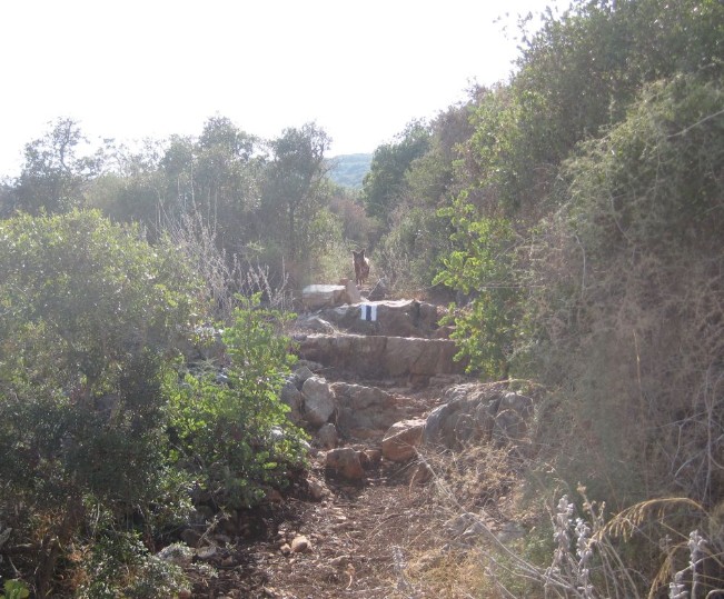
Red trail near the top
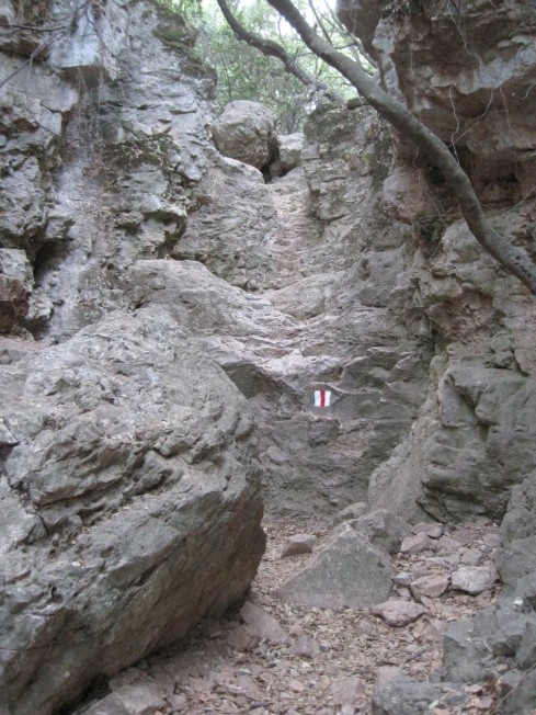
One of the numerous climbs on the red trail
Back to Carmel Mountain Day Hikes home page