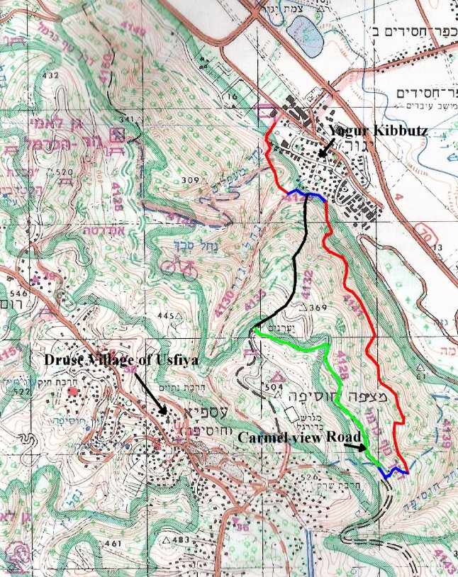
Hike 7: Diagonal hike up the red trail to the Carmel View Road then back down the black trail.
| Hiking Time | 4.5 hours |
Blaze | red, blue, red, blue, green, black |
Trail # | 4130, 4129, 4141, 4139, 4128, 4132 |
Difficulty | Medium to easy. |
Type of trail | The green trail is a gravel road, the rest are single file paths. |
Highlights | Lovely views, picnic grounds. |
Problems | Most of the hike has noise from route 70 in the valley. |
Cleaniness | Clean except for the area near Kibbutz Yagur. |
Dec 2010 Fire | Not affected by fire. |
Remember to take out MORE than you bring in.
Trail Narrative
Go south toward the mountain from the parking area near the horse stables and go through a gate that has the Israel Trail Tri-color blaze (orange blue and white) and a sign that has the green blaze and says “
נשר” - Nesher. Right after the gate there will be a junction of three trails: The Israel trail and the red trail which go to the left (southeast) and the green trail which goes to the right (southwest).Take the red trail. After a few minutes the Israel trail branches off to the right (southwest), stay on the red trail to the left (southeast). This goes steeply up and down a shoulder of the mountain. After about 25 minute you will come to the junction of the red and blue trails. The red trail goes straight up Nachal Yagur to the right (south).
Take the blue trail to the left (east). After about 10 minutes you will come to the junction with the black trail, stay on the blue trail and after another 5 minutes the blue trail ends and there is a junction of the green trail going straight up to the right (west) and the red trail going diagonally up straight ahead (southeast).
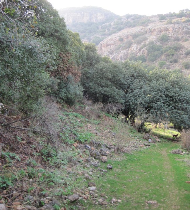
Take the red trail. This is an excellent path that goes along rock faces and through several Wadis as it gradually makes its way up the mountain. During the winter it is full of wild flowers (buttercups and cyclamen). After a little less than 2 hours the red trail ends at the blue trail.
Take the blue trail up to the right (west) and in about 15 minutes you will reach the Carmel View Road marked with a green blaze. Take this dirt road to right (northwest) and enjoy the beautiful area as you walk about 45 minutes and you reach the Bet HaShomer picnic area. This is where I had a late lunch. From here continue on the road for another minute and you will reach the junction with the black trail.
Take the black trail down to your right (north). The black trail is a relatively easy trail straight down the mountain. It goes past several forestry roads, make sure to stay on the trail and not the roads. It take less than an hour to return to the junction of this black trail with the red trail where you started.
From here follow your tracks back the way you came.
Getting to the trail and back:
By Bus:
Take Bus 37 to the University. The 37 bus starts down in Bat Galim, goes through Hadar, Central Carmel, Ahuza and ends either at the University or if it is a 37 Aleph goes all the way to the Druze villages. Get off the bus on the Southern Side of the University. From the University walk across the main highway to the Anemone Picnic area where the green trail begins.
By Car:
Drive to Haifa University on Abba Hushi Street. Park either at the Mount Carmel parking lot, which is the first parking lot on the right when you see the University tower on the left. This is where the hike ends (black trail). Or you can park in the Chi Bar parking lot further along, also on the right. This is where the Hike, green trail, begins.
Pictures of the hike:
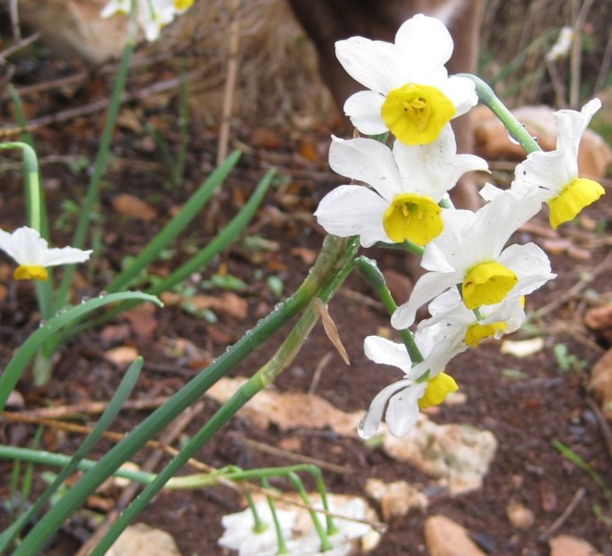
Wild daffodils (Narcissus) right after rain
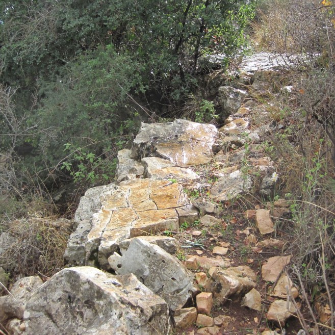
Rocky part of the red trail after rain