The Israel Trail skirts Jerusalem, but does not enter. The closest it comes is Sataf, the look out point where we left the Golan Stone at the end of our last hike. Sataf
purportedly has several interesting sites including a spring and an area dedicated to recreating ancient agriculture, though we didn’t have time to look around.There is another trail, the circular 42 kilometer Jerusalem Trail, which goes up into the city, visits important city landmarks, and returns to the Israel Trail. Long ago we decided that we would make the Jerusalem Trail our one and only detour off the Israel Trail. We used my father’s apartment as a base and did the Jerusalem trail in two day hikes.
29Oct.2010
We left my father’s place at 6 am, and parked our car at the Sataf parking lot where we ate a quick breakfast of hot tea and granola while looking over the view. The weather was perfect for hiking, overcast and cool. By quarter to seven we had found the Golan Stone and turned left (east) off the Israel Trail on to the blue trail. This took us down a few meters to the rotary where Rt. 395 and Rt. 3965 meet. There, across the street, we found the blaze for the Jerusalem Trail.
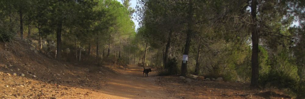
Pine forest on the path to Jerusalem
We found ourselves on a pleasant dirt road through a pine forests which eventually gave way to old olive trees full of ripe black olives. There were suburbs around us, but we didn’t feel their presence. Old, probably ancient, stone terraces lined the road above us. After about an hour and a half of walking we descended into a valley of vineyards, passed a kibbutz where kids were taking a horseback riding lessons, and then found ourselves going under Rt. 1 near Ramat Motza.
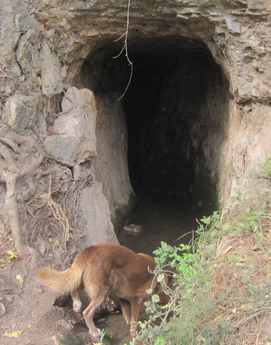
Year round spring, Ein Motza.
The trail soon passed a spring with flowing water coming out of a small cave into a man made pool – called Ein Motza. A group of young men, probably army friends having a reunion, were camped out there, some still in their sleeping bags. The path climbed for a few minutes and then entered a valley, with Rt. 1 to the right in the distance. We were soon in the Einot Telem park where there are a group of year round springs which have been used since antiquity. We sat at the edge of one of the springs and had an early lunch of tuna fish sandwiches with chocolate for dessert. In the distance we could just make out the Andrei Sakharov Gardens above Rt. 1.
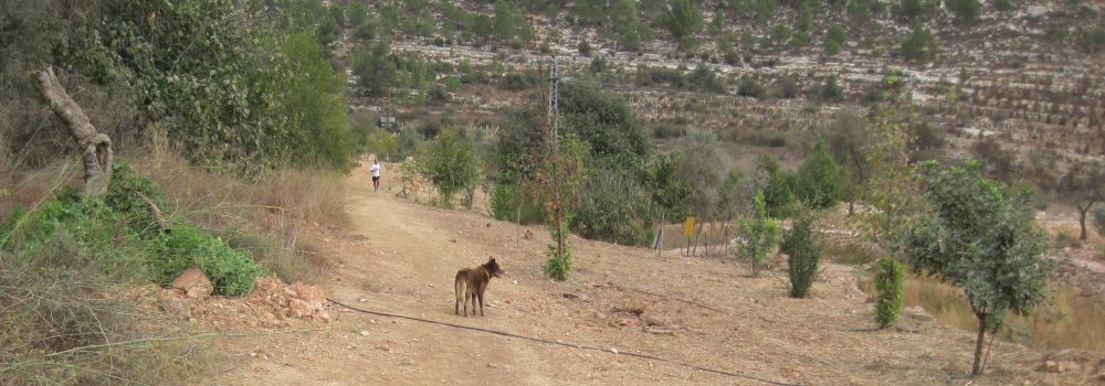
Valley leading to Einot Telem Park
After our lunch we continued past the park where for a short time the trail was on and off of paved roads. We passed Tur Sinai, an organic farm that caters events, it was set up for some special dinner, and looked lovely. After walking another 10 minutes we suddenly had a view of the basin between two build up ridges that leads up to Jerusalem. The cantilever string bridge
designed by Santiago Calatrava, which now graces the entrance to the city, was clearly visible in the distance.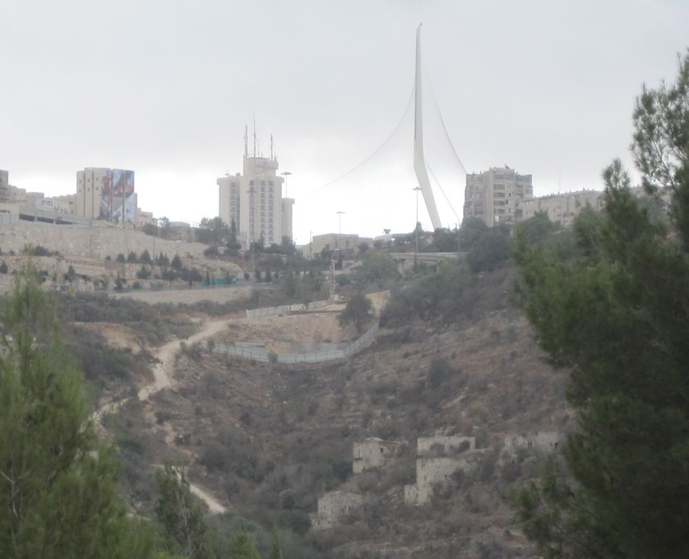
The path up to Jerusalem with the cantilever string bridge above
Another half hour saw us starting up the steep path that climbs in the basin to the city. A head of us were a cluster of abandoned houses that made up the vacant village of Lifta. Many many times while driving into Jerusalem on Rt. 1 I’ve gotten a glimpse of those buildings and wondered what they were, but until now I never investigated further. The closer we got to the buildings the more I felt the melancholy of their emptiness. There is no question that these beautiful stone structures were built with love. You could see it in the stone work of their windows, and in the remnants of the tile floors, and elegant arches. At the time, while we were walking through, we didn’t know the history of the place, but you could glean the essence of the story from the disturbing atmosphere. There was a lot of graffiti (Hebrew and Arabic) on the walls, everything that could be scavenged was taken, litter was everywhere, and there were squatters actually living in one of buildings on the other side of the village.
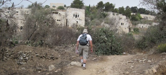
Don walking up into Lifta.
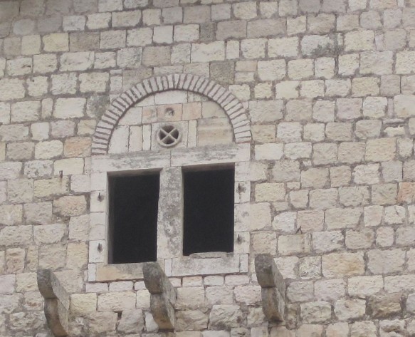
Detail of one of the windows in Lifta.
Lifta was an Arab village before the Israeli war of independence in 1948. From the feeling I got from what is left of the buildings themselves, I think the village was a lovely place to live. Certainly it had incredible views and picturesque alleys and courtyards with a year round spring a few meters up from the village proper. The people who lived there were no doubt innocent, it wasn’t their fault that war broke our around them. It must have been gut-wrenching for them to leave their homes.
I would have loved it if Lifta could have been made into a museum showing the way of life in the village, but it seems that there are other plans if this article in the Jerusalem Post is accurate. I am sceptical that the developers of luxary apartments could adequately restore the village, but almost anything is better than the state of affairs now.
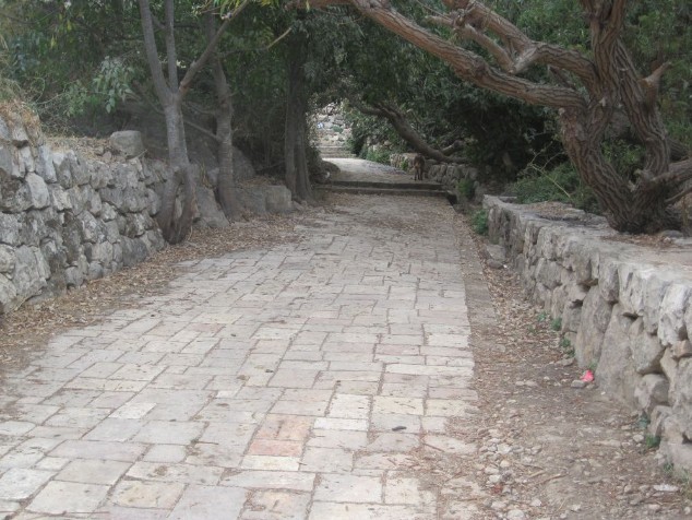
Paved street in Lifta heading towards the Lifta Spring
Ten minutes from the Lifta spring we climbed off the path and into midtown Jerusalem. There the blue trail and the Jerusalem trial markers ended. To follow the Jerusalem trail inside the city proper you need to get a detailed description of the route by down loading the GBS markings of the trail. We had done that and now followed a print out we had made for ourselves. We crossed the street on the walking bridge, walked under the string bridge and then straight east along Weizman until it becomes Shazar, and then become Shmuel Baruch and then that merges into Agripas and goes into the Mahane Yehuda Open Market (Shuk). Here we turned off the Jerusalem Trail and walked the few meters to my mother’s home where we left our Golan Stone which we have now carried by foot every centimeter from the Golan Heights to the center of Jerusalem.
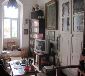
My mother's house in Nachlaot Jerusalem.
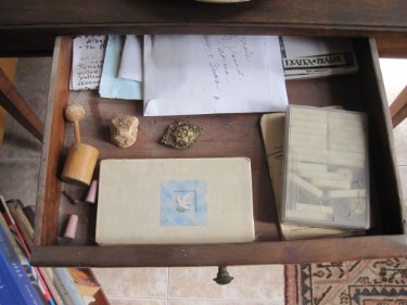
The Golan Stone in a draw in my mother's house.
10Dec2010
We took an early bus from my Dad’s place up in Ramat Sharett to my Mom’s in Nachlaot. There we had a tasty breakfast that my mother had laid out for us, took our Golan Stone, and started on the hike of the city.
We proceeded through the Mahane Yehuda Open Market, a sensuous experience in the literal meaning of the word. It was early and the proprietors were setting up their various booths full of every conceivable fruit and vegetable. The bakeries were open with pastries and challot (Sabbath egg bread) warm out of the oven; there were flowers being delivered, mainly Rakafot (Cyclamen) and Calaniot (Anemones). Spice shops, hardware stores, cloths stores, shops with racks of roasted seeds and nuts, kitchen goods, cafes, carts with burechas (stuffed pastries) and hard boiled eggs – all this typical of any shuk in Israel – but Mahane Yehuda is a particularly good one.
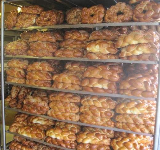
Chalot (braided egg bread) just baked for the Sabbath
Soon we were out of the market and walking though the center of modern Jerusalem, we walked down Hillel to Salomon and onto Yafo. From there we went though the lovely Safra square where the municipality has its buildings, and past the historic Russian Compound
with its prison and old buildings. We then skirted Me’a She’arim, an ultra orthodox, neighborhood and made our way to Haim Bar-Lev Boulevard which goes straight up toward Mount Scopus and Hebrew University. It might have been uncomfortable walking along such a main thoroughfare, but we walked along the yet unfinished trolley which separated us from the traffic and made the walk pleasant. There was even a Jerusalem Trail marker to assure us we were navigating correctly.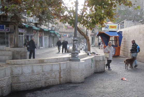
The end of Agripas street after the Market - Modern Jerusalem
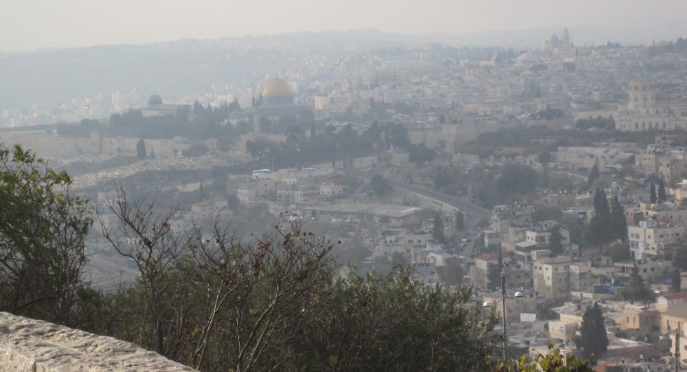
Forty minutes later we were standing next to Hebrew University with the whole city of Jerusalem spread out before us in the haze. The old city with the prominent, golden Dome of the Rock on the Temple Mount was plainly visible. There was a bus load of Asian tourists, some of them in interesting traditional dress, at the look out point along with us. One of them kindly took our picture.
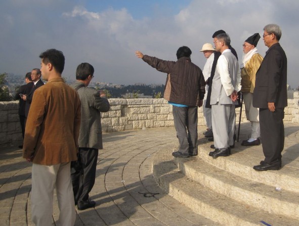
Interesting tourists taking the view near Hebrew University overlooking Jerusalem
Fifteen minutes walking down and around took us to another lookout point with a view of a landscape so dramatically different we might have been transported to a different planet. Barren, pale yellow hills stretched out to infinity in the haze. If it had been clear, Jericho, Amman and the Dead Sea would have been visible.
Looking west over Jerusalem
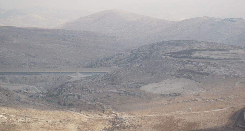
Looking east towards the dead sea and Jordan
The trail now looped back toward the southwest. In a few minutes we were walking steeply down a stairway in a new park called Zurim Valley National Park dedicated to preserving the natural landscape of the area. The park was still being planted, but there were both old and newly planted olive trees through out. We then passed an Arab Community College on the left, walked for a few meters on a road, and then turned west onto a fascinating path through olive trees, with ancient burial caves in the bed rock.
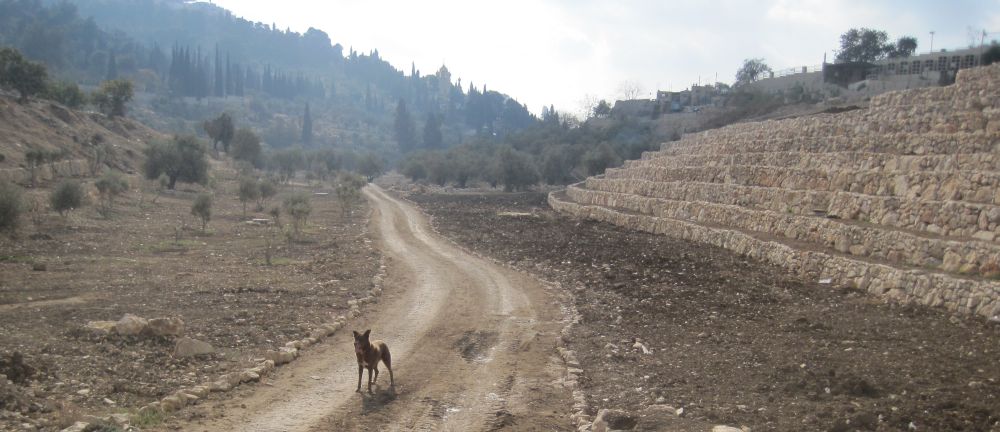
Taffy on the path in the Kidron Valley
Soon the old city was high above us to the west with the Dome of the Rock dominating the view. In the distance high above us to the east was a spectacular Russian style church glittering golden in the sun. It was the Church of St. Mary Magdalene. It is hard to describe the drama of this path. We were walking among some of the holiest places on earth. I am not sure how I managed to live in Israel for 22 years without taking this walk before. It was also simply a lovely natural hike with a good path, lots of old olive trees and a walled garden full with tall cypress trees.
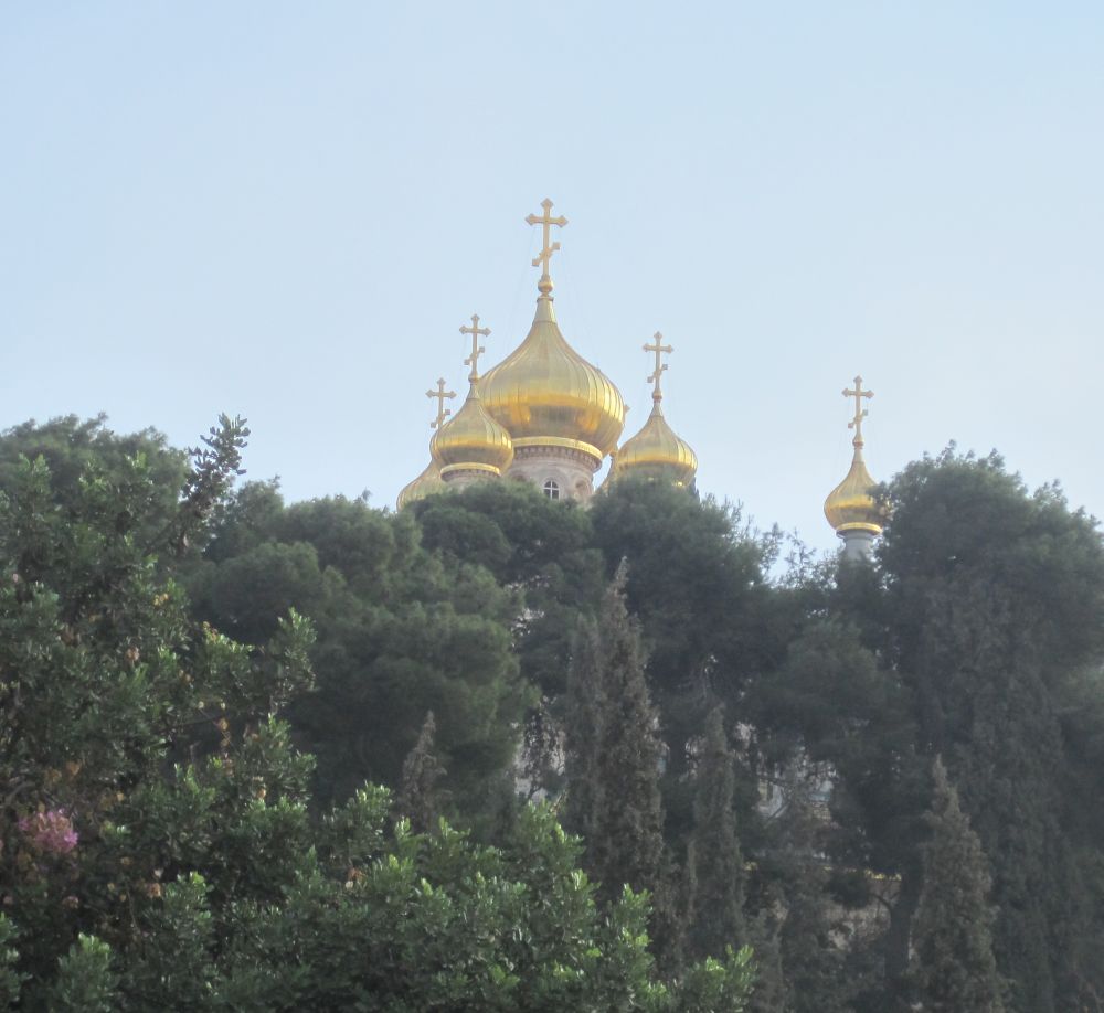
Church of St. Mary Magdalene
The path climbed up to Jericho street where there were little stone paved streets with lots of tourist shops. A large group of tourists were going into the Garden of Gethsemane
(Gethsemane comes from גת שמנים Gat Shemanim which means Olive presses). Here the old old olive trees are suppose to be either the very trees or the descendents of the trees where Jesus once prayed. Down the street and around the corner was the Church of all Nations, a spectacular sight. While to the west in the walls of the old city, the Golden Gate, which according to tradition will only open when the Messiah comes, was opposite.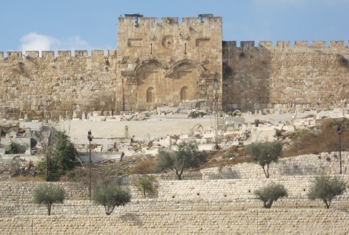
The Golden Gate in the Wall of the old city of Jerusalem
We continued on Jericho street for a few meters and then down another paved path. A few minutes walk brought us to an odd structure (see the picture) called Avshalom’s pillar, traditionally this is monument that Avshalom built for himself so his name would be remembered, however there is considerable controversy about the structure.
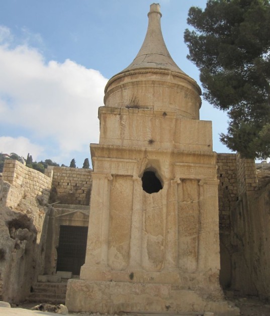
Avshalom's pillar
The path went beneath the Mount of Olives cemetery and soon we were walking at the bottom of a steep valley with the old city, and the city of David above us on one side, and the Arab neighborhood of Silwan above us on the other side. Three children in a balcony far above us waved and watched us as we walked down the strange path. After a few hunderd meters the path joined a road, Ma’alot Ir David, which is a busling throughfare in Silwan. After about ten minutes on this road we veered off slightly to the west and were now walking towards the Valley of Hinnom
that lies between walls of the old city and the cinematheque.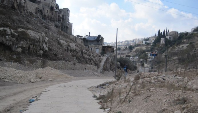
Road in valley with Silwan on the left and the old city on the right
Here we left the Jerusalem Trail (which does not enter the old city) and climbed up a steep path to Ma’ale HaShalom street and into the old city through Zion Gate. We quickly walked down through the Armenian quarter and reached the area of the Western Wall. Instead of going to the area where most people pray, we went into the archaeological park. We tied Taffy outside with the ticket man watching him, and went to Robinson's Arch
. This is my favorite place in Jerusalem, and it was a deep satifaction to have walked from the Golan Heights all the way to this awe inspiring place. Some nice tourists from Connecticut USA heard our story and were happy to take a picture of us holding the Golan Stone with Robinson’s Arch in the background. We then rejoined our anxious dog. We rested our feet for a few minutes, and ate a couple of tangerines before we started again.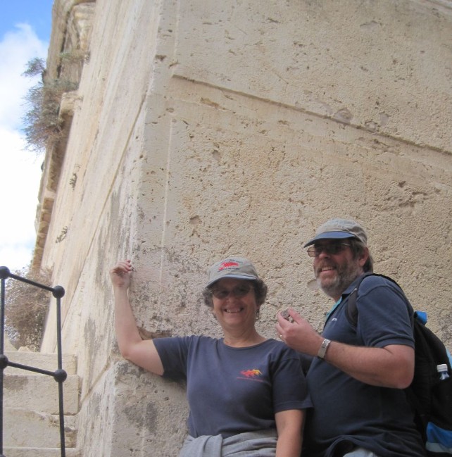
Diana and Don (holding the Golan Stone) at the Western Wall near Robinson’s Arch
Having accomplished one of my main goals in Jerusalem we walked quickly along the main road around the old city and rejoined the Jerusalem Trail about half a kilometer further along past the valley of Hinnom near the cinematheque. Here we walked over a foot bridge across the main road, past the Begin Center, and found ourselves again in the center of modern Jerusalem.
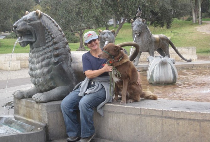
Lion Fountain off of King David Street
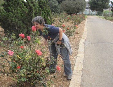
We rested briefly at the Lion Fountain, which I love, and then continued on King David street, past the President’s residence and though many of the little streets that make up the beautiful and charming neighborhood of Rahavia. We went down through Sir Charles Clore Hill gardens, under Haim Boulevard, into Sacher Park. It was only about a 20 minute walk from there to the Rose Garden outside of the Knesset. I took the time to smell the roses, and we then made our way around to the menorah and Knesset compound. The weather was getting cooler and threatening, so maybe that was the reason we were the only people there.
Rose Garden near Knesset
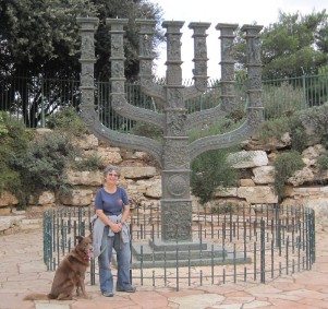
Menorah
Our sons say that they hate the architecture of the Knesset (Israel’s parliament building) and wish it were more like the grand buildings in European capitals, but we stood there, alone, looking at the building and the space around it, and to us it seemed exactly right - simple, functional, and a bit austere, it imitates nothing.
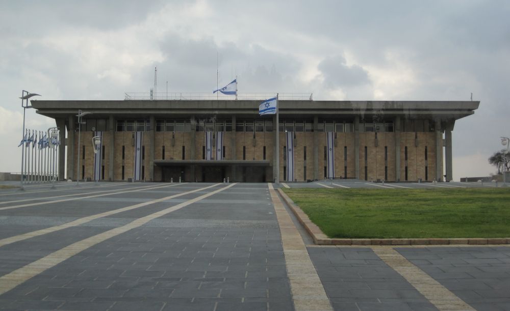
Knesset building - Israel's Parliament
From the Knesset it was a 30 minute walk, past both the Israel Museum and the Science museum, to reach the bridge over Begin Highway. This brought us to a tree lined street (Hagai) in a quiet neighborhood. A few streets further up and we were in a square with a supermarket that was still open. It was already 2pm and we had yet to eat any lunch. So Don went in and bought some rolls with cream cheese and some chocolate. We shared the rolls and cheese with Taffy while we rested. It was nearly the shortest day of the year and a Friday so the sabbath would be starting early. But we knew that we were not far from the end of our hike.
After our late lunch we started again, looking for the continuing road to Herzl Boulevard. We couldn’t find it because we were on Herzl. Feeling a bit foolish, we turned up to the northwest and walked the final kilometer to the Military Cemetery.
We planned to leave the Golan Stone near the grave of the hero of Israel, Yoni Netanuahu, who died saving the lives of the hostages hijacked to Entebbe. The problem was that I wasn’t sure where he was in the Cemetery. We had already walked 25 kilometers and were tired out, but we spent 45 minutes looking for him. Right when we were about to give up, Don found the grave. There overlooking Jonathan Netanyahu’s resting place we hid the Golan Stone until we take our next hike.
“How are the mighty fallen in the midst of the battle!
O Jonathan, thou wast slain in thine high places.”
2 Samuel 1:2
Back to the Israel Trail home page
To the next hike - Leg 8 Jerusalem to Tel Azeka