Day 1: July 6th 2009
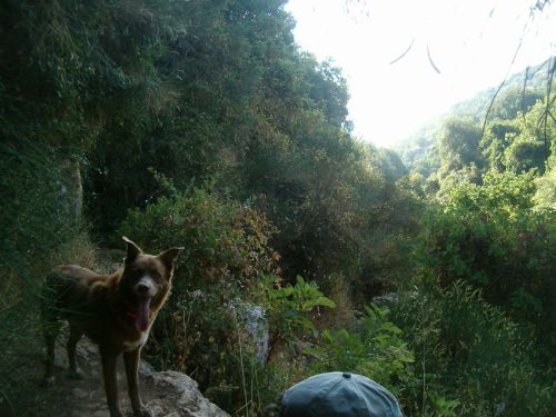
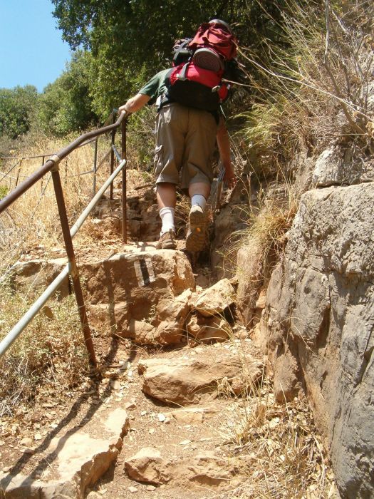
Starting our hikes is becoming a routine which makes it easier. Just like the last two hikes we had a good breakfast, and walked down to the first bus. We ended up on the 9:30 bus from the Haifa Mifratz central bus station to Meron and arrived there a little after 11. Now our problem was hitchhiking to the place on the Israel Trail and Route 89 where we had finished leg 2. Within a minute an ultra orthodox Chabadnik stopped and squeezed the dog, our backpacks and selves into his tiny car. He turned out to be one of the park rangers who help maintain the trail and was actually on his way to the top to spend a few hours cleaning litter. Certainly different than the stereo type people have of the ultra orthodox! He convinced Don to lay tefillin and so we began leg 3 praying. Don enjoyed doing this particularly because our Chabadnik didn’t correct Don’s Hebrew too much. Only in
I went to the place where I had left my stone and sure enough there it was, and off we went up the mountain.
We stopped at the Meron field school and ate peanut butter sandwiches that we’d made ourselves for lunch and filled up our water bottles there. Then we continued up until we arrived at a look out place where a two young men and two young religious women were eating lunch.
This was the day for forgetting about stereotypes – the two orthodox religious girls were hiking the entire Israel Trial. And what a lovely sight they were with their jeans skirts over ¾ pants. They finished eating and silently prayed the Grace after Meals prayer. We rested in the cool breeze and I found myself actually getting cold so I got up looked at the view towards the North. We could just make out Wadi Dishon where we’d hiked last time.
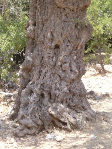
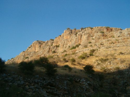
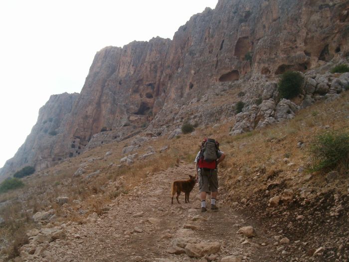
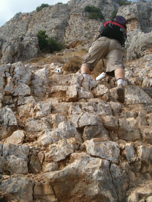
As we approached the top we passed some olive trees that looked old indeed. The oldest olive tree in
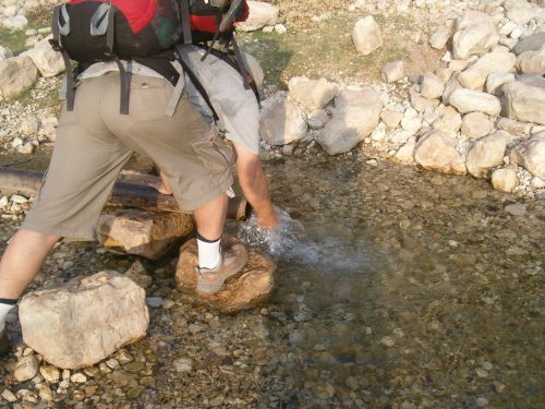
We continued past the army base at the top of the mountain headed to the main picnic area where the map indicated there was water, but when we arrived there we found that the water had been turned off. It is serious when the map has incorrect information. We had counted on refilling with water at this location so once again we continued hiking with water or the lack of it on our minds.
On the other side of
We continued down the
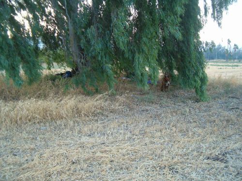
It was now nearing 5pm and we were getting tired, we didn’t want to try to find a place to camp off the mountain, so we started looking for likely places. On a small rise before the final decent to the main road and the town of
The only problem was water. After some agonizing we decided to hide our backpacks and continue down the mountain to the picnic area at the bottom where the map indicated there was water. However after our last experience with the map being wrong we were worried we’d walk the extra kilometers and find nothing. I found it disconcerting to to walk away from our packs, and although the walk was only 15 minutes, it seemed much longer. However, we reached the area, and there was water. There were also a group of around 50 tired American teenagers making camp there. I think the organizers of such groups should be more careful of where they take such groups. There were no working toilet facilities. It horrifies me to think of what a group that size left in that area.
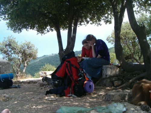
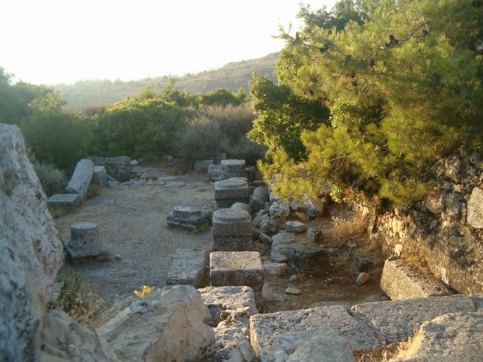
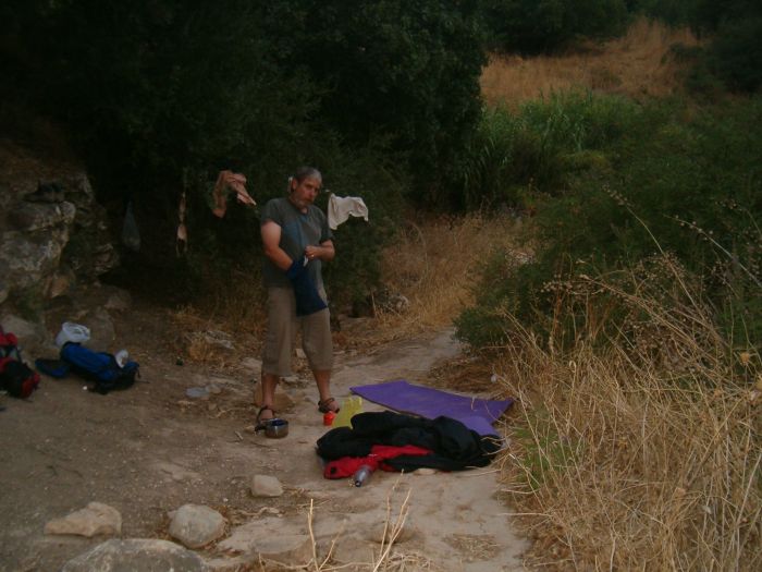
As for us, we filled our bottles and walked back up to our camp area. It turns out we were in Khirbet Shema, the ruins of a synagogue that are at least 1600 years old. There is some controversy about the place. The Israeli archeologists think there were two synagogues at this site, the first from the 3rd century, which was damaged by and earthquake and rebuilt, and then finally destroyed by another quake. An archeologist working at Tufts thinks there was only one synagogue and that it was a from the 4th century. To read their discussions go to this interesting site:
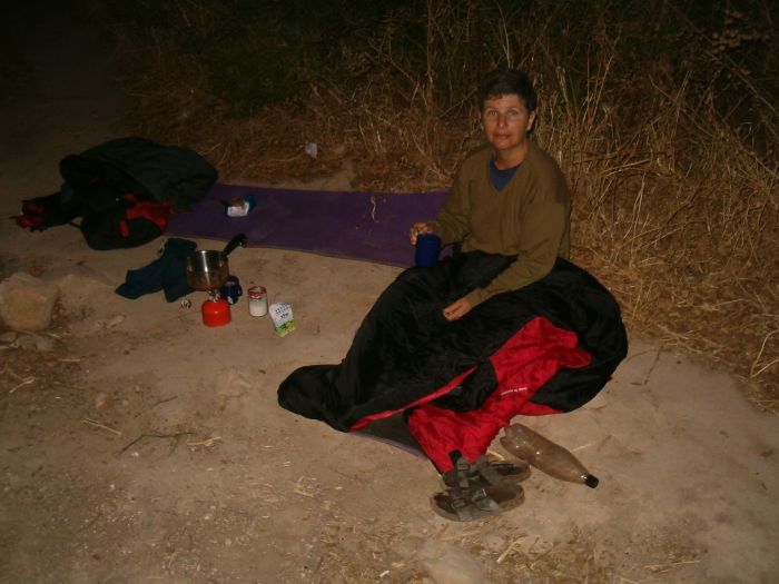
We made our camp and took advantage of having plenty of water to take sponge baths. Both of us put on our warm clothes because it was surprisingly cold. Then we rested and talked about the people who had once prayed at this place, and as the day ended we prayed the Shema ourselves “Hear oh
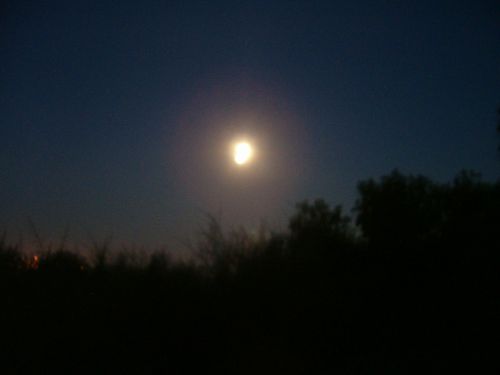
How many people can hike in the wilderness and camp near ancient ruins by the full moon? We felt honored.
Again I had the same problems with sleeping on the hard hard ground. I watched my friend the big dipper and the full moon take their paths across the night sky, and in-between observation periods I did sleep a little.
Day 2: July 7th 2009
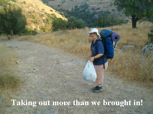
The next morning Don made me breakfast in bed (or sleeping bag) because I was too wimpy to face the cold. Only after the hot tea and cereal did I manage to get going. I spent 30 minutes cleaning. I left the whole area near our camp pristine, and I tried to pick up a wider area around the surrounding ruins. There were areas there that were badly trashed. How I hate littering. Please everywhere you hike, take out more than you bring in!
We walked down again to the picnic area, filled our water bottles, and with heavy packs crossed Rt. 866 and began the long decent to the Kinneret (Sea of Galilee) in Wadi Amud (
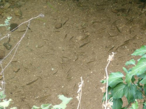
We walked near a year round river with an abundance of good sized fish. I still am not sure what species the fish were, but I’m working on finding out.
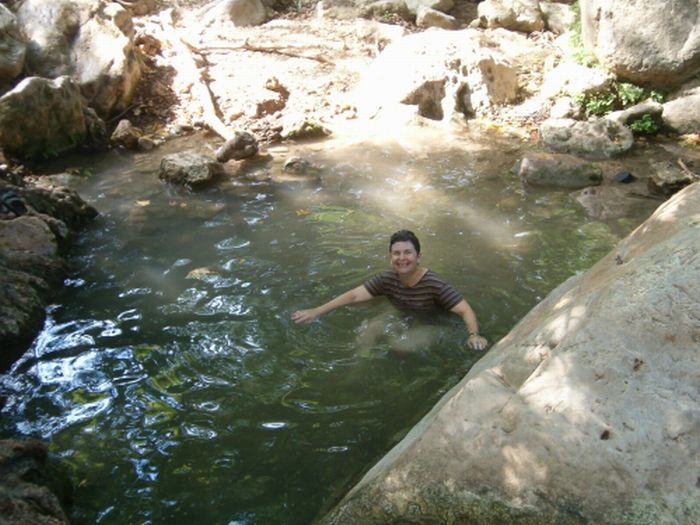
After a few hours of this lovely kind of hiking we arrived at the Shechvi pools hot, sweaty and ready for a refreshing swim. Two men and a boy, and another couple left the area as we arrived so we had the place to ourselves. I immediately plunged into the pool. It was shockingly cold. I practically couldn’t breath for a moment. Don called me a wimp until he too was amazed at the icy water. It was delightful to get out, bask in the hot sun, and then freeze in the water again. We spent a happy refreshing hour there.
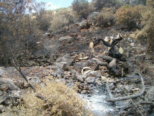
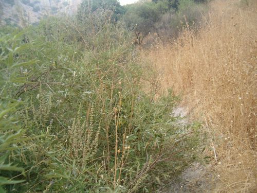
Soon after the pools the river disappeared into the ground and again we were hiking in a dry canyon. Then we came to an area where there had been a fire about a week earlier, on July 1st. We walked through a sad kilometer of burnt vegetation.
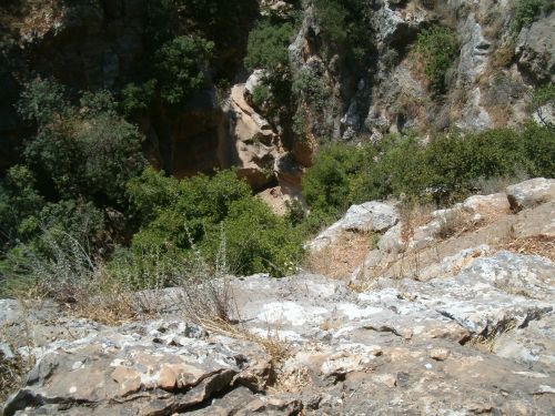
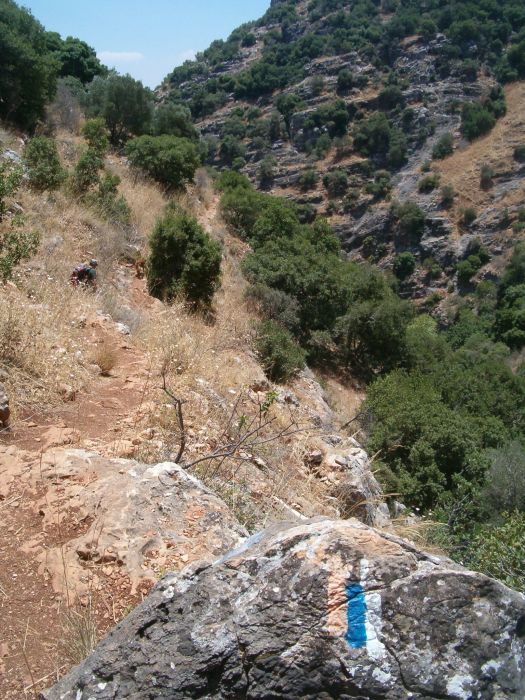
Then the canyon became increasingly narrow and difficult, soon the Israel Trail took us up the south side, up a steep path that would have been treacherous if it hadn’t been to the rails.
We congratulated ourselves on successfully getting back to the bottom only to find that the trail now went up the north side of the canyon. Here there were no rails or staples to help us, and we found ourselves unexpectedly climbing the most difficult part of the Israel National Trail that we had encountered so far. There was nothing in our trail guide to prepare us for this section. “Continue on the black trail south in Nachal Amud for another 4 kms” is the entire description. The more of the trail we hike the less the guide it helping us. We both call it “Jacob’s incomplete guide to the complete Israel National Trail”.
The trail hugged what ever ledges it could find on the north side, going up and down to avoid outright cliffs. There were areas where I couldn’t get up to the rock ahead without either getting an arm up from Don or taking off my pack.
Besides the actual difficulty of the climb it also was on top of cliffs with the trail sometimes quite slippery. I kept imagining one of us tripping with disastrous results and for the first time on any of these hikes I was scared.
One of the contributing problems was that the more exhausted we became the less we could contemplate eating anything. We did rest in various safe nooks, but food repulsed both of us, so we had basically been exerting ourselves from 5am when we had breakfast until 3pm with out eating, and this probably made our situation worse.
Finally after about 4 hours of climbing to get 4 kilometers further along the trail we found ourselves at the bottom of the slightly wider canyon with an easier trail ahead. At this point I fed Taffy the salami – dog food concoction that he loves and we tried to rest. We still couldn’t eat. There was now a dry hot wind blowing up the Wadi and water again became an issue. Route 85 was about 1 kilometer further, if there was no way to get water we decided we’d have to hitch a ride to the nearest gas station, fill up with water and hitch back. While we rested we watched as a group of teenagers literally ran down the trail that had almost defeated us. Yes they didn’t have heavy backpacks, but basically the difference was between middle age and youth.
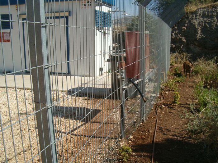
As we approached the road we saw another Israel Water authority pumping station. Again there was a leak creating a stream where Taffy waded and drank his fill. It had clearly been leaking for a long time because there were turtles living in the area and the vegetation was lush. Taffy had his water, but what about us? The facility was closed, but we were not deterred. We scouted around the perimeter fence and found a faucet that was within reach if you squeezed your hand through the fencing material. But how could we fill our bottles? We found a discarded piece of tubing and MacGyvered a way to fill our bottles.
We should have stayed under the tree near this facility and taken advantage of having as much water as we wanted to wash our hair, and refresh ourselves, but we now felt this huge boost in morale and simply continued hiking. We planned to go far enough so that we didn’t hear the highway and find a nice place to camp. However, the canyon again became narrow, the vegetation was lush, and we couldn’t find anyplace that was flat enough to make camp. We walked and walked and I got more and more exhausted. I felt like I’d hit a wall and truly could hardly move forward. In this state anyplace would do and we choose a spot where the path was a bit wider and decided to camp out right there on the path.
It wasn’t the best camp site, but it was startlingly beautiful, with a long cliff face reflecting the evening sun getting more and more pink.
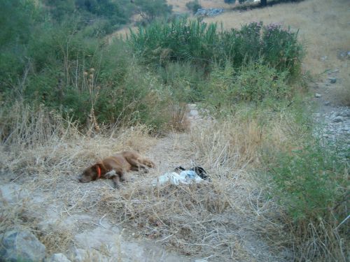
We forced ourselves to eat a bit and then dozed for a few hours as the evening fell. Suddenly Taffy started barking, growling and having a fit. A hippy / orthodox young man and his very lovely wife came walking by. She insisted that they could walk to the Kinneret (Sea of Galilee) by moon light. We calmed Taffy down, and as night fell Don put his sleeping bag out, right on the path and I found a flat area near the path.
We laid down and watched the full moon come up over the cliffs as we tried to go to sleep when again Taffy had a fit. He was like a different dog than his normal friendly self “The Hound of the Baskervilles” comes to mind! We heard some voices in the distance speaking in English, “what is that?” I heard one say tremulously, obviously scared to death of the wild ferocious monster. I tried to get Taffy to stop, but he wouldn’t so I simply held him tight and yelled out to the voices that it was alright, that it was just a dog and that I was holding him. Finally three young Americans walked up. After they were actually there and I was speaking with them, Taffy smelled them and calmed down. They were having a hard time of it. They had no map, had been hiking from
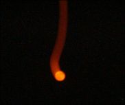
We wanted to sleep, but sleep didn’t come. I watched the moon go behind a tree and cause a ghostly silhouette, and that is when I saw a UFO. There was a light, brighter than a star, rapidly going across the sky from south to north. I pointed it out to Don who at first though it was a plane, but the light wasn’t blinking or making any sound, and it was moving too fast. It disappeared behind the cliffs and then there was another one, the same path and speed, but much less bright. Perhaps they were satellites, but we’ll never know for sure.
I was wrong we did find out for sure. Don checked on NASA's sky watch web site and found out that what we had seen going across the sky was the International Space Station with the Space Shuttle docked to it. You can check the flight path of the Space Station and of many other satellites and figure out whether they are visible in your night sky by navigating to this website:
Day 3: July 8th 2009
The next morning we made our usual breakfast of strong tea with granola. We had special little boxes of long life milk that were exactly the right size for each breakfast so we were able to have our cereal and our tea with milk.
We packed up, I cleaned up the area, and then we started towards the
The trail stayed nicely down at the bottom so it was easy hiking, though it was extremely over grown with a lush, sweet smelling bush. I was grateful that it wasn’t overgrown with thorns. I found out later from Dr. Ori Fragman-Sapir, the Head Scientist of the Jerusalem Botanical Gardens that the bush was Vitex agnus-castus. The common name is chasteberry because it was thought to lower the libido. That property hasn’t been substantiated, but extracts from this plant repel mosquitoes, ticks, and fleas, and also seem to have a beneficial effects on premenstrual stress syndrome.
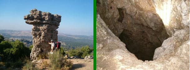
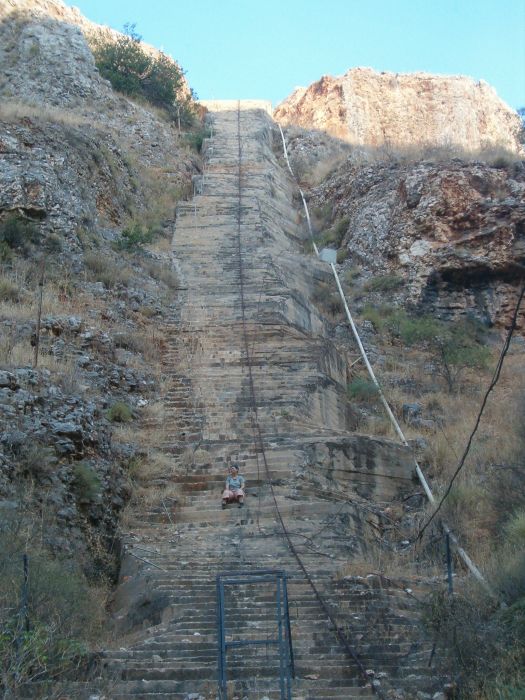
Our first stop was at the place were the Israel Water Carrier crosses the canyon. A huge pipe goes down one side of the cliffs and up the other in a huge concrete stairway. The stairs are steep at the top and it would probably be pretty scary to walk the whole way up that way, but I couldn’t resist climbing them a small distance.
As I sat there on the steps I saw a mother wild boar and 4 babies trot by on the other side. We were both mesmerized by this strange spot, but eventually we pushed on towards the big lake ahead. The canyon was deep and steep so it was still in shadow making the walk particularly pleasant. And the cliffs themselves were fascinating, punctuated with lots of deep caves.
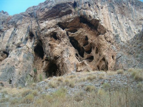
Several skeletons of prehistoric man were discovered in some of these caves. If you google Amud Neanderthal you’ll get many sites about the findings. Here is one link to an academic paper about the Amud prehistoric findings:
There is something strange about the fact that in this area where Neanderthal lived perhaps 60,000 years ago, we camped and watched the Space Station pass by us across the same sky that these almost humans also watched.
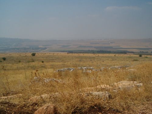
As we continued we could see through the canyon to a flatter more gentle terrain. We could tell that the canyon was coming to end soon.
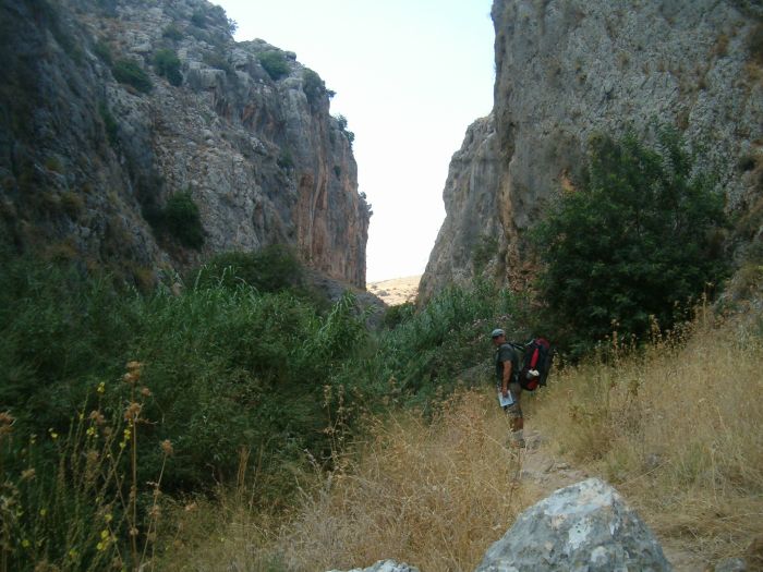
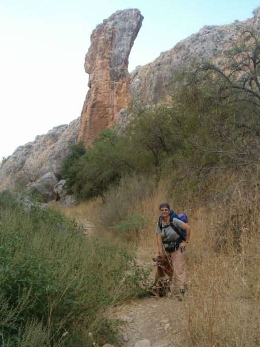
We came around a corner and suddenly there was the Wadi’s name sake, the “Amud” or pillar. Even though we knew to expect it, when we came upon it we were both astonished at its size and grandeur.
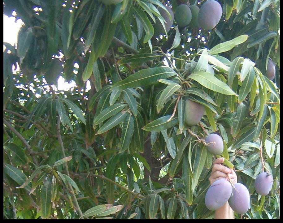
From the pillar it was only a short walk to Rt. 8077, and after the road the path widened and the cliffs vanished and soon we were walking on a dirt road through verdant orchards. I couldn’t believe the size of the first fruit we saw. As we got closer I saw that they were mangos.
Next there was an orchard with beautiful small red fruit. There weren’t cherries. What could they be? It turns out they were Lychees, absolutely, perfectly ripe.
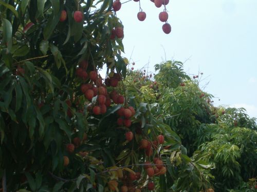
We couldn’t help but take a few, but we didn’t want to steal. We saw that there were quite a few that had fallen and we gathered those and ate the luscious sweet fruit as we continued along the road. We were now about 180- meters below sea level, and it was about 11am – it was hot and humid. Don and I were both soaked in sweat, Taffy was going from shade to shade, but we still had a few kilometers to go. Finally at around noon we reached Rt. 90 the main road going into Tiberius. On this road there are several kiosks with food, drinks, bathrooms and places to fill up with water. The Israel Trail parallels Rt. 90 and then turns to the west again towards
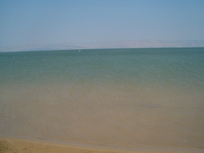
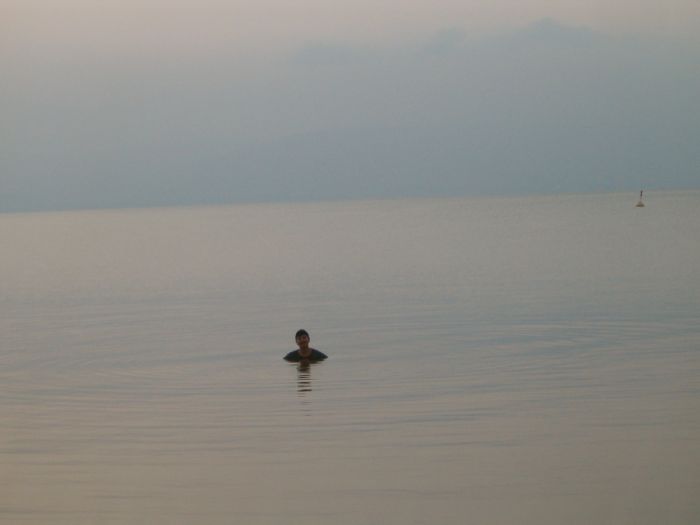
Don struggled to get into his swim suit, but I simply went into the water as I was. The water was perfect, cool and refreshing. I dove in and swam away all the sweat and dirt. I will never forget the feeling of going into that lake.
We stayed at the beach for several hours, but Taffy wasn’t happy. There was no shade and he didn’t stay in the water the way we did. We made him a makeshift tent out of reeds, but it was only partially successful. Then the wind came up and before we knew it there was a full blown sand storm. Reluctantly we admitted to ourselves that we wouldn’t be able to camp on the beach in these conditions. We packed up and walked back up the road looking for a protected area. We found a huge eucalyptus tree not far from the beach and inside its protective branches it felt like being inside a house. There we made camp.
We watched an orange moon raise over the lake and shine on
Day 4: July 9th 2009
We decided to start extra early the next day so that it wouldn’t be too hot climbing the mountain. At 4:30 before dawn, we had our tea and cereal and then walked back to the beach for one last swim before we left the
Feeling completely refreshed we started the last days hike up
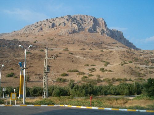
There was a spring of gushing water at the park under the mountain where Taffy drank deeply and up we went.
The first half of the climb was a very steep well kept path.
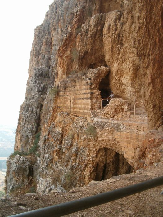
This brought us to The Castle. I’m ashamed to admit that we’d never heard of Mount Arbel before encountering it on this hike. According to the writings of Josephus, about 2000 years ago rebels, presumably Jews, who were not happy with the rule of Rome, hid in the caves of this mountain and staged attacks on the valley below. In these inaccessible caves the rebels were able to defend themselves from all attempts to subdue them. Finally the Romans devised a way to lower soldiers in baskets from above. They used hooks on long poles to pull the rebels out and cast them down to their death.
In the 17th century the Druze build a three story castle in the caves. They used this place to collect taxes from all the villages below. We spent about an hour exploring the ruins of that castle. Believe me when I say that this particular part of the Israel Trail is not for anyone with vertigo! As we left the Castle, Don came up with a little ditty.
I lost my wife on Mount Arbel.
Up we went and down she fell!
Leaving me to live in hell.
I lost my wife on Mount Arbel.
The words might sound sad, but he recited it with a bit too much glee J!
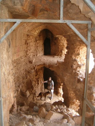
From the Castle the trail changed from walking to climbing. However, it was not a repeat of the second day in Wadi Amud. Here the trail was beautifully maintained and set up with staples in all necessary areas so that while we were always conscious of the huge drop behind us, there was never a time where the climb itself was difficult. There were two places on the trail where it was impossible for Taffy since it was necessary to rely totally on the metal staples which were not made for dogs. At the first place Don handed over his collar to me on the other side and together we basically dragged him over the difficult spot. In the second difficult place I pushed him up a vertical wall. Both times Taffy seemed to understand the situation and cooperated.
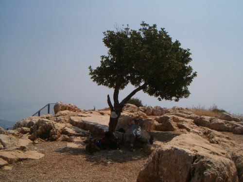
It felt so great to reach the top where there was one lone carob tree to sit under. Don let out a holler that might have been heard back in
The views from the top were spectacular, and we spent a good long time relishing our accomplishments and eating the fresh mangos we’d found down below.
The top of
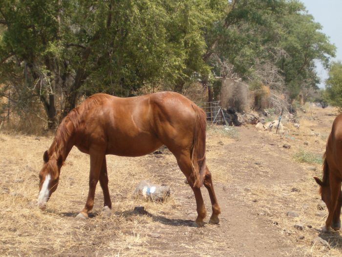
We had depended on getting water in a nearby cemetery, but probably because someone had left the water on in the past, when we passed by, the main valve was turned off, locked and inaccessible. We reached a holiday village that was marked on the map as a camping grounds. It looked deserted, but there was a cook making Napa Valley Chicken in their restaurant and we managed to get water there. Then I enjoyed the company of their friendly horses.
From there it was not a long hike to the Junction of Mitzpe and Rt. 77, but it was so hot, and there was so little shade we felt done in by the time we arrived. We had 45 minutes before the next bus so we walked to the nearest store, sat there half dead, and drank a whole 2 litter bottle of ice tea . Then we tried to clean up ourselves for the bus ride home. On the way back to the bus stop we placed my rock under some Oleander bushes ready to be picked up on the next leg. Can’t wait for our next adventure.
Please everywhere you hike take out more than you bring in!
Back to main Israel Trail page
To Leg 4: Sea of Galilee to Mount Tabor