Advance Planning: We became aware of a problem when we started planning Leg 4. There is no reliable source of water from the Jordan River to the Gas Station at the base of Mount Tabor 27 Kilometers away. Even an extremely fit person can not carry enough water to hike 27 kilometers in the middle of the summer without a refill. To solve this problem Jacob (from Jacob’s guide to the Israel Trail) took a detour off the Israel Trail to the town of Yavnael. We decided we wanted to stick with the Israel Trail so on Wednesday 29 July we used a car and cashiered water at two points along the trail between Yardenite and Mount Tabor.
Day 1: Monday August 4th 2009
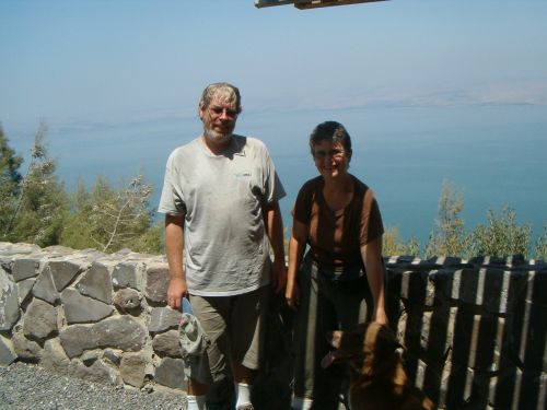
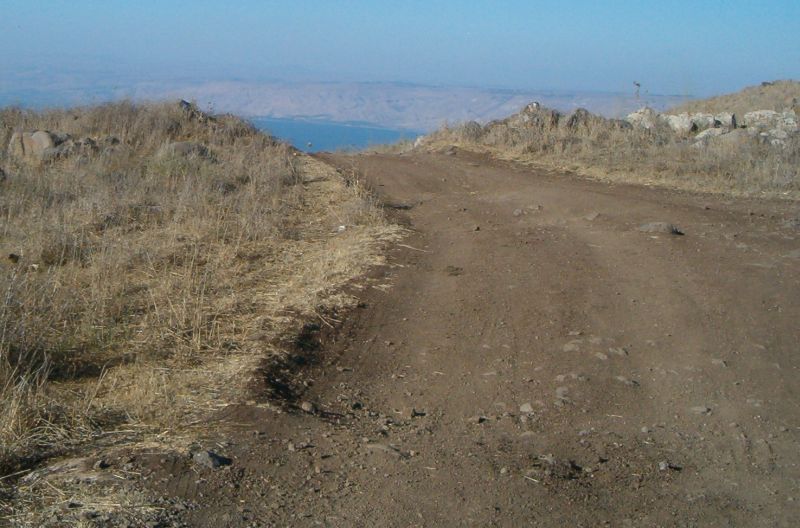
Although we tried to get out early so that we wouldn’t have to start our hike right at the hottest part of the day, nevertheless we found ourselves getting off the bus and retrieving the stone at 12 pm. We went to the same small grocery store (by the gas station on the corner of route 77 and the main road though the upper part of Tiberius) where we finished leg 3. We bought ourselves a couple of rolls, a small container of tehina and two snicker bars for our eventual lunch. Then we filled up our water bottles and started walking with the fierce August sun directly above. Taffy went from one shady spot to the next. The first part of the trail took us right through the residential area of Tiberius. There were no cafés or shops along the route so I was happy that we’d filled up with water where we did. After about a kilometer of city walking the road veered off to the right while the trail continued straight and slightly down. It was now a gravel road. The whole of the
Please everywhere you hike take out more than you bring in!
There we had our light lunch. We continued south slowly getting lower and nearer the lake. We passed a running spring called Peoria on the way and rested there for a cool relaxing 30 minutes. Then the path went off the gravel road and steeply down for a short time. There was a unexpected spigot where we could have filled up on water if we needed to.
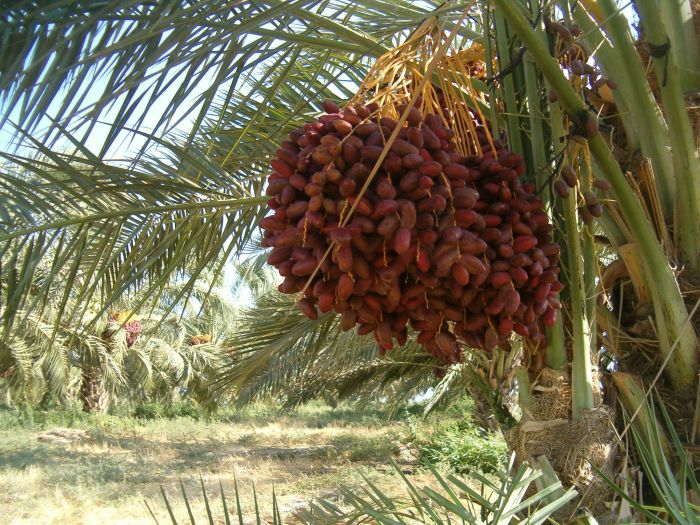
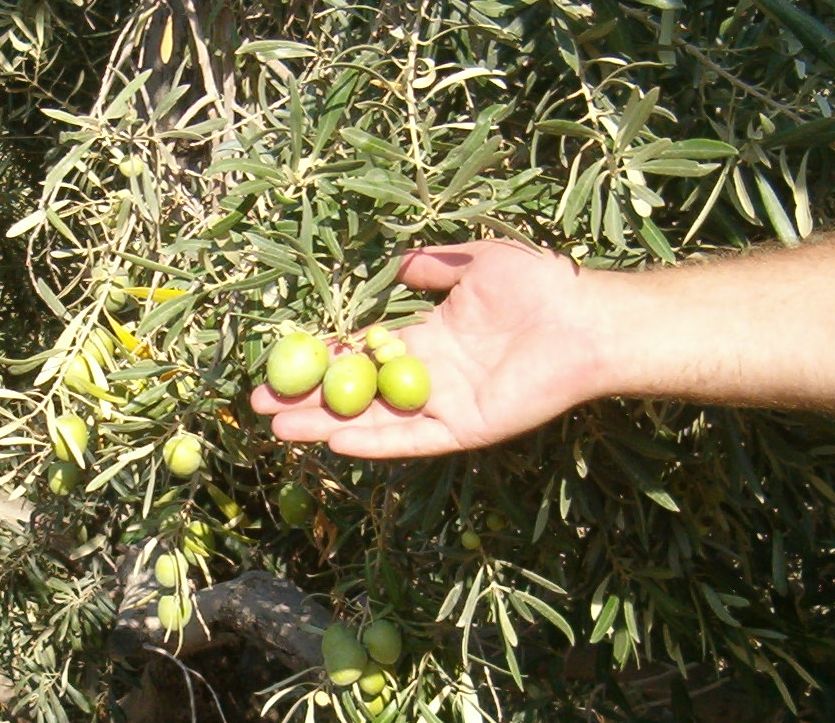
We passed many orchards of diverse fruit. There was one olive tree orchard with the largest olives we had ever seen - the size of small plums. Then we passed orchard with date palm trees, then mango trees with ripe fruit where we helped ourselves to a couple of just fallen mangos. The richness of the produce along this hike continues to astound us.
We then entered the small town of
From there the trail joined the main road (Rt.90) that hugs the edge of the lake. Here we went off the trail and found the first access to the Lake where we could take a swim. It is important to note that the law in Israel states that the shore of the lake is free access for anyone, and that charges can only be levied for parking. So even though the first place we came to – a launch for boats – seemed to be private, we simply walked though their car block and took a refreshing swim at the beach. Taffy swam out to us, swam back, barked his head off, and altogether couldn’t understand why we’d stay in the water. We didn’t stay long, not because of him but because the daily wind came up and started blowing a sand storm.
After the town of Kinneret the Israel Trail crosses the intersection of Rt. 90 and Rt. 767, and veers slightly to the west off the road. We had thought from studying the map that this part of the hike would be tedious, near large roads, and built up areas, but the trail entered an area called Rachel’s Park, and we found ourselves on the best part of the trail for the day.
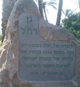
Large date trees, planted in the 1933 as part of a project to bring back the date palm to
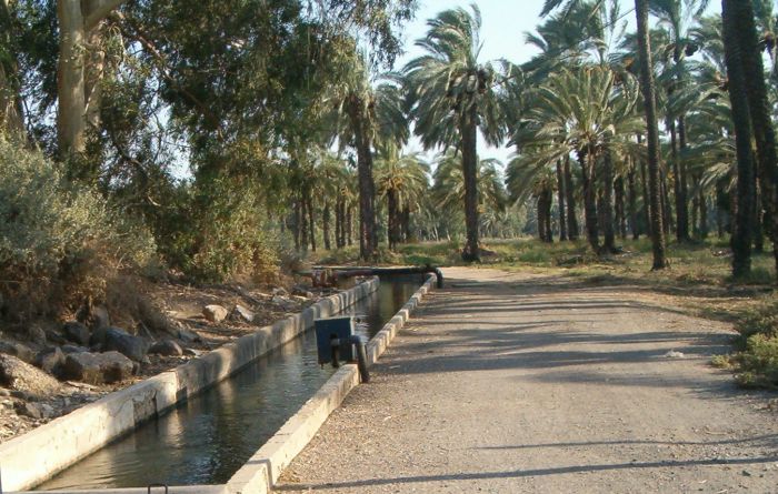
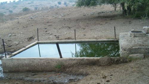
There were numerous water spigots along the way to fill our bottles. We ended up at a small museum at the site of the first pumping station that was used to irrigate the initial crops planted by the Zionist pioneers in the early 1900s. Don was fascinated by the Roman era stone pipe section that was placed outside the building. There was a water fountain here where we topped off our water supply so we left the with all our bottles filled with water knowing that the next day there would be water waiting for us about 10 kilometers away where we had stored our cash the week before.
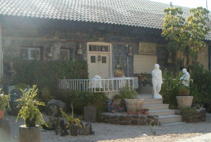
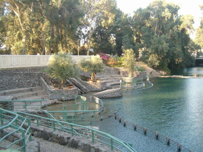
We left the park, went across a small side road and found ourselves at the Yardenite Baptismal facility. I would have walked right by, but Don wanted me to see it. I walked in expecting a kitschy touristy place, but found something different. This is where the
From the Yardenite the trail followed the
Right at the place where the
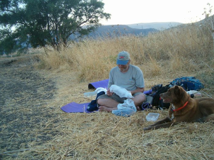
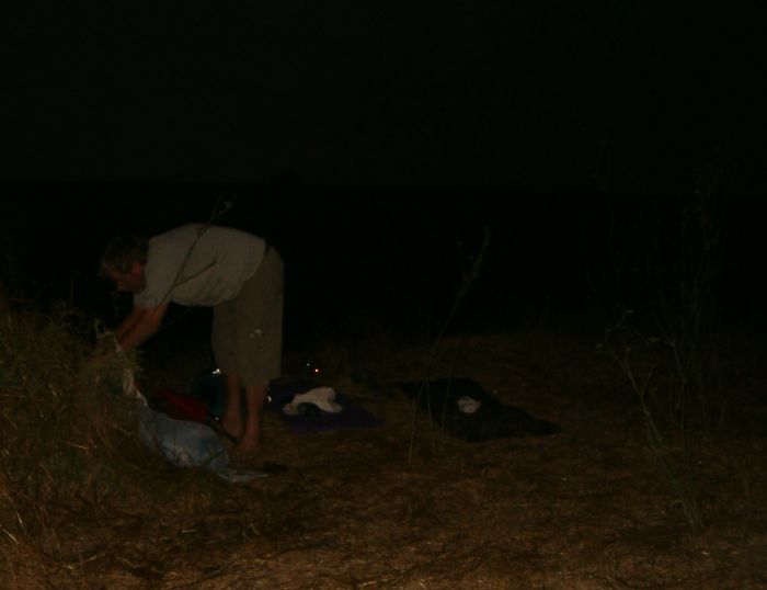
It was way to hot for a sleeping bag, we slept directly on the pads with the sleeping bag as a cover so that we didn’t feel totally exposed. Don wondered if somebody could please turn off the light as the moon was so bright he could read by it. He promptly fell asleep and I had my customary night in the field, dozing, turning, watching the indescribable beauty of my friend and comfort the big dipper, the glorious full moon, the stars and planets, wishing the whole time that I could miss it all and simply sleep like Don or Taffy who both seemed as comfortable as if they were at home in bed.
Day 2: Tuesday August 5th 2009
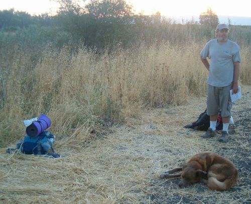
We always take the time to leave camp cleaner than we found it
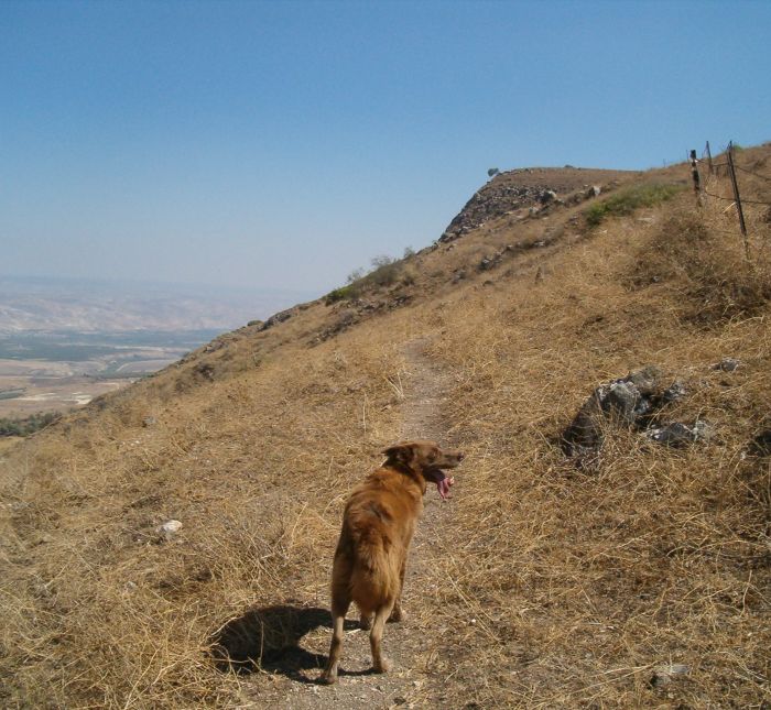
At dawn the next morning we found Taffy to be lame. He clearly had aching feet, and for a while we weren’t sure that we could continue. Taffy, however, is not like certain breeds of dog that will literally die to please their owners, he is exceedingly expressive, and we felt that if he was really in trouble he would refuse to go further. (When I talked with the vet afterwards he said that feet problems were common on hike with city dogs because their pads were not thick enough. He recommended dog shoes which I have yet to find.)
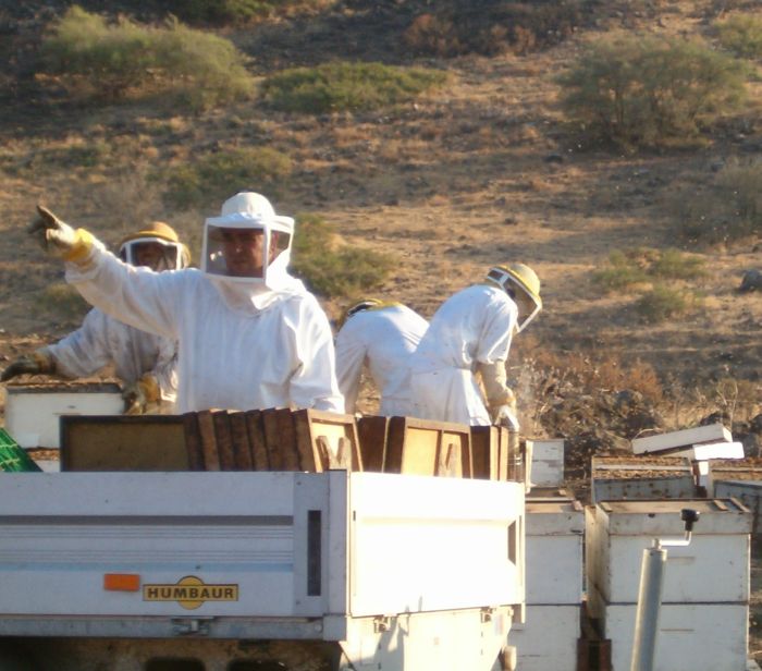
We hiked up along the Yavniel vale and watched while bee keepers were harvesting the honey from their hives. They looked like space men in their white protective suits. One of the men warned us to be careful of the bees in the hives further up where they had already worked as they would continue to be angry for quite some time. I was attacked by an enraged bee, though it got stuck in my hair and wasn’t able to sting me.
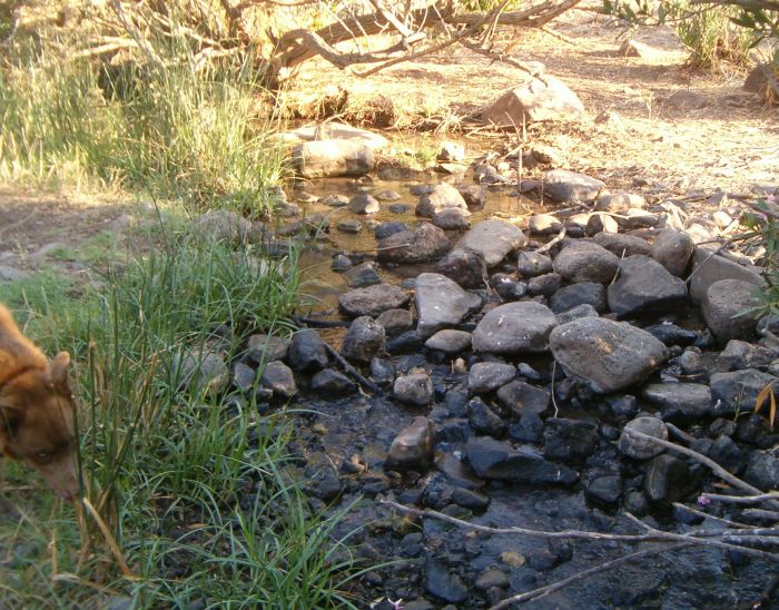
We were surprised to find that the Yavnael vale had a lovely living stream babbling through it that clearly ran year round because it had catfish in it as well as freshwater crabs. We spent an hour messing around the stream and the many springs that seeped out of the earth and fed into it.
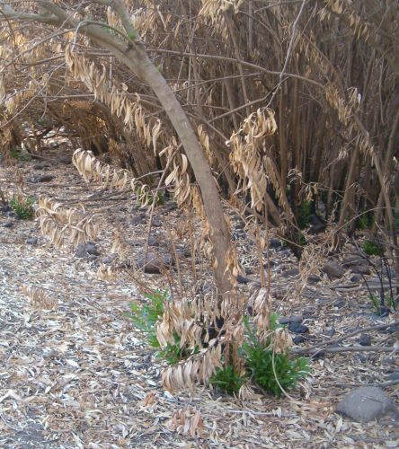
There had been a fire in parts of the area in the recent past and I was fascinated by how the seemingly dead trees were sprouting new branches. A metaphor: how many times have our people seemed vanquished only to rise up again? The trees and the Jewish people have deep roots!
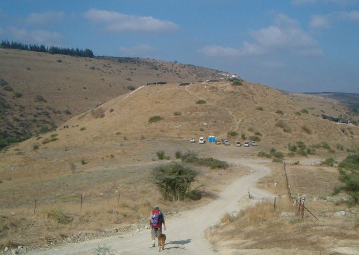
Now we followed another Wadi which climbed steeply towards the south. We climbed out of the Wadi on to a shoulder of the assent and were soon at out first cash of water. It was now close to noon and hot so we stayed in the shade resting and reading until about 3pm and a less fierce sun. We then went on with a full load of water straight up the mountain. We weren’t mountain climbing, but the path must have been at least 40 degrees steep at certain points. At the edge above us there was our goal a lone tree growing out of the cliff.
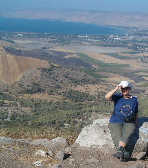
As we neared this high point we found ourselves in a gale force wind which took our packs like sails and seemed strong enough to push us off the cliff. Nevertheless panting and sweating we managed to safely reach the top. We took off our packs in a safe area, and then feeling less vulnerable to the wind we explored the look out point. I have never seen a view like it. You could see south straight down the green lush Jordan Valley, I think the dead sea would have been visible if it the air was clear enough; you could see the Sea of Galilee to the north with the Hermon and the Golan Heights behind and to the East. Directly east was the gorge that separated the Golan Heights from the mountains of Jordan. To the north west we could see the whole trail we’d just traversed with Mount Meron, Safed and the upper part of Tiberius further away.
The wind was so strong that any thing we might have dropped would have been lost forever. Don even put the map away. Finally we followed the trail away from the look out point towards the west.
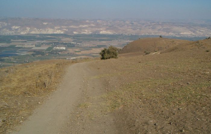
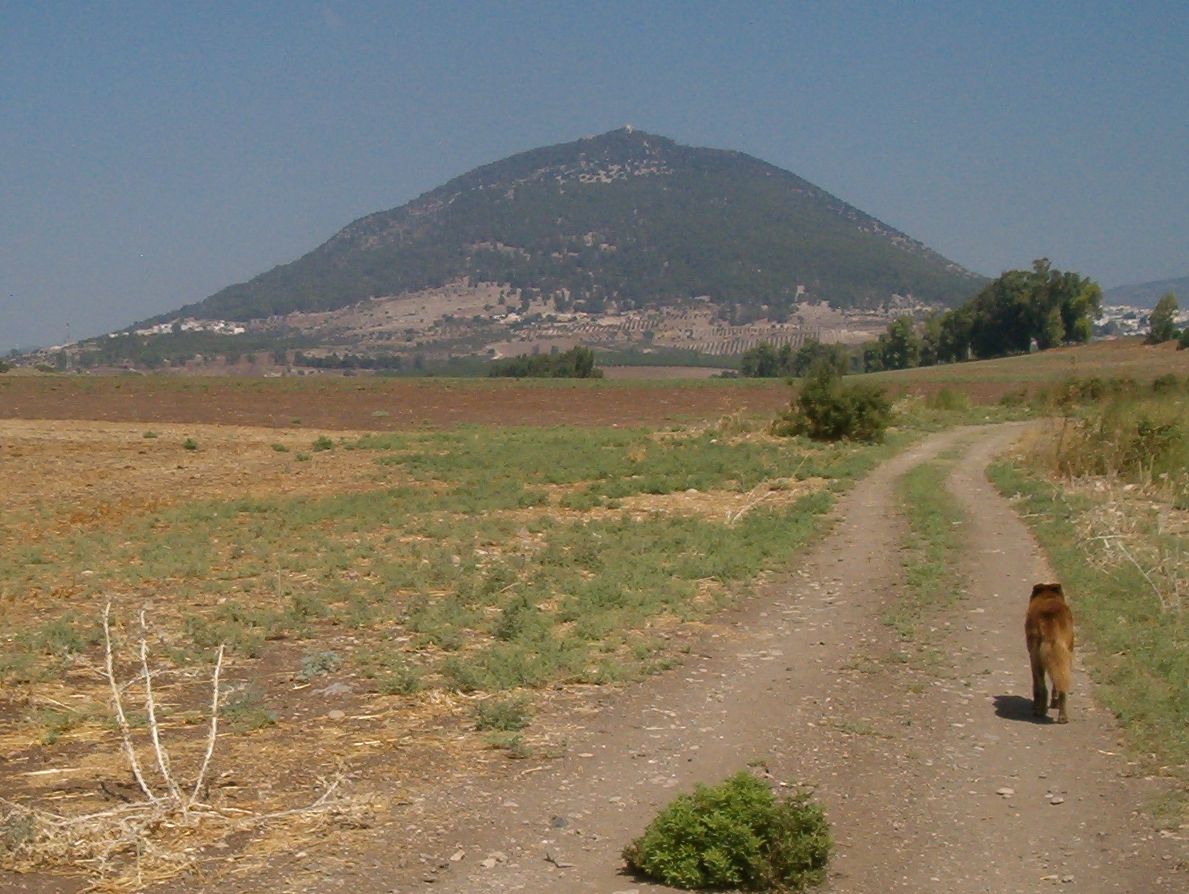
We were now almost on the top of the plateau that rises to the west over the rift valley that stretches from the Red Sea north to the Hermon mountains. After about an hour of walking we went over the ridge and saw Mount Tabor to the west while we said good bye to the Sea of Galilee which was now lost from view and not to be seen again on the trail.
We were now on a flat plateau, all of it agricultural fields mostly of long ago harvested winter wheat that was now just yellow stubs. There wasn’t a person or a structure to be seen. We knew where we were going to camp because we had left a stash of water there, it wasn’t far, so slowly, with Taffy limping and us not much better, we main our way to the edge of the plateau where it looked over the Jezreel Valley and Mount Tabor. We found the site, recovered our water, but in the end we had to find a different place to camp because the site we’d chosen turned out to be a Hyrax ‘city‘. When the funky little animals saw us with Taffy they had a fit of screeching. Then they all disappeared into their rock crevices, but it was clear that between Taffy and these rambunctious creatures there would be too much commotion for us to have peace. While we were looking around for suitable place to camp away from the Hyrax, I came up on a fox. It stopped and stood like a stone and then turned around and vanished in the silent way that wild animals can move. This is the first time I have ever seen a wild fox.
We soon found another spot closer to the trail, but as there wasn’t a soul anywhere what did it matter. Or so we thought. While we were setting up our camp and starting to make our dinner two guys appeared walking from the east. They stopped right near us and started praying.
I had two almost opposite emotions. One was delight at the amazing prospect of two young men praying the evening prayers there in the wilderness facing Jerusalem with the sun setting behind Mount Tabor. But at the same time I didn’t want people camped so near to us. They were invading our privacy. I shouldn’t have worried, the minute they finished they continued hiking. The full moon was rising and the sun was setting, so we supposed that they were going to continue walking by moon light. Considering that the trail in that area was easy and that it was so hot in the day, this was actually a great idea. I wish we had been friendlier and less territorial.
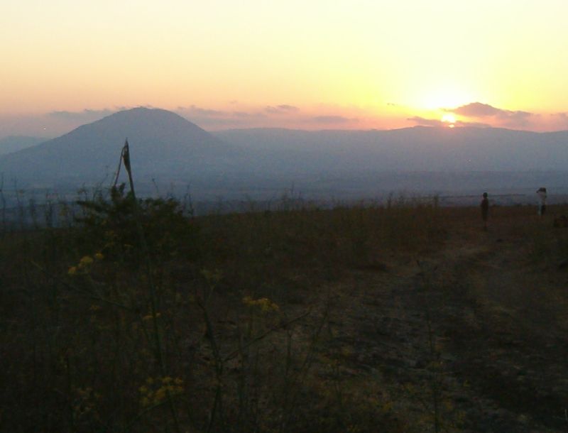
As we sat there on the edge of the plateau eating our standard camp dinner, we noticed a range of mountains far away towards the south east. For a minute I thought they were the Carmel, but that was nonsense. They were barren, grey mountains in a completely different direction. There were no lights on this range and as darkness fell they were a black silhouette far in the distance. We didn’t figure it out while we were there, but when we returned we found them to be the Gilboa Mountains where Saul and Jonathan fought their last stand together and fell. (How are the mighty fallen!) And because of this King David cursed the Gilboa and at least from the angle that we could see the curse still holds. “Ye mountains of Gilboa, let there be no dew nor rain upon you, neither fields of choice fruits; for there the shield of the mighty was vilely cast away, the shield of Saul, not anointed with oil.” Our camp that night was the most beautiful of all our previous camp sites. In back of us was the plateau and there was literally not a single light or human structure for 200 degrees around us. In front of us was the Jezreel Valley and Mount Tabor. Mount Tabor had a string of light around its base, but the summit was black. Don thought it was a flying saucer in disguise. To the southeast were the black Gilboa Mountains - as yet mysterious to us.
Day 3: Tuesday August 5th 2009
We woke before dawn to avoid the heat. The early morning had gotten cold and all our gear including our sleeping bags were soaked with dew. Out hike today was down off the plateau and through agricultural fields to Tabor, there were few trees and little shelter. We were afraid the sun would fry us into crisps. This was to be our last day because in this segment for several reasons we were only hiking two nights, three days.
Our goal, Mount Tabor, was directly in view to the west, so it was somewhat irritating that the Israel Trial was going due south. Don kept looking at various trails and dirt roads that seemed to go more directly to our destination, while I kept reminding him that we were not trying to get from point A to point B in the quickest way. Finally I came up with a rhyme to keep him on the right path.
Ours is not to wonder why.
Our is but to follow the tri! (tri color)
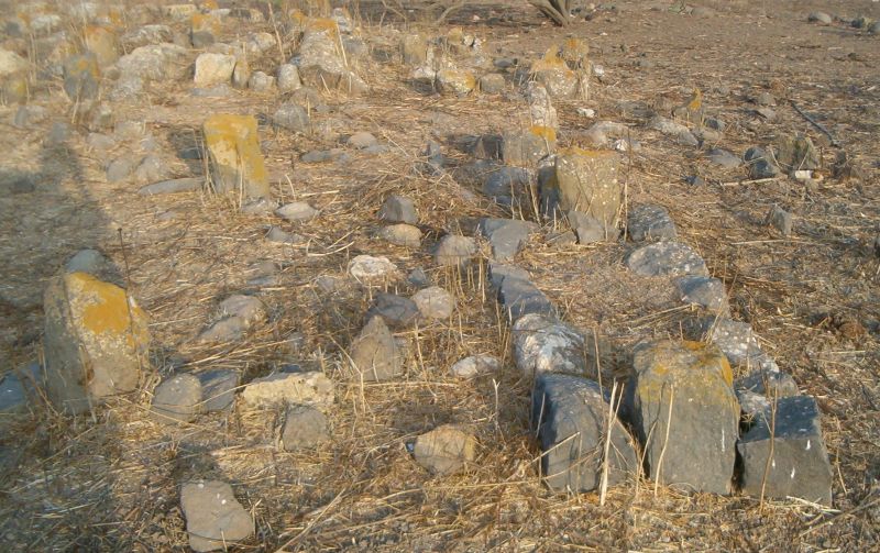
We passed a spring, Ain Olam, that seemed to run year round. It was being used for cattle, but if we hadn’t cashiered water we probably could have filled our bottles there. We also passed an ancient ruin called Sirin. It had no sign or explanation, but from the way the stones were laid it seemed to be an ancient graveyard.
We started before dawn in the cool morning, so the walking was lovely, and to our delight the morning started cloudy, so instead of the August sun we had expected , we hiked in the blessing of soothing fresh shade. We made incredible time - about 3 kilometers an hour!
Now the trail turned to the west and we had the pleasure of walking directly towards our destination. We passed Tel Rakesh where archeologists were at work. (I could not find any information about the site on the web.) As we passed the Tel we crossed a small stream where Taffy drank and cooled off. Tabor was now visibly closer.
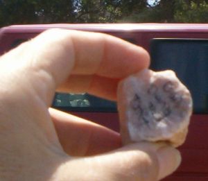
The sun came out at about 11 am and beat down on us as we came to the last part of the hike which closely paralleled or was actually on Rt. 7276 from Kfar Kish to Rt. 65 where we ended Leg 4 at the base of Mount Tabor. I found a place to hide my rock and we went back home until we start leg 5 in September.
Back to Israel Trail home page
To Leg 5