Please, everywhere you hike take out more than you bring in!
Day 1: 8 Sept 2009
Everything was dry and dusty, and there was the hush of waiting. The land was waiting for rain. That was the main feeling throughout this hike.
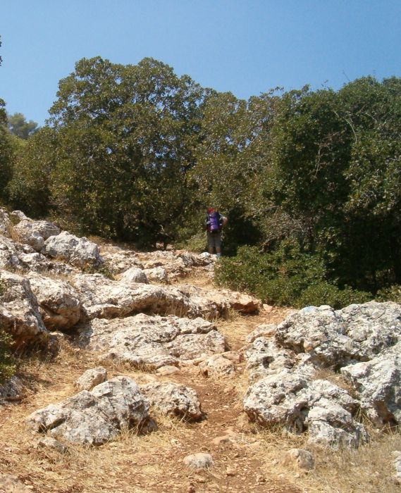
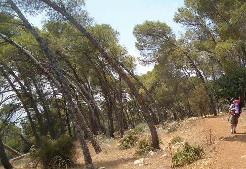
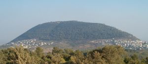
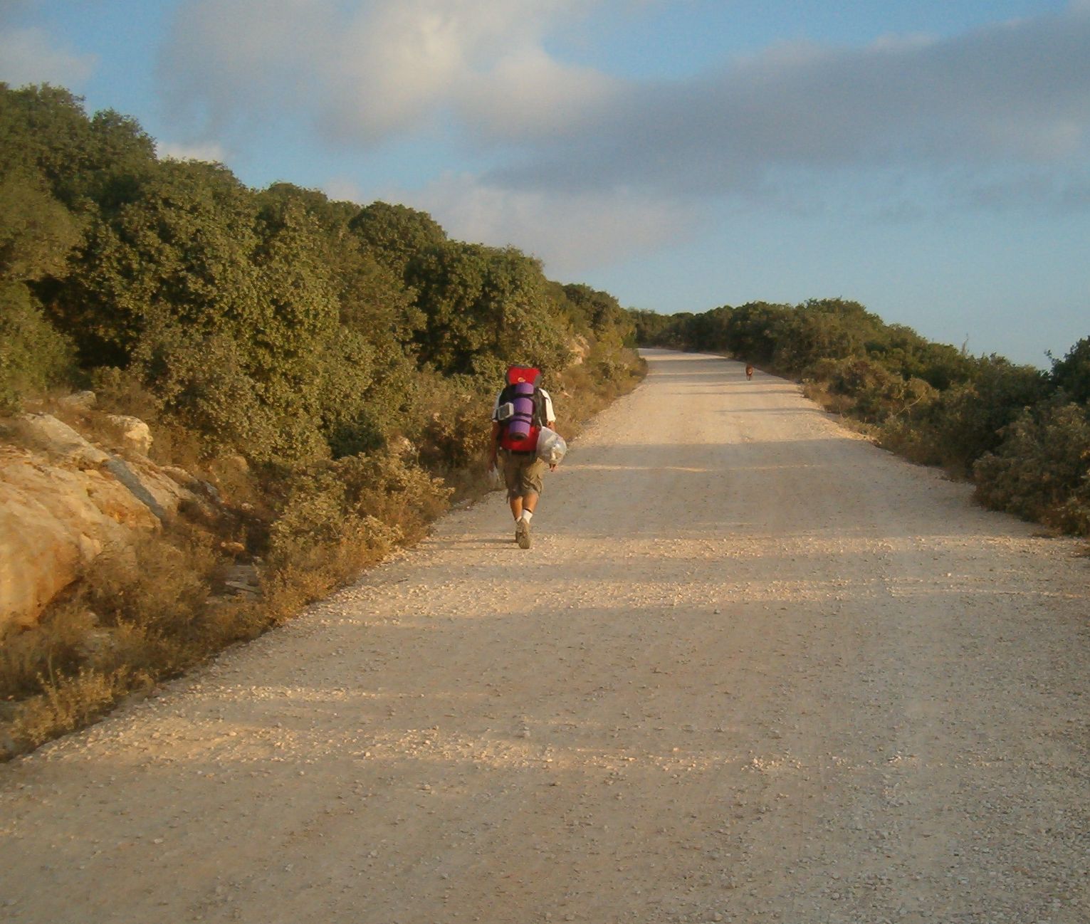
The funny thing about the trail up Mount Tabor is that it goes literally straight up. Has nobody heard of hair-pin turns? Zigzagging up the mountain? Apparently not on this trail, as it goes up the 500 meter accent in an unrelenting straight line which took us about 2 hours to climb. Once at the top there was a circular path around the summit through lovely pine woods with wonderful views in all directions. One section of the woods had trees that seemed to be bowing like a congregation during the Alenu prayer.
The circular summit path took us to the Franciscan monastery, a place built in honor of the “Transfiguration of Christ”. The monastery is open from 8am- 11:45 and then from 2pm-5. We arrived at 1pm and spent the hour until it opened having lunch and resting. There was a water faucet on the side wall right outside the gates, so even if you arrive when the monastery is closed there is still a source of water at the top of Mount Tabor. You don’t need to climb up with a full load of water!
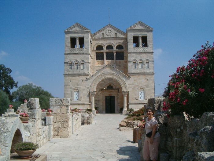
The Monastery itself is beautiful and well worth visiting. There are ruins of byzantine structures there, the church is nice, and the grounds are peaceful. There is also a souvenir shop and bathroom. As we filled up with water before leaving, Christians making pilgrimage streamed in, asking us about what we were doing and, of course, about Taffy, our trail dog!
The path going down suffered from the same straight line mentality as the trial going up. If anything it was even worse because instead of being rocky it was mostly slippery dirt. We slip-slided our way down and found a Mount Tabor tourist center, with plenty of places to fill up with water, at the bottom. So there was no need to fill up at the top and carry all that weight down. It drives us crazy that there is no place to get good information about water sources.
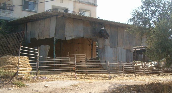
From the tourist center the trail goes though the Bedouin village of Shibli. During the Israeli war of independence in 1948 most of the Arabs of the area fought against Israel and ended up in Syria, but the clan of Shibli fought with the Israelis and now live in this amazing village at the base of Mount Tabor. They have huge multi-story houses, with the bottom ground level usually compromising a barn like structure. There were chickens, goats, and sheep as well as kitchen gardens and small orchards. Fig trees bursting with ripe figs were everywhere, and we helped ourselves to several ripe figs as we walked through.
However, the feeling that you were in a little piece of heaven vanished as the trail left the village and went through a kilometer or more of trash and garbage. Every Arab village we went through had the same disastrous trash situation. I know that this problem has recently received considerable publicity and that education programs in these towns about environmental issues were started about a year ago. I hope these initiatives help the situation.
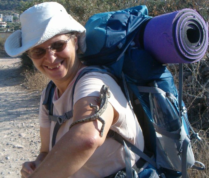
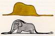
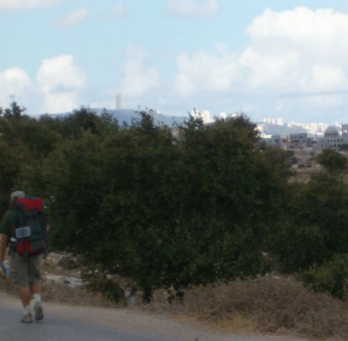
Right outside the village we saw a chameleon, Chamaeleo chamaeleon crossing the path and we picked it up for a photo-shoot before letting it go on its way. The path now went through another pine forest taking a round about route to Mount Devorah on its way to Nazareth. Tabor was getting further away in the distance and we could now see how strange and unnatural it looked jutting out all by itself, with a shape that reminds me of the picture in “The Little Prince” of the Boa Constrictor eating the elephant.
Our feet were hurting and we were exhausted, so our mission was now to find a place to camp. Don had hoped we could camp on the top of Devorah, but we were too tired and found a spot overlooking Shibli and Mount Tabor on the dirt road to the summit.
That night we were serenaded by competing calls to prayer from the various Arab villages in the area while the moon rose next to Tabor. It was loud enough where we were, and I can not imagine living near to such blasting every day. Afterwards, when silence was regained and we were settled for the night, there was another disturbance. First we heard a group of young men hiking past us in the darkness. Then we heard a car or truck going down-hill past our camp site without their motor or lights on. What was that about? The weird thing is that we will never know whether it was some nefarious transaction or completely innocent.
Day 2: 9 Sept 2008
We walked up the dirt road to the top of Mount Devorah talking about what might be the explanation for the night time vehicle going silently past. At the summit there was a memorial for the 50th anniversary of the queen of England given by the English Jewish community. When was the 50th anniversary, and why have a memorial here? Strange and funny place.
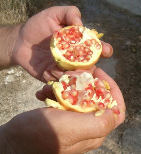
Nazareth was right there on the next mountain. We walked down Mt. Devorah and through a wadi full of pomegranate trees with ripe fruit. Then we looked back and said goodbye to the last view of Mount Tabor and climbed out of the wadi onto a big street that skirted the edge of Nazareth Illit. We’d been worried that this part of the walk would be terrible, but the street turned out to be tree lined and had a wide sidewalk. So it was a pleasant stroll, with interesting views. A path then took us off the road and down to the Arab village of Meshhad (which means grave of a holy man). The holy man buried there is traditionally thought to be Jonah. We walked right through the middle of the village buying a carton of cold apple juice in one of the small grocery stores that we passed. A pretty mother with her young daughter walked by. The feeling was of peace and tranquility, but as we walked past their mosque I thought of what if must be like when the call to prayer was blasted out of the load speakers.
We walked onto the dirt road out of the back of the village and initially missed the turn, but eventually we turned back and found the turn into a pine woods on a path towards Tzipori National Park. We went to the entrance to the park and debated whether we should leave the trail and go through the park instead. In the end we decided to miss the park since we could visit at our leisure anytime, however, now I think we made a mistake. The path takes people to places for a reason! I don’t want to be so much on a schedule that I miss what is extraordinary.
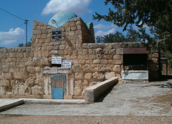
After Tzipori we came to a small neglected cemetery next to the tomb of Rabbi Yehuda Hannasi who compiled the Mishna (Now that I know how important this Rabbi is I am a bit disturbed that the area was neglected). There was a sink with running water where we refreshed ourselves and refilled all our water bottles. Then we rested and ate lunch on the large cement picnic tables.
The trail continued down into a valley, up through a pine forest, and down again until it reached a major highway: Rt. 77. For me this part of the trail was the worst so far. First we had to walk in a deep drainage ditch by the side of the highway for about a half a kilometer. The sun was straight a head of us and it felt like we were walking in a furnace. The ditch took us to the intersection with Rt. 79 where there was construction being done. The tricolor symbol for the Israel Trail was nowhere to be found. Relying on the map we ended up going right through the construction with all its dust and grit. By the time we had gotten back on the marked trail and were away from the horrible commotion I was totally frazzled.
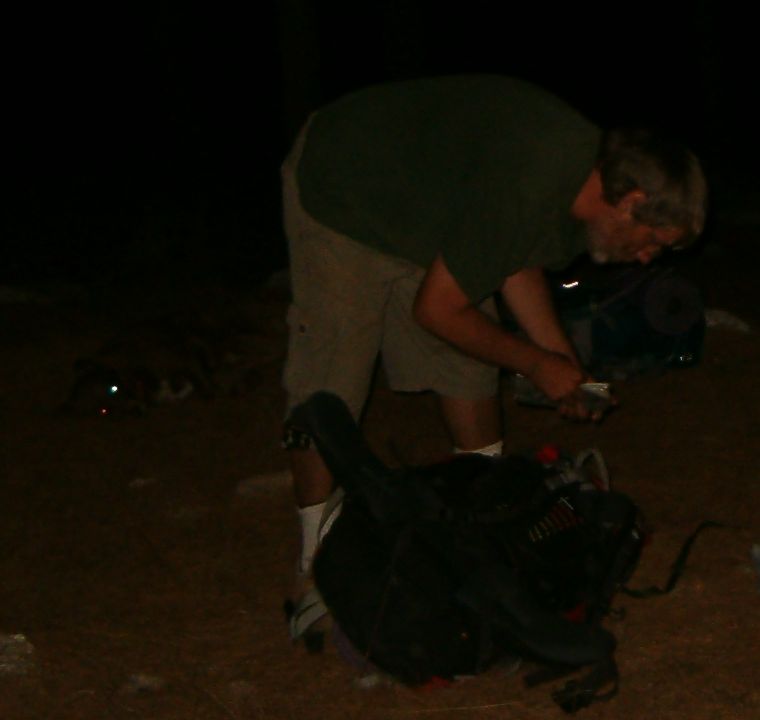
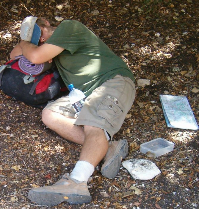
From there we walked a few more kilometers past the Yiftach winery and up to the top of a hill in the Alonim Forest. It is a bit strange because Alonim in Hebrew means Oak, but the forest we were in now was all pine. The Alonim Nature Reserve, however, is made up of many small parks over a large area, and we would be hiking in and out of them throughout the rest of this leg of the Israel Trail. At the very top under all the pine trees we made our camp. However, our first spot turned out to be on the route Kibbutz members used for their evening jog, and it felt too exposed. So we moved to the side of the hill away from the path and made camp again.
On this trip we forgot to bring the second days raman noodles so for dinner Don improvised a grilled cheese pita. It wasn’t as good as our noodle dish, but it was good enough.
Day 3: 10 Sept 2009
We planned to reach Kibbutz Yagur at the base of the Carmel Mountains at the end of this leg. That would bring us as close as the Israel Trail gets to our home in Haifa (within 12 kilometers as the crow flies). To do that we had to walk about 22 kilometers in one day and we were not at all sure that we could make it. To give us a better chance we started before first light at 4:30 in the morning.
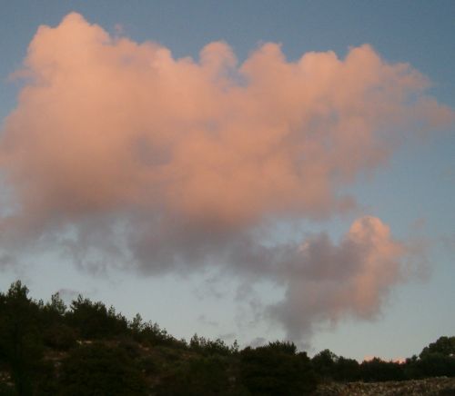
Dawn came as we walked along an idyllic valley with small plots of land planted in vegetables interspersed with orchards of olive and pomegranate all watered by a living spring that flowed at the bottom of the vally. The first sun made the clouds pink.
We walked out of this valley and through the village of Caabia ( כעביה-טבאש-חג'אג'רה
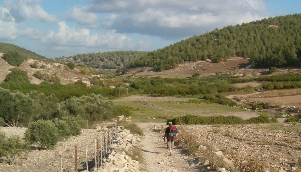
), a prosperous Arab town of 4400 people. From there we walked on a dirt road and then onto a path leading down into the Tzipori Vale. Gradually we left behind development and again found ourselves in a peaceful gentle countryside. All it needed was a stream.About a kilometer into the valley we came upon the Tzipori spring with a stream flowing out of it through the middle of the valley. It was indeed a little paradise. We passed a vineyard absolutely bursting with purple table grapes. I picked a couple of bunches and we munched them as we strolled.
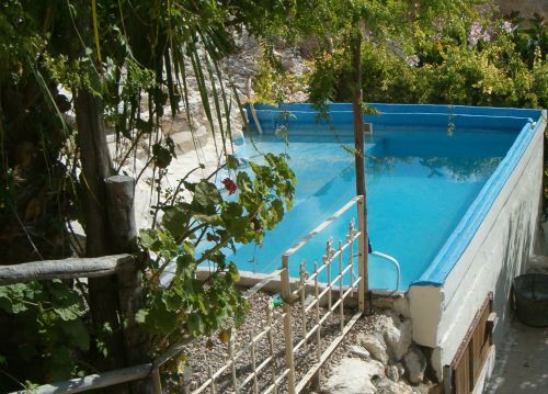
Right in the middle of Tzipori Vale is an old mill house that has been renovated as a Bed and Breakfast. We walked in through the open gates to take a look around and get information, but there wasn’t anyone there, though everything was open. We sat in their terrace for a while marveling at the view and the serenity of the spot. There was a tiny swimming pool gleaming in perfection and I so much wanted to dunk my sweaty, dusty body into the perfect water, but my better half (Don) reminded me that we were on somebody else’s property and I managed to resist.
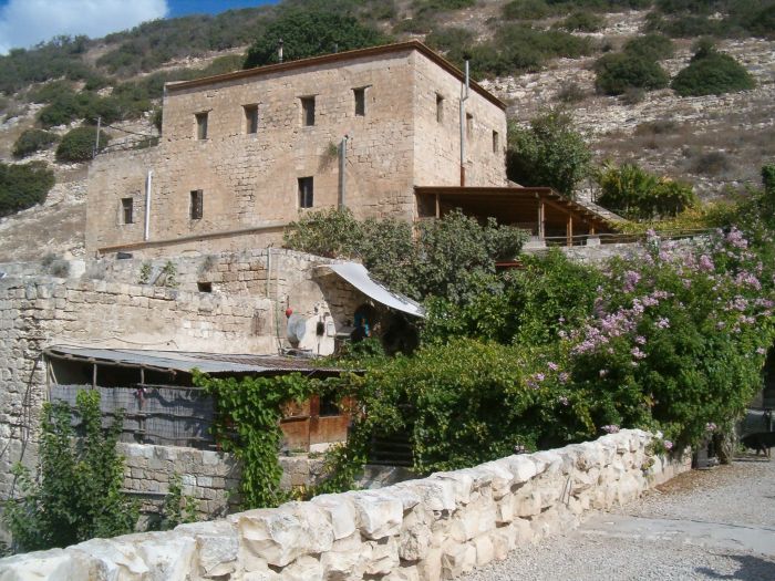
After playing with a puppy, and watching a bunch of chickens fearlessly clucking around us with no regard to Taffy at all, we regretfully left the place and resumed our hike. What a place to live. If you are hiking the Israel Trail and want one night of comfort, I suggest you reserve a place at the mill and let me know how it turns out. If I did this hike again, that is what I would do.
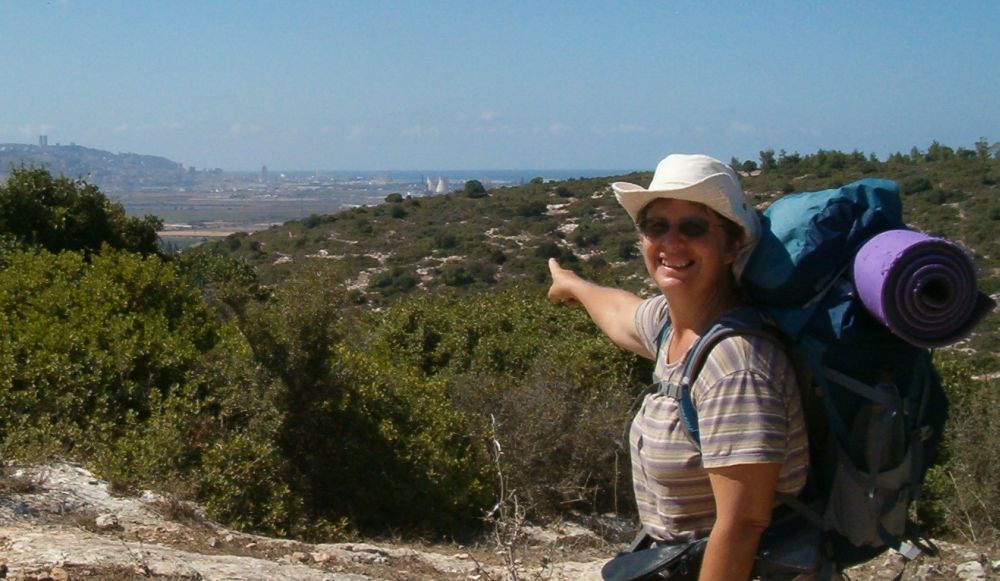
We still had many kilometers to go so we didn’t linger too long. On we went out of Tzipori Vale around Kibbutz Nofit and into a another valley in the Alonim Nature Reserve. Right before we walked down into the valley a view opened up towards the west showing a green range of mountains. It took Don and me a few minutes before we realized that there a head of us was the tower building of the University of Haifa on the Carmel Mountains that skirt the Mediterranean coast. We had almost walked the whole distance from the Golan Heights to our home near the Sea.
Down we went in the valley of the nature reserve. This time, however, all the trees on the surrounding hills were Oaks. The bottom of the valley was wide and covered with endless rocks. The end of summer dryness was palpable.

We had been making excellent time and it was evident that we would be able to reach the Carmel Mountains before dark, but we were tiring. My feet were hurting, and I noticed that every time we stopped Don would bend forward. As we took off our packs for a rest I prodded him into admitting that for some time his back had been bothering him. He had strained a muscle. I had Optalgen, a good pain reliever, and after taking it Don said that he was in much less pain and for the rest of the hike he was OK. It is important to bring basic medical supplies on any camping trip.
We were now walking near the city of Tivon, basically in the vicinity of Haifa, and yet we were now in the loneliest part of leg 5. There was no sight or sound of the urban areas around us, and the only person we saw for hours was a Bedouin cow herder. We could have been in a different century or continent. Only when a person is walking does is become clear how much topography can isolate you from the surrounding region.
We had a late lunch of apples, nuts and dried fruits right before the trail started to leave the valley. The Oaks became Pines and soon we were on the top and the Haifa Bay Industrial area could be seen in the distance. For the first time on the Israel Trail we could just make out the blue waters of the Mediterranean.
We found the trail markers going down the other side of the hill and after about an hour of scrambling found ourselves walking along a street on the edge of Kafar Hassidim, a Kibbutz with Dairy cows opposite our destination: Kibbutz Yagur. Here the Israel Trail goes right past a large Grocery Store in this village which would be a convenient place to stock up if you were hiking through.
With the sun still quite high over the Carmel we walked the last 2 kilometers through an under pass and into Kibbutz Yagur. We were exhausted, but it turned out that buses to Kibbutz Yagur do not actually go into the Kibbutz and we ended up having to trudge all the way out of the Kibbutz and along the side of the Highway until we reached the bus stop at the Yagur intersection. This added more than 2 kilometers, so that day we walked 24 km., a record for us.
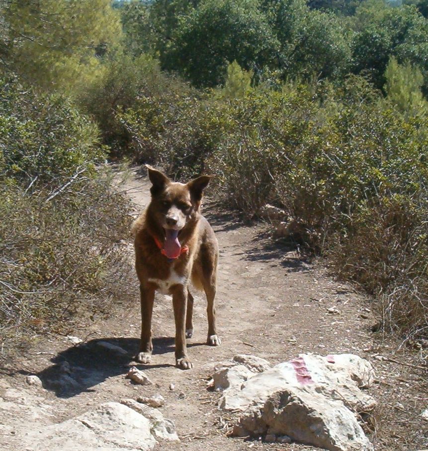
Luckily this time Taffy had no feet problems. We wouldn't have nearly as much fun if he was not with us!